Visiting Minnesota’s North Shore: 10 Stunning Walks & Hikes
The North Shore of Minnesota, along Lake Superior, is a spectacular destination, boasting scores of hiking opportunities just off scenic Highway 61. With mountains on one side of the highway and a nearly ocean-sized Great Lake on the other, these hikes are a real treat.
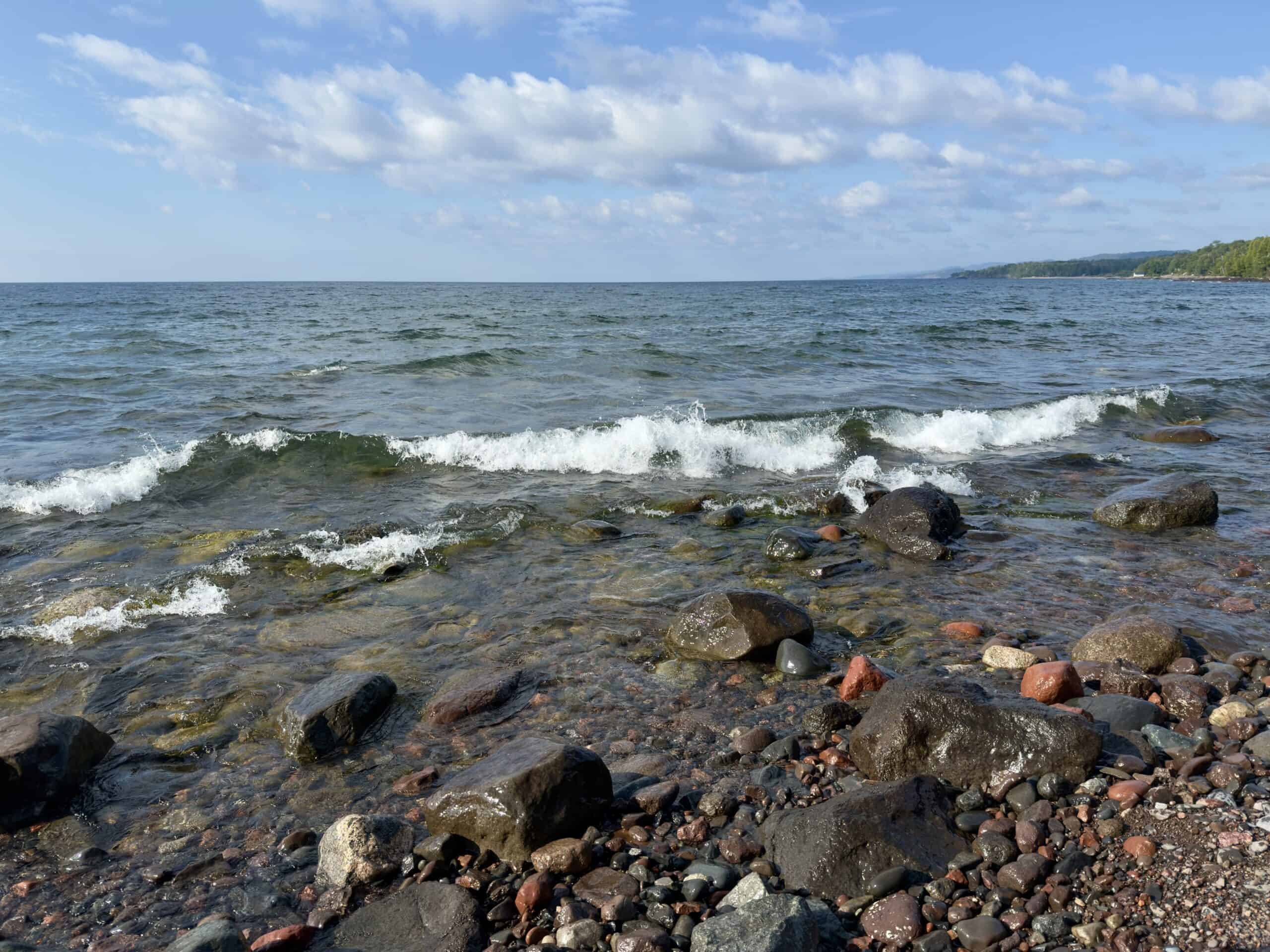
Lake Superior is called the Gitchi-Gami by the Ojibwa people, who have lived near it since at least the 1600s. It is the largest lake in the world by surface area, and contains 10% of the earth’s fresh water. It is also one of the cleanest and clearest lakes in the world, with an average underwater visibility of 27 feet and, in some places, up to 100 feet!
Many of the hikes listed below are located within the well-maintained Minnesota State Parks. An inexpensive vehicle permit is necessary to enter the parks. Permits can be purchased online through the Minnesota DNR by the day, or for a full year.
Before you head out, we highly recommend you download the free AllTrails app. You’ll receive driving directions, trail maps, descriptions, and reviews that provide an update on the current condition of the trails. The app works all over the US and also internationally. If you opt for a membership (with a nominal yearly fee), you can download the maps onto your phone, which is really helpful to keep you on track, particularly in areas with no cellular service (which there are many of on the North Shore). Click on any of the walk/hike titles for a link to the appropriate AllTrails page.
Adequate water is necessary, and hiking shoes/boots are highly recommended. In the summer months, bug spray is a must. For Carlton Peak, Agnes Lake, Lookout Mountain, and Devil’s Kettle, trekking poles are an excellent idea.
** Please note that this page contains affiliate links, meaning we may earn a very small commission if you book through them (at no extra cost to you).
Below are some of our favorite hikes and walks along Minnesota’s North Shore, all of which are rated easy or moderate, and all between 30 minutes and 3 hours. (Listed in order along Highway 61, driving from Duluth to Grand Marais):
Table of Contents
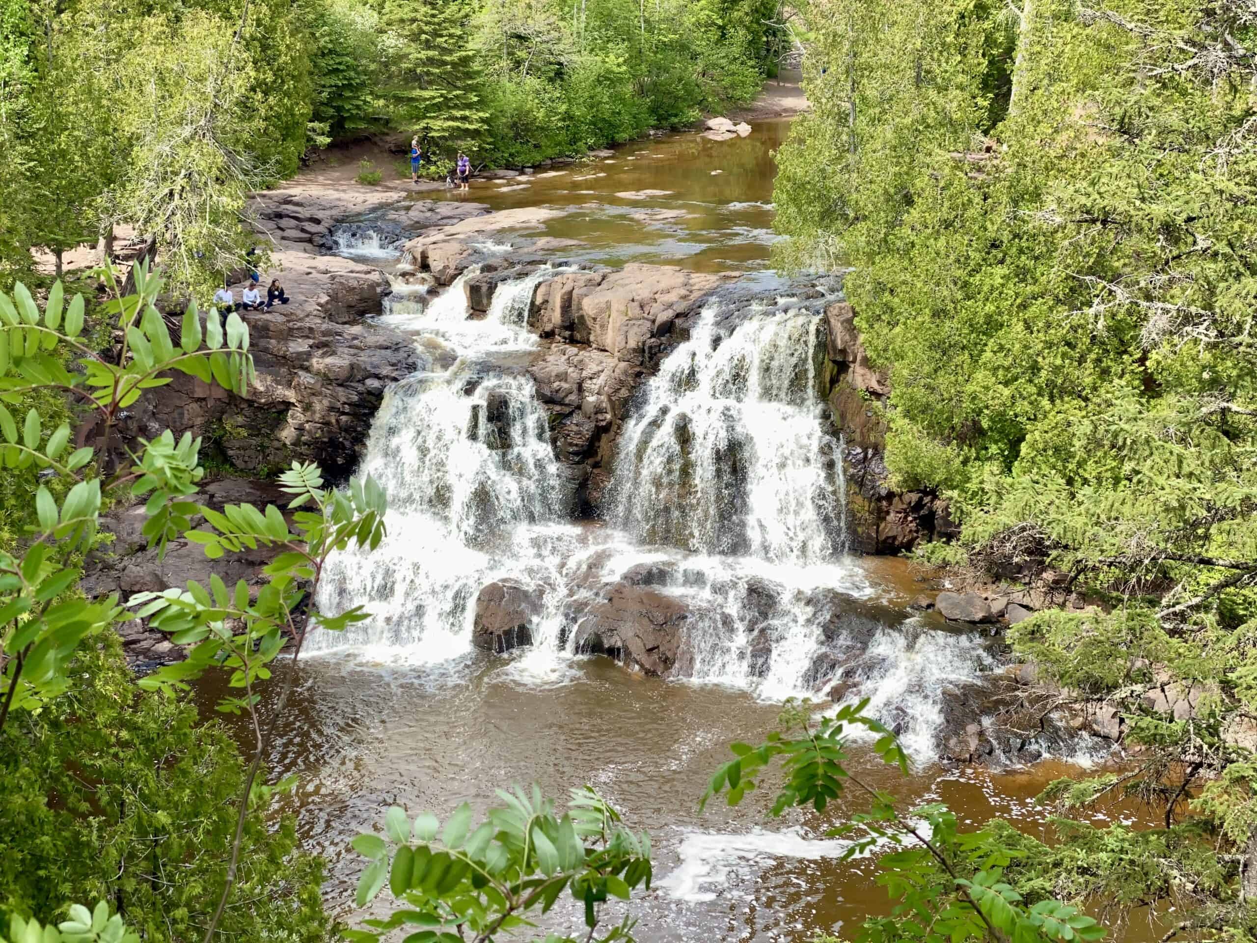
Gooseberry Falls State Park
Just a 45-minute drive from Duluth, Gooseberry Falls makes for a fun and easy day trip. It offers a variety of hikes, rated from easy to moderate, five spectacular waterfalls, and lovely views of Lake Superior. On warm summer days, you’ll find children (and adults!) frolicking in the calm water below some of the falls.
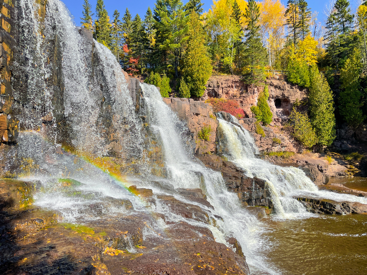
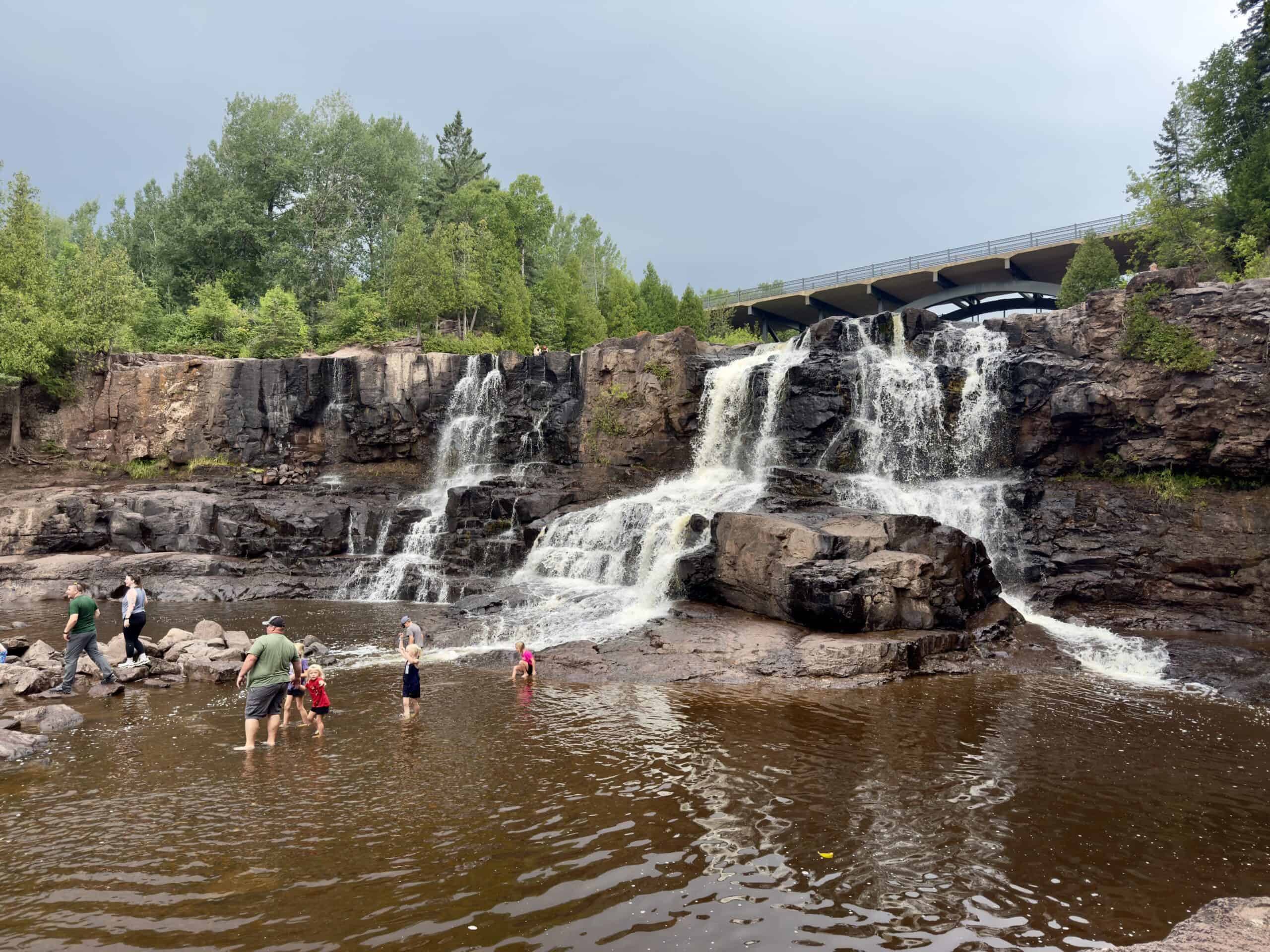
In addition to the waterfalls, overlooks, and trails, the park features Agate Beach, a sandbar at the mouth of the Gooseberry River, where it meets Lake Superior. This is a pebble beach, ever-changing due to the force of the Superior waves. If you’re lucky, you’ll find some of the sought-after Lake Superior Agates.
There is a large visitor’s center near the entrance with maps, interpretive displays, snacks, and a nice gift shop.
This is an extremely popular park, for good reason! It is best to visit on a weekday or off-season.
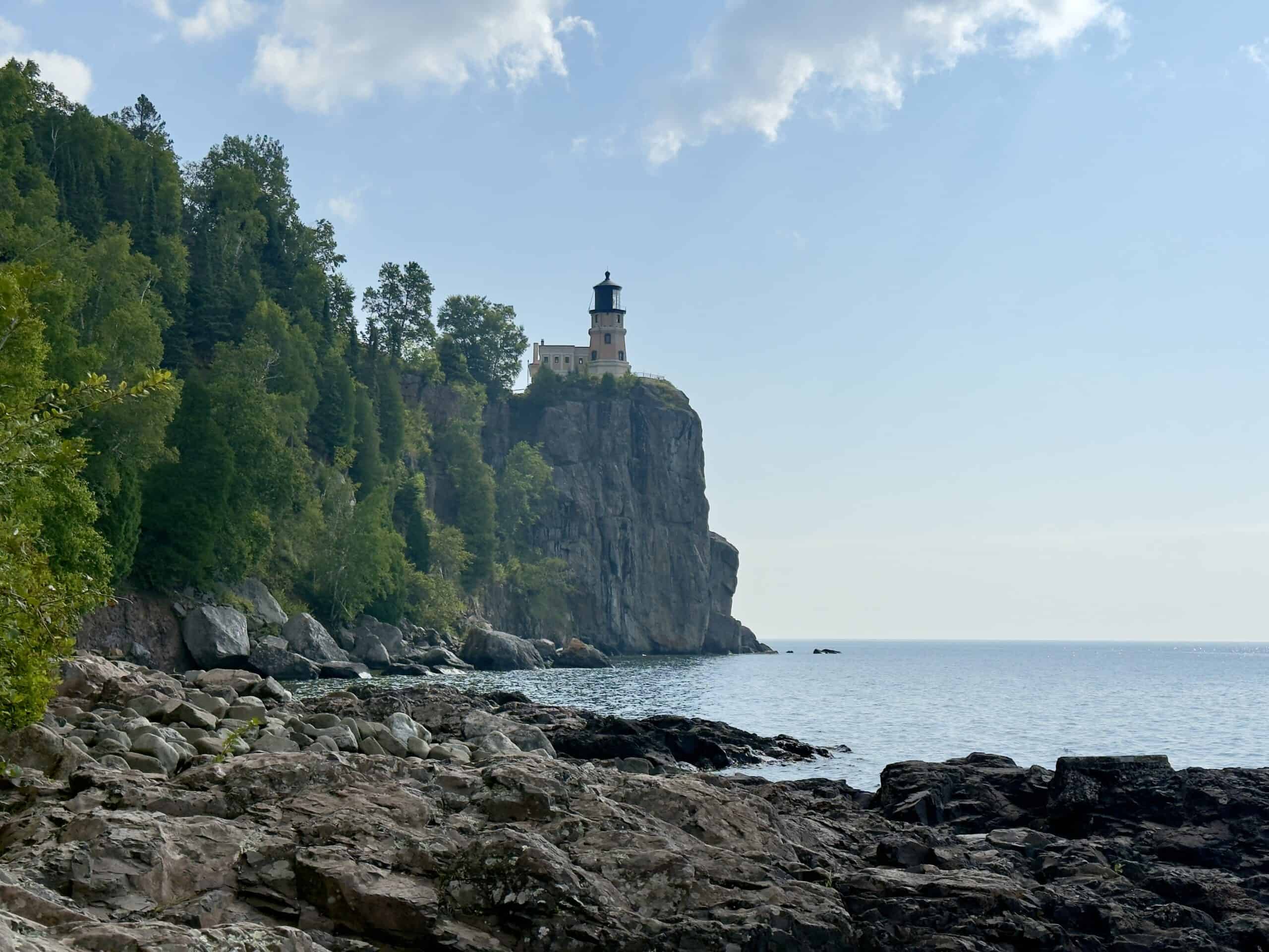
Split Rock Lighthouse State Park
The historic lighthouse for which this park is named was completed in 1910 in response to a terrible November storm in 1905 that damaged or sunk 29 ships. The lighthouse is perched dramatically atop a 130-foot cliff, and was originally accessible only by water. Due to advances in technology, Split Rock Lighthouse was no longer needed and closed in 1969.
The State of Minnesota has managed the park since 1971, and it is now a National Historic Landmark. More than 150,000 people visit each year, and the lighthouse is one of the most photographed and recognized sites in the state.
To visit the less-crowded side of the lighthouse and beach, park at the Trail Center, and pay only the DNR vehicle registration fee ($7 at the time of this writing). This 1.2-mile walk is mostly easy and leads down to the shoreline, offering gorgeous views of the lighthouse as well as Ellingsen Island, and lots of opportunities for playing on the rocks.
For a more in-depth look at the park, skip the vehicle pass and go straight to the Visitor’s Center. It features exhibits, artifacts, and photography detailing the history of the lighthouse (including a model of it made of 10,000 Legos), and the Indigenous peoples who used to inhabit the area. The entrance fee ($15 for adults and $8 for kids at the time of this writing) includes access to the grounds, where a short walk will take you down to a beach with great views of the lighthouse (a different viewpoint than from the Trail Center hike, above). For an extra fee, small group tours inside the lighthouse are available.
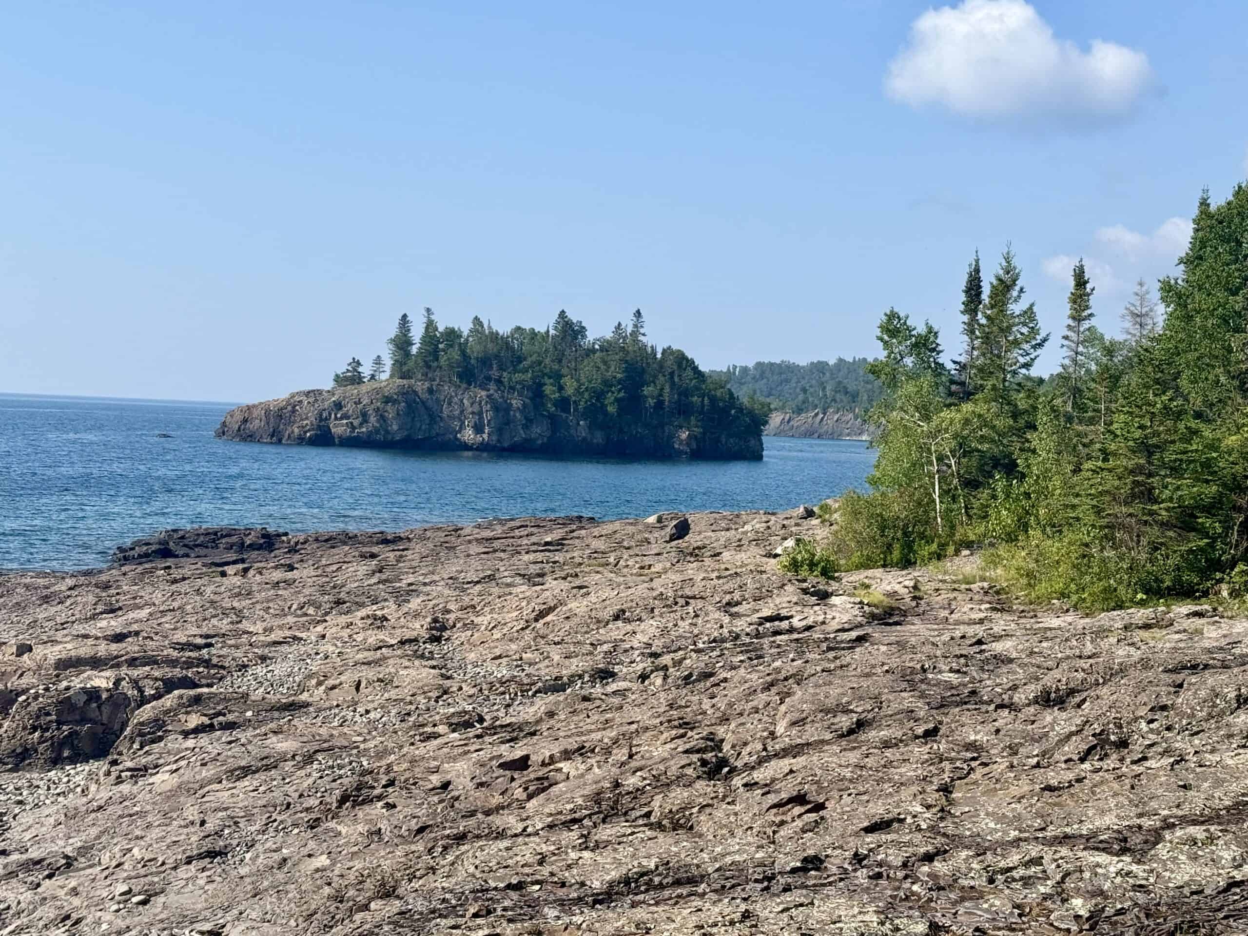
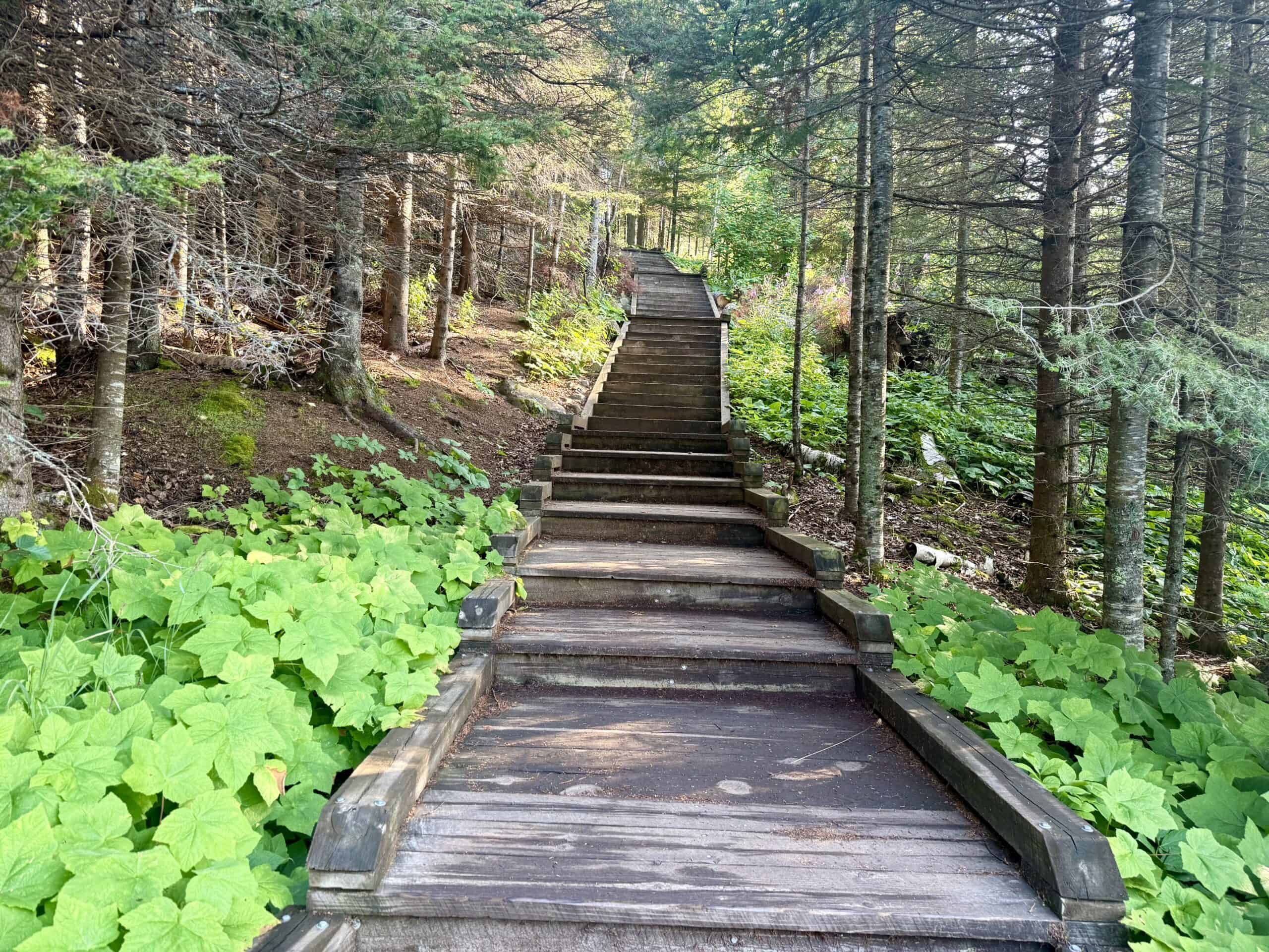
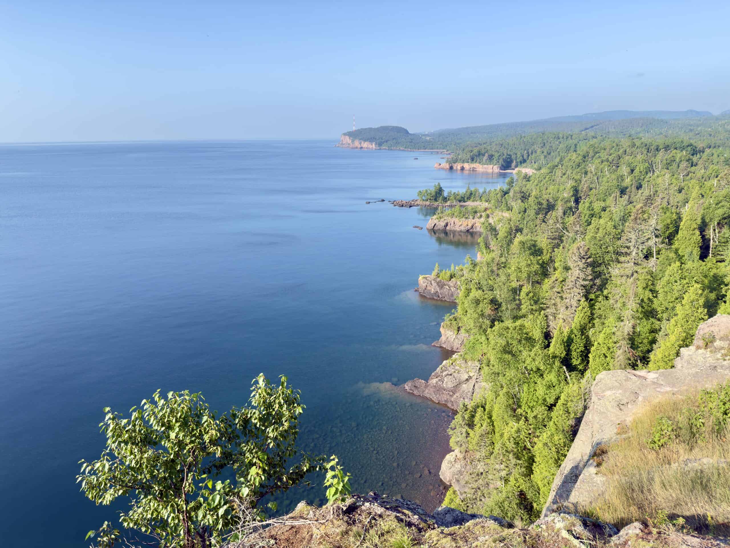
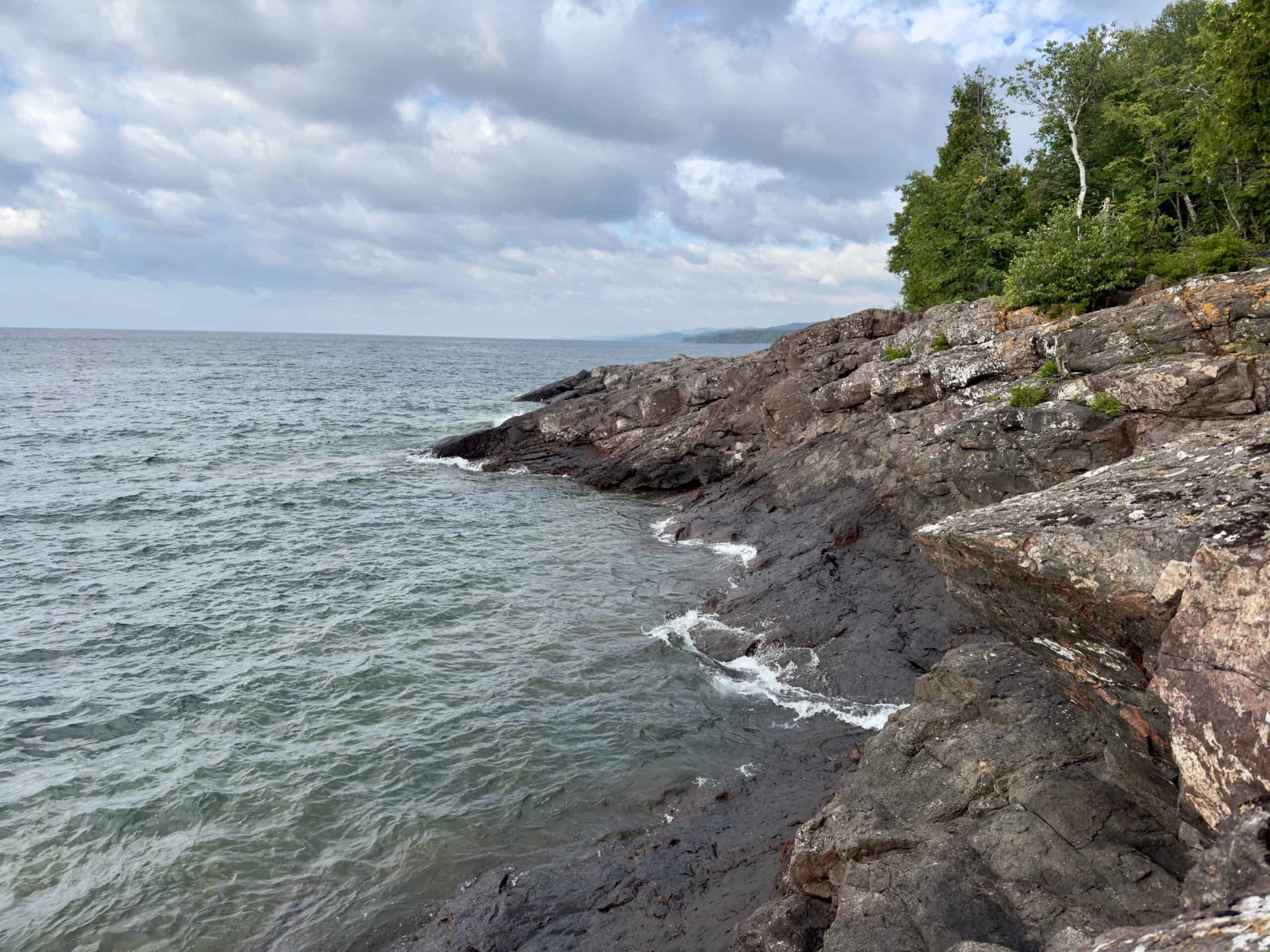
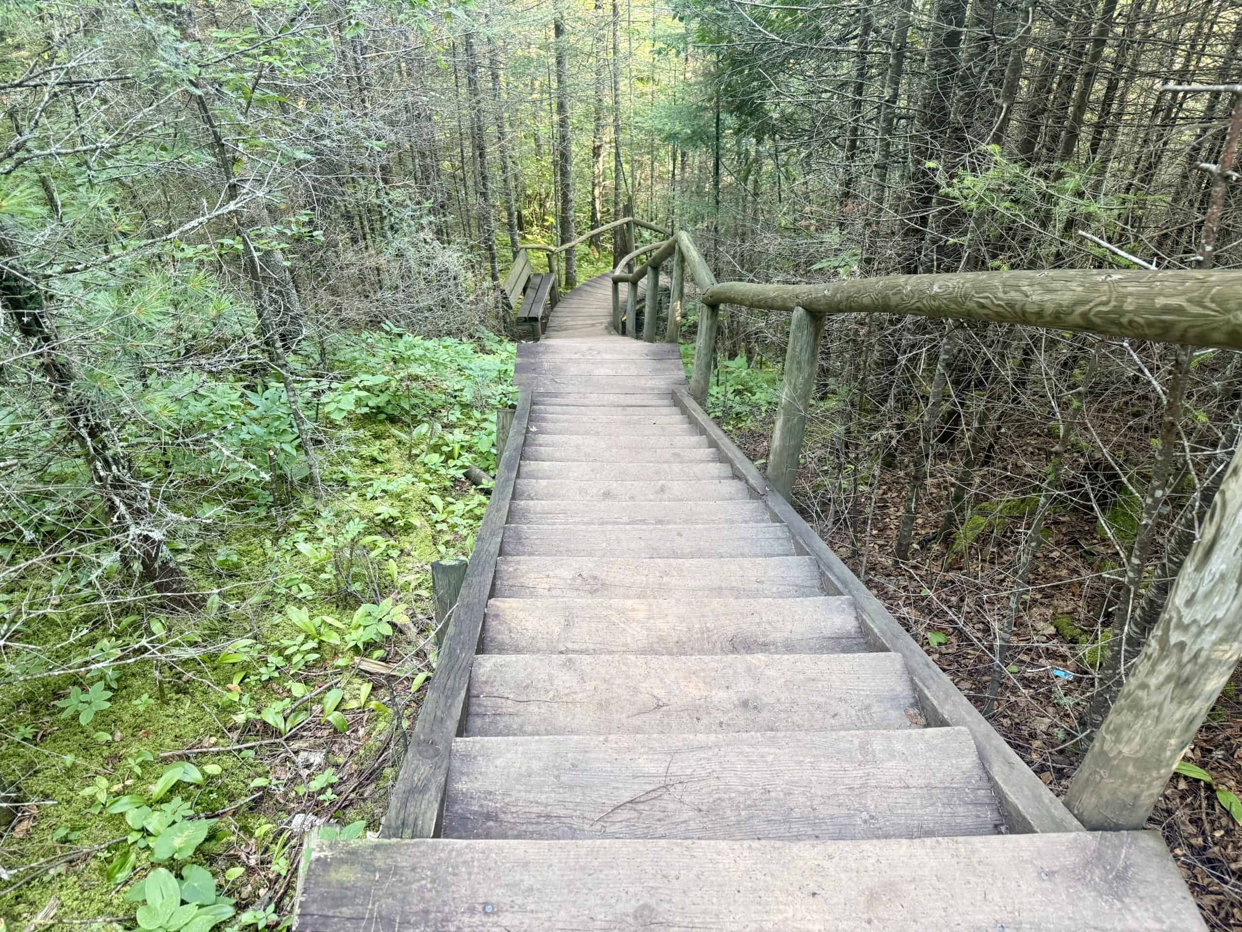
Shovel Point at Tettegouche State Park
Tettegouche State Park (pronounced TET-a-gooch) features 23 miles of outstanding hiking trails, all rated moderate or more difficult. One of the easier and shorter trails is the 1.5-mile hike to Shovel Point and back. Roughly 2/3 of the trail is wooden ramps and stairs (lots of stairs!) built to allow access to sweeping overlooks along the way, and to breathtaking views at the hike’s destination – Shovel Point. It is an amazing feat of engineering.
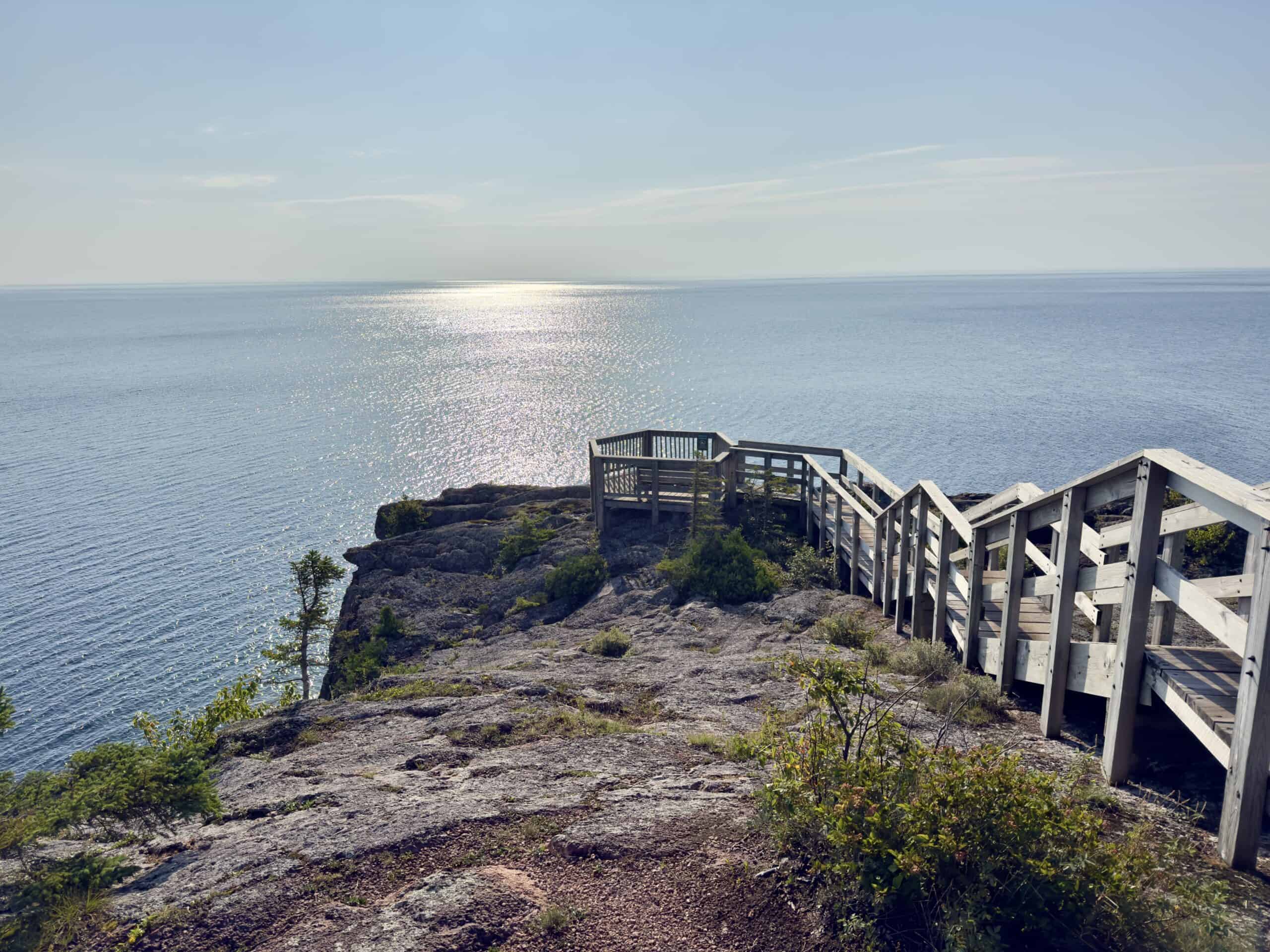
The hike begins at the visitor’s center. Consider first taking the very short trail to the right, to see the mouth of the Baptism River, where it meets up with Lake Superior. From there, return to the visitor’s center and follow the signs to Shovel Point. The high cliffs shortly before the point are a popular jump-off spot for brave rappellers.
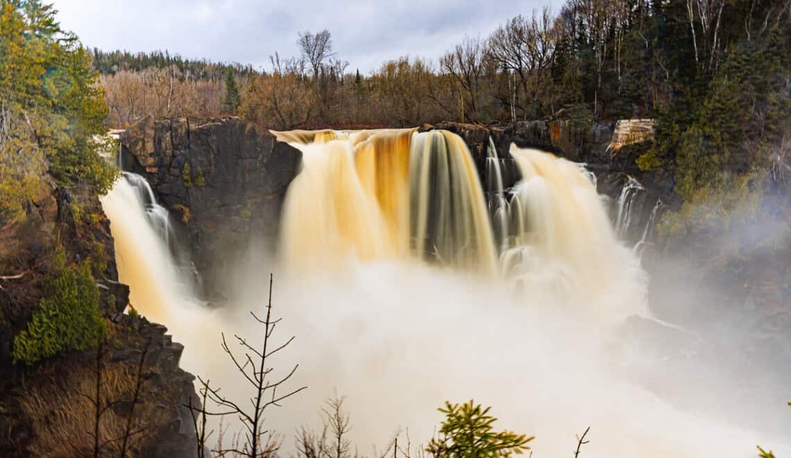
If you are interested in a longer hike in Tettegouche, the 3-mile Baptism River Trail provides viewing of three waterfalls, including High Falls, the highest in Minnesota. As of summer 2025, though, there is significant construction work at and around the upper trail and bridge leading up to High Falls, so check conditions first.
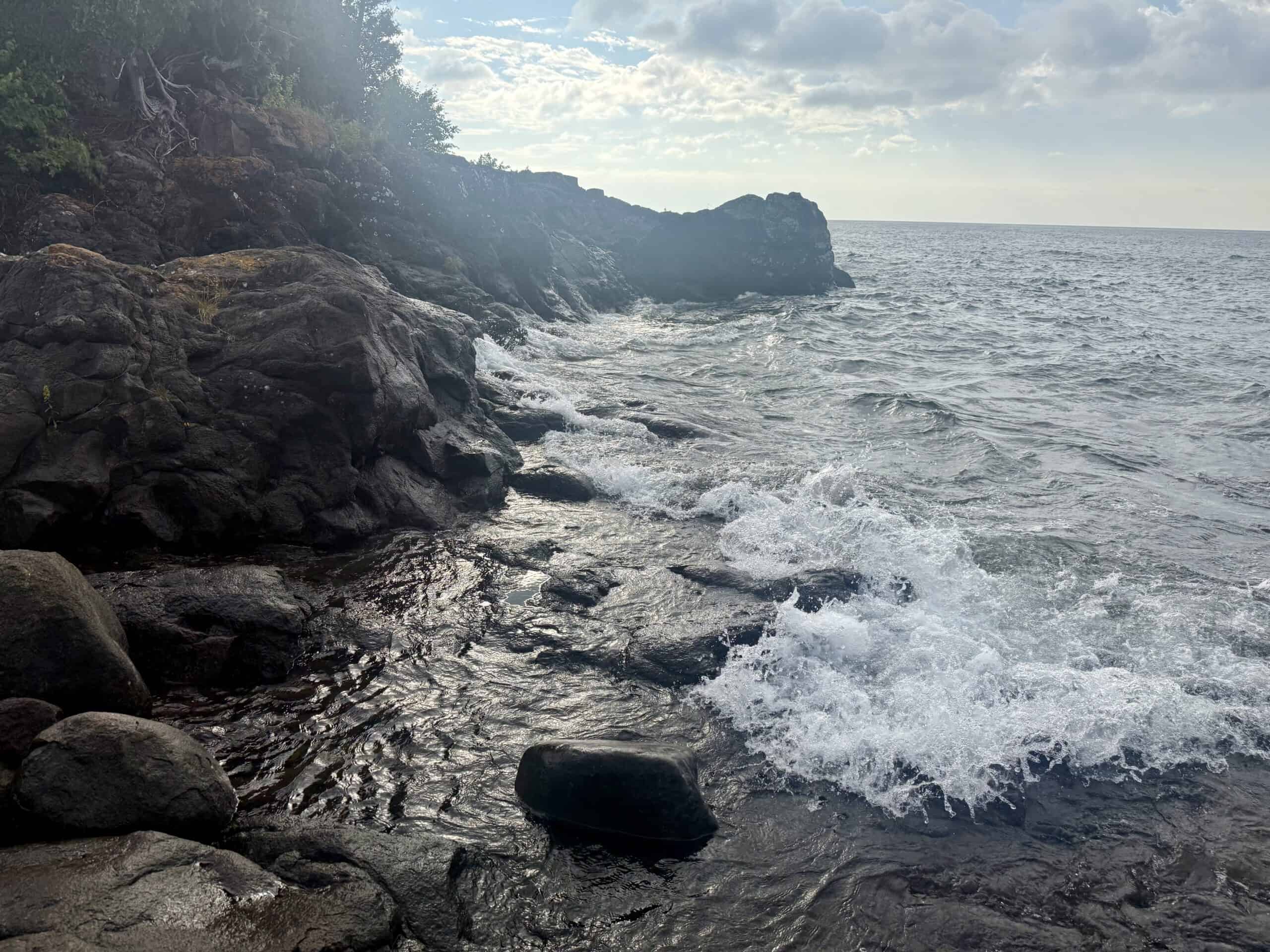
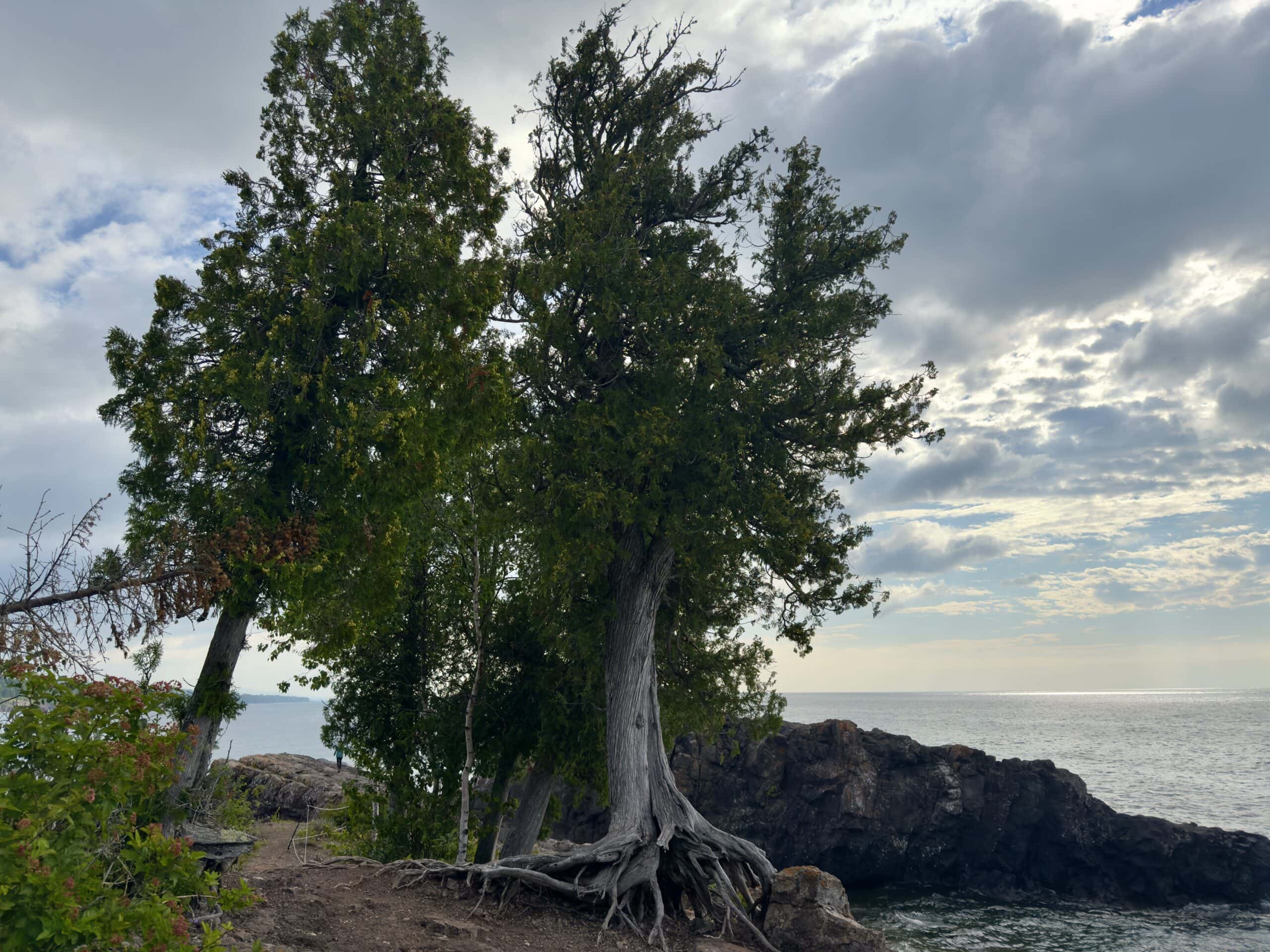
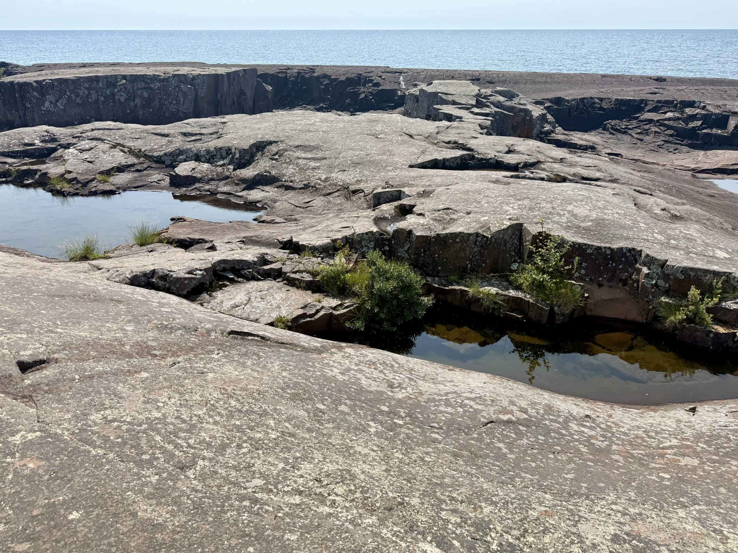
Sugarloaf Cove
The North Shore Stewardship Association, a nonprofit group, is responsible for the restoration and preservation of this pristine 30-acre property, including some of the most beautiful shoreline in the area.
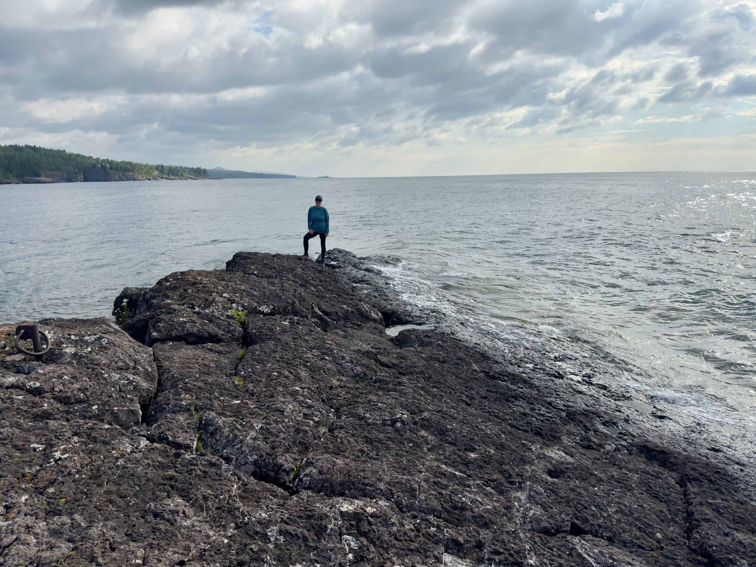
The short, easy hike here is so much fun, and blissfully uncrowded. The best part is walking out on the long area of ledge rock, among craggly trees, to Sugarloaf Point. You can walk all the way to the tip, and stand with the protected cove and cobblestone beach on one side of you, and the temperamental open waters of Lake Superior on the other.
Sugarloaf Point is made of rock dating back more than a billion years, when the continent began rifting, or breaking apart. The continental rocks became thinner, and molten lava from beneath the Earth’s crust came up to the surface. It cooled and created the basalt rock that makes up Sugarloaf Point, as well as other areas along the Lake Superior shoreline.
The walk is about 1.5 miles if you do the whole loop through the forest and out to the point. It can easily take an hour or more, depending on how long you play on the rocks and at the beach. For an even shorter walk, start to the right toward the sign for the Nature Center and return the same way. (You’ll miss most of the lovely forest walk.)
The Nature Center offers exhibits on the history and ecosystems of Sugarloaf and a small bookstore. Educational opportunities offered regularly by the center include geology walks, dark sky viewings, bird watching, and much more.
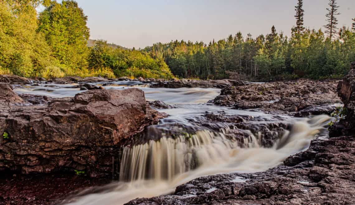
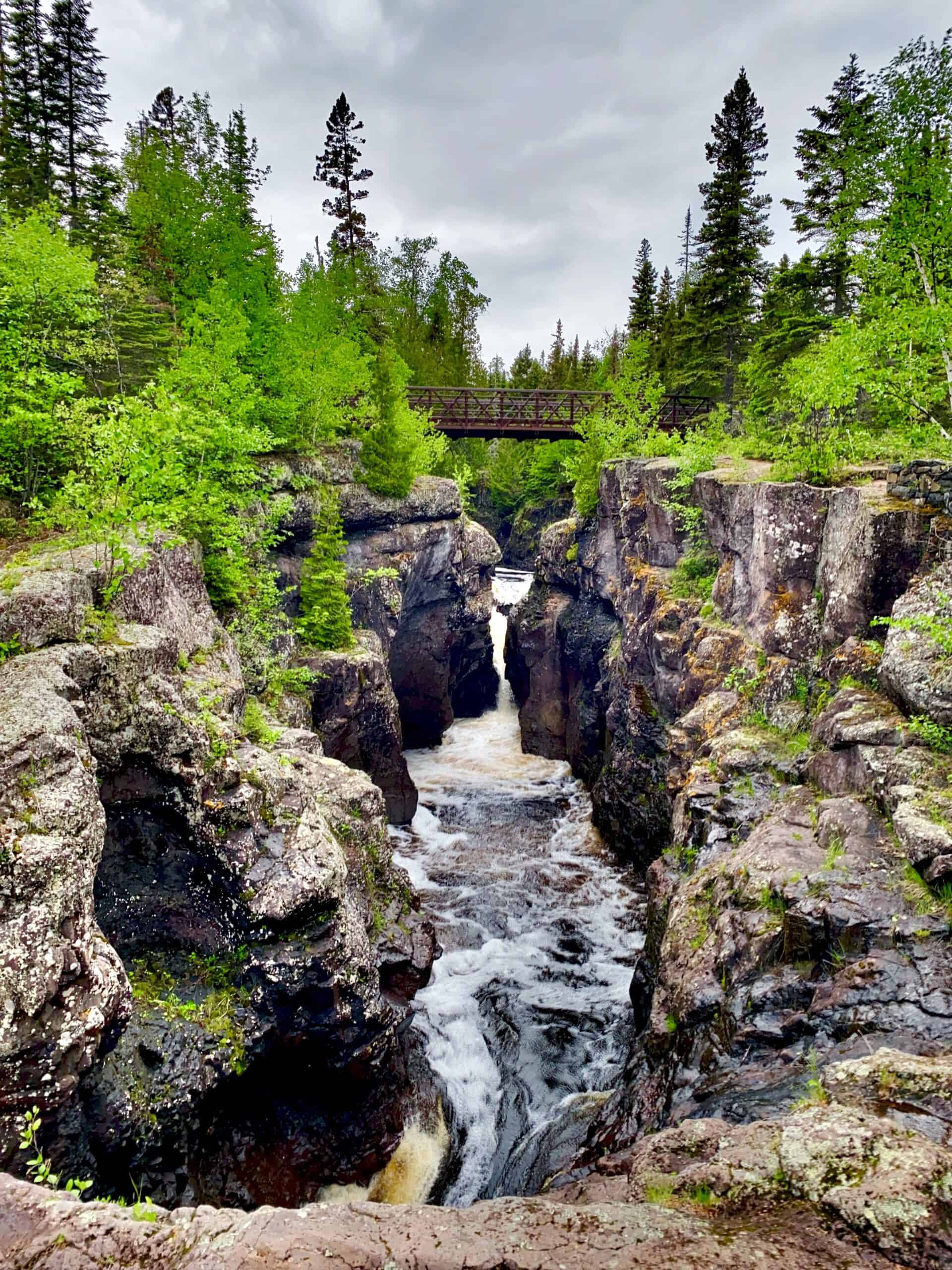
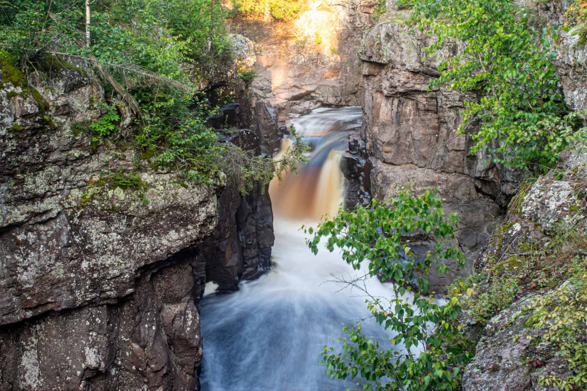
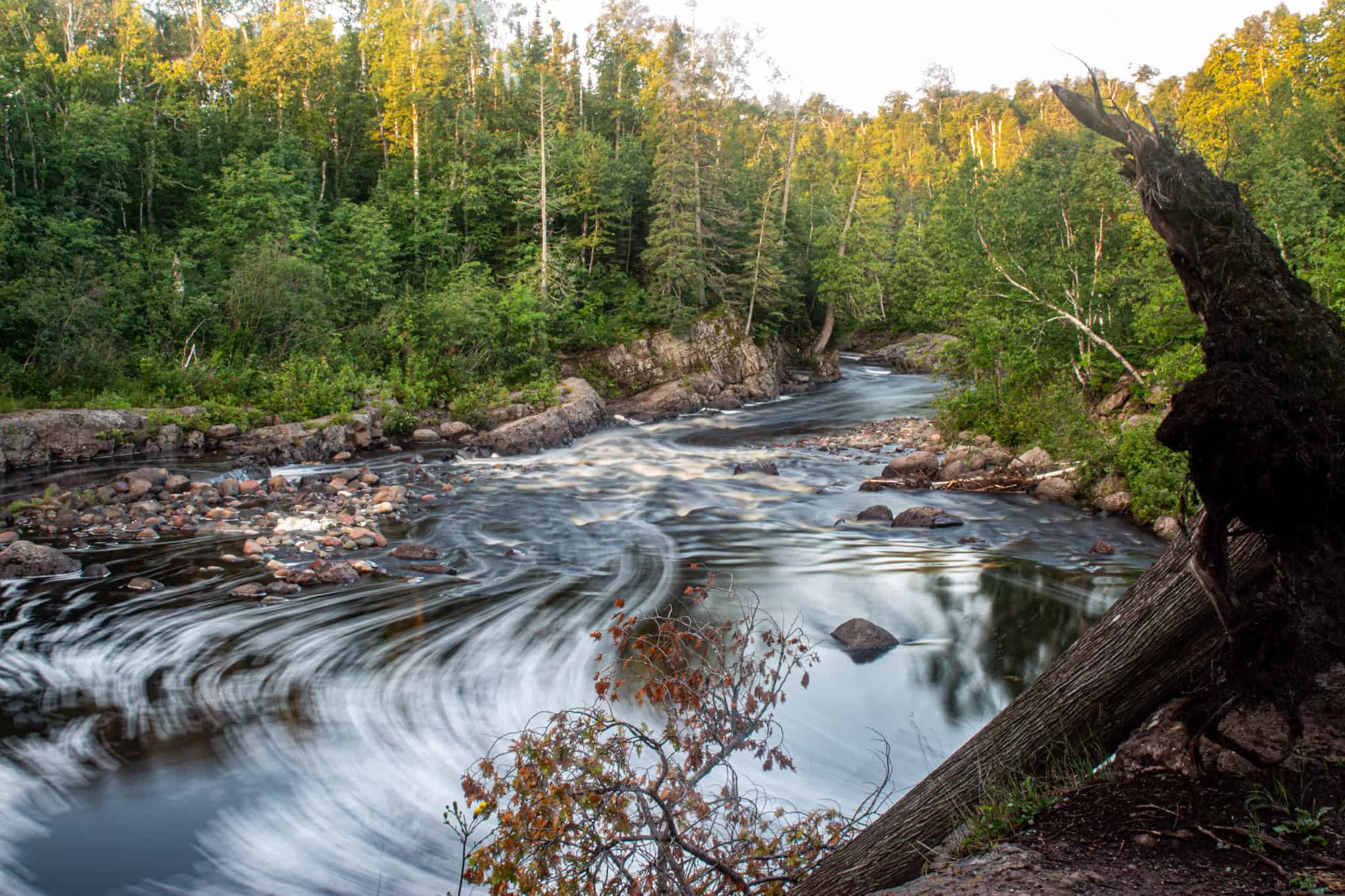
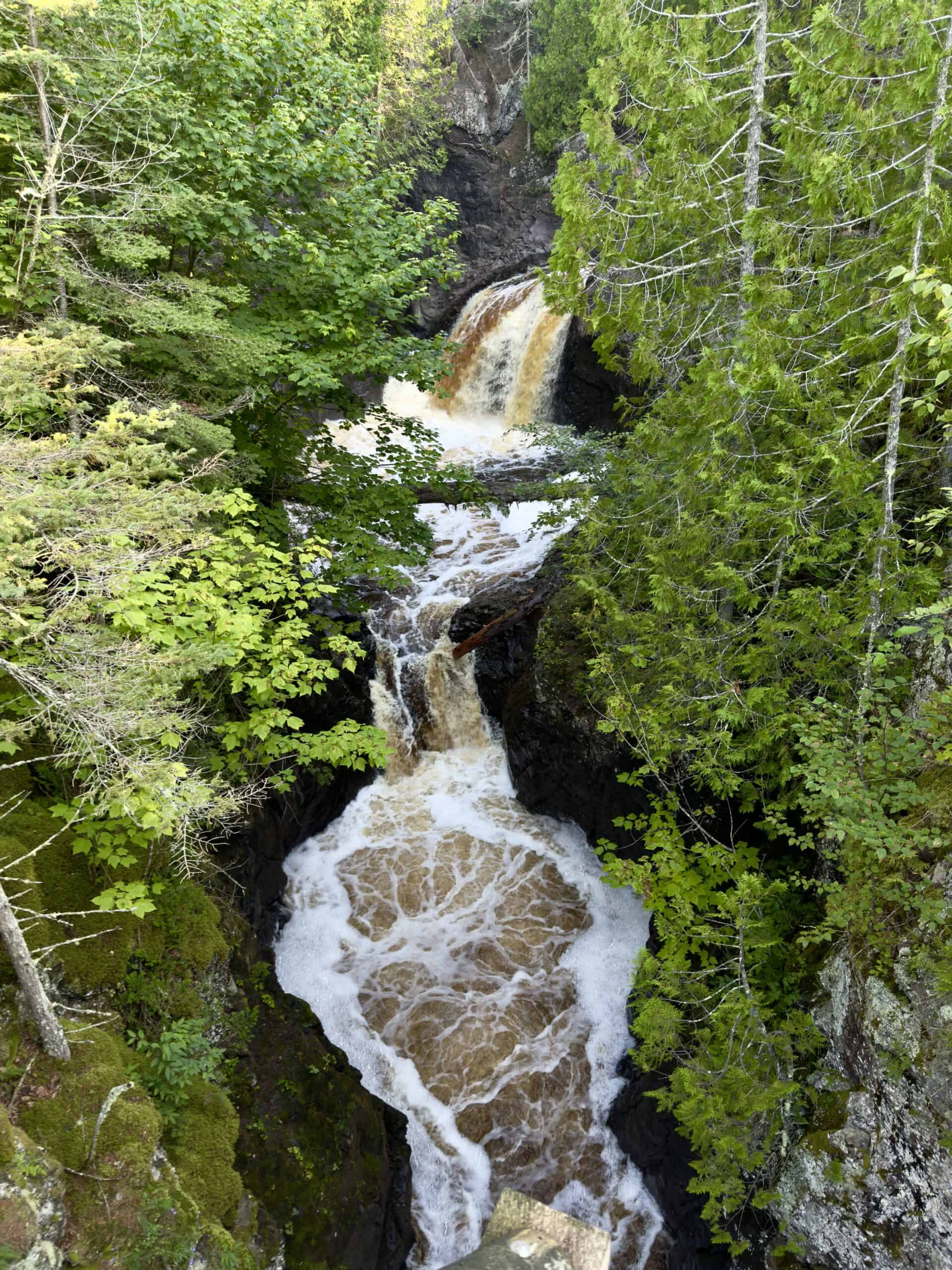
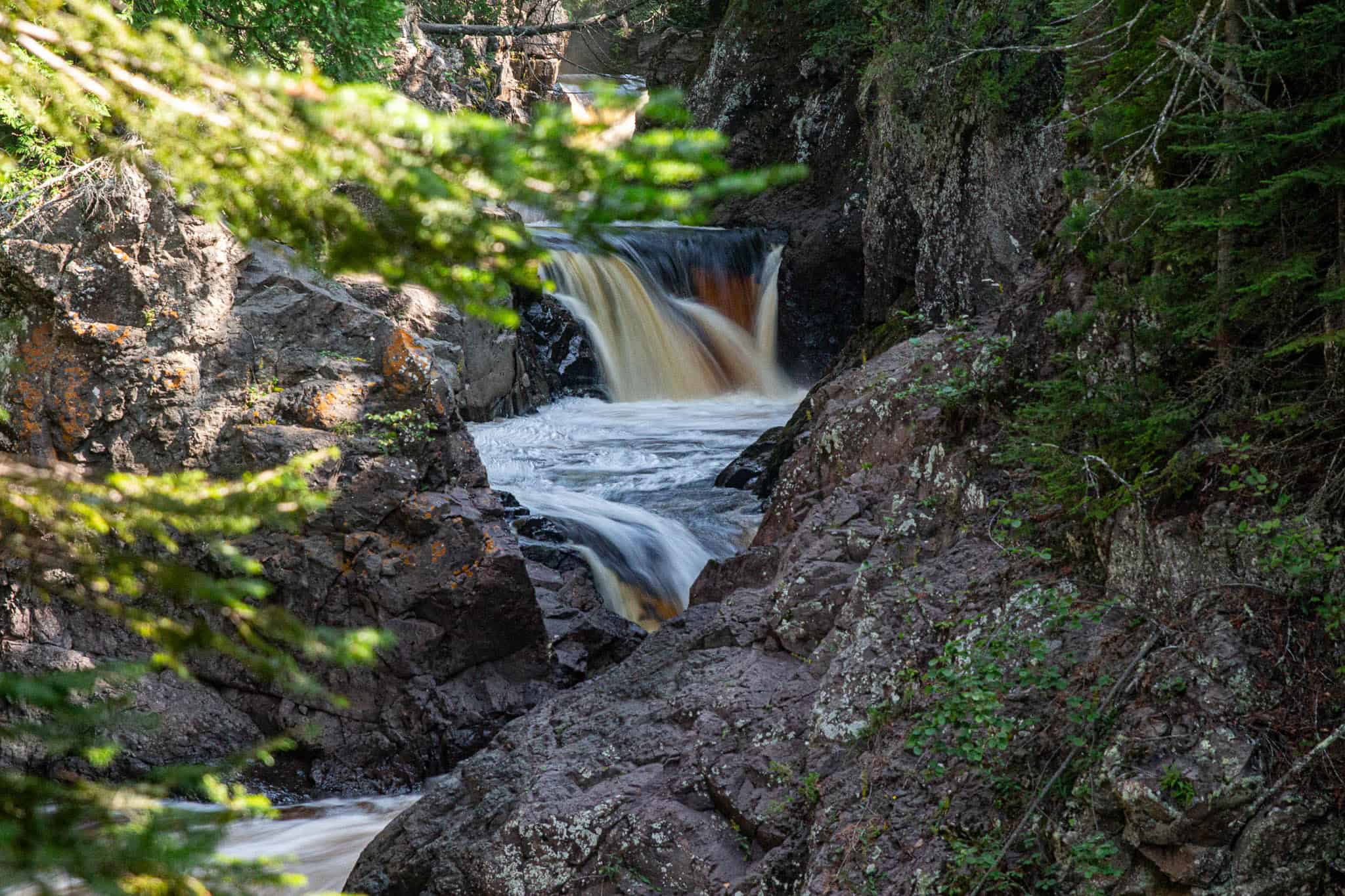
Temperance River Falls Loop at Temperance River State Park
This spectacular trail is hard to beat. Much of the hike follows the rushing Temperance River, seeing it at eye-level, then climbing to clifftops to view it flowing through the gorge below.
The trail is paved in the beginning, with signage describing the interesting history of the billion-year-old landscape. A quick climb takes you to a ledge to view “Hidden Falls” before hiking up rock and rock stairs for another half-mile or so.
In addition to getting great views the gorge pictured to the right, there are numerous opportunities to climb down on ledge rocks for a closer view of the water, and of several waterfalls.
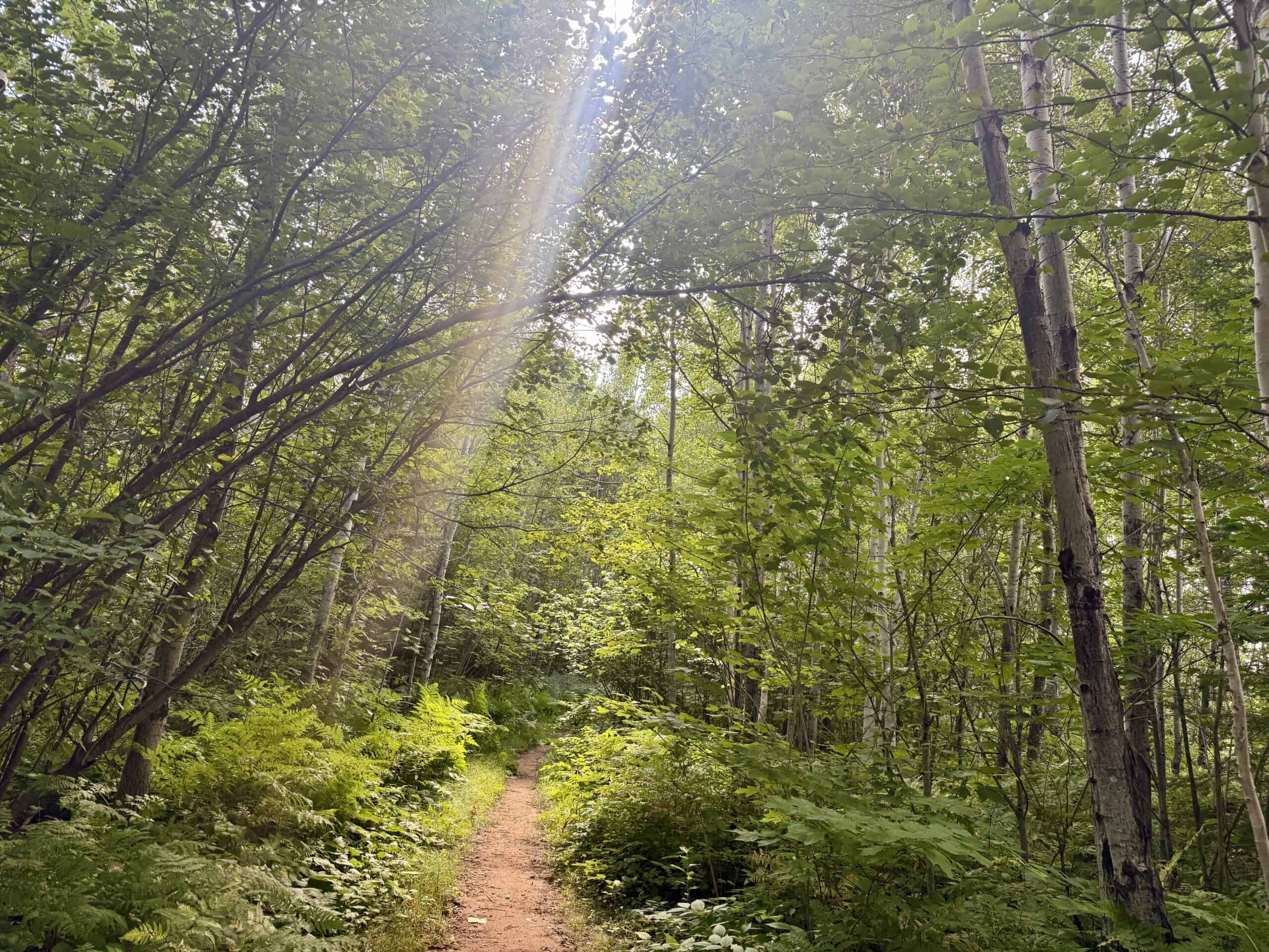
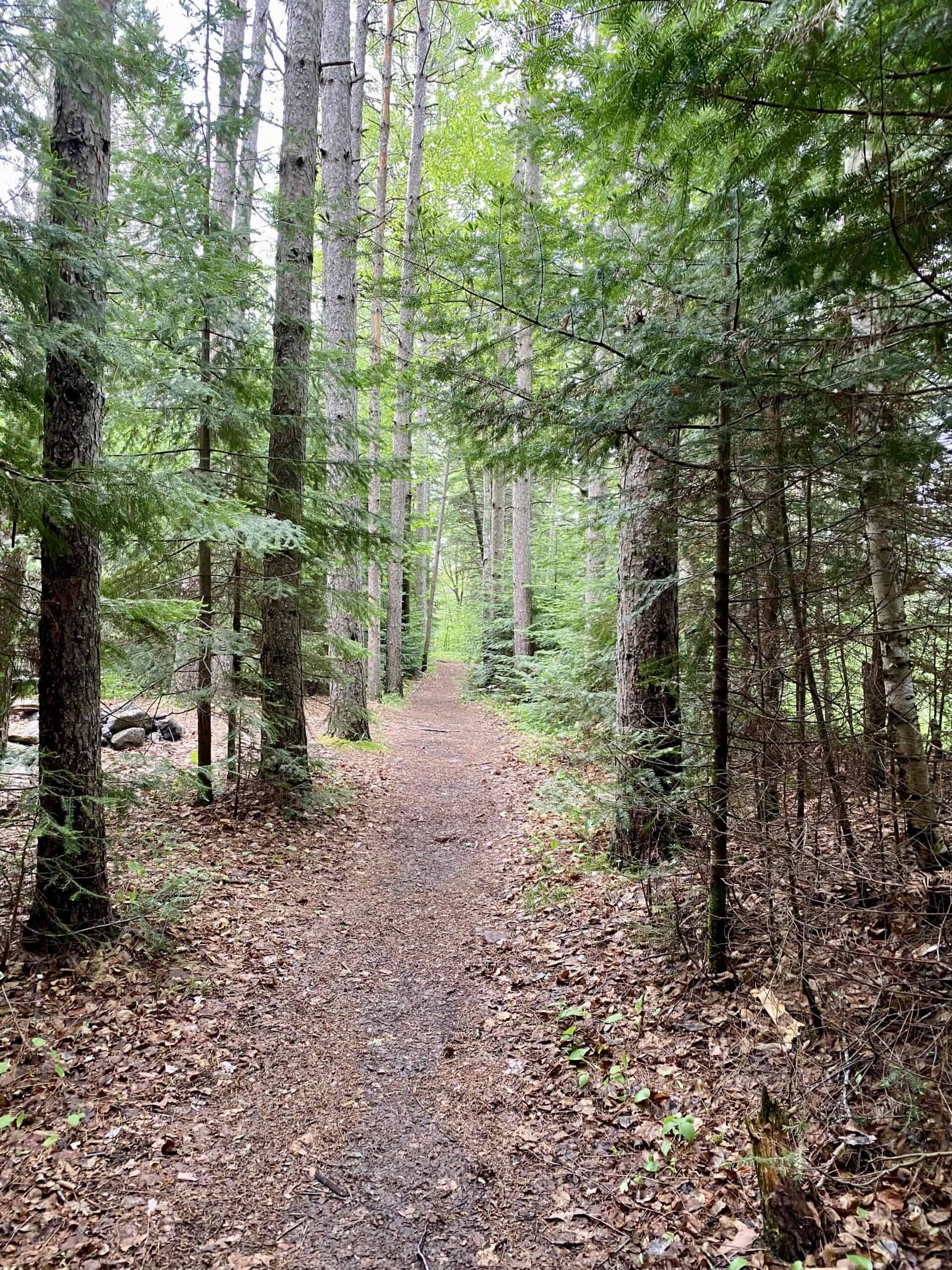
After about a mile, the trail becomes less crowded. Follow the signs to turn to your right and pass through a beautiful forested area with birch, pine, spruce, fir, and cedar trees, before looping back and re-joining the riverside trail to climb down. The entire hike is a joy.
Humerously, the river was called the “no bar river” by early settlers, because it is the only river along the North Shore with no sand/gravel bar at its mouth. It is said that during the temperance movement in the US, the name evolved into Temperance River, as a nod to “no bar”.
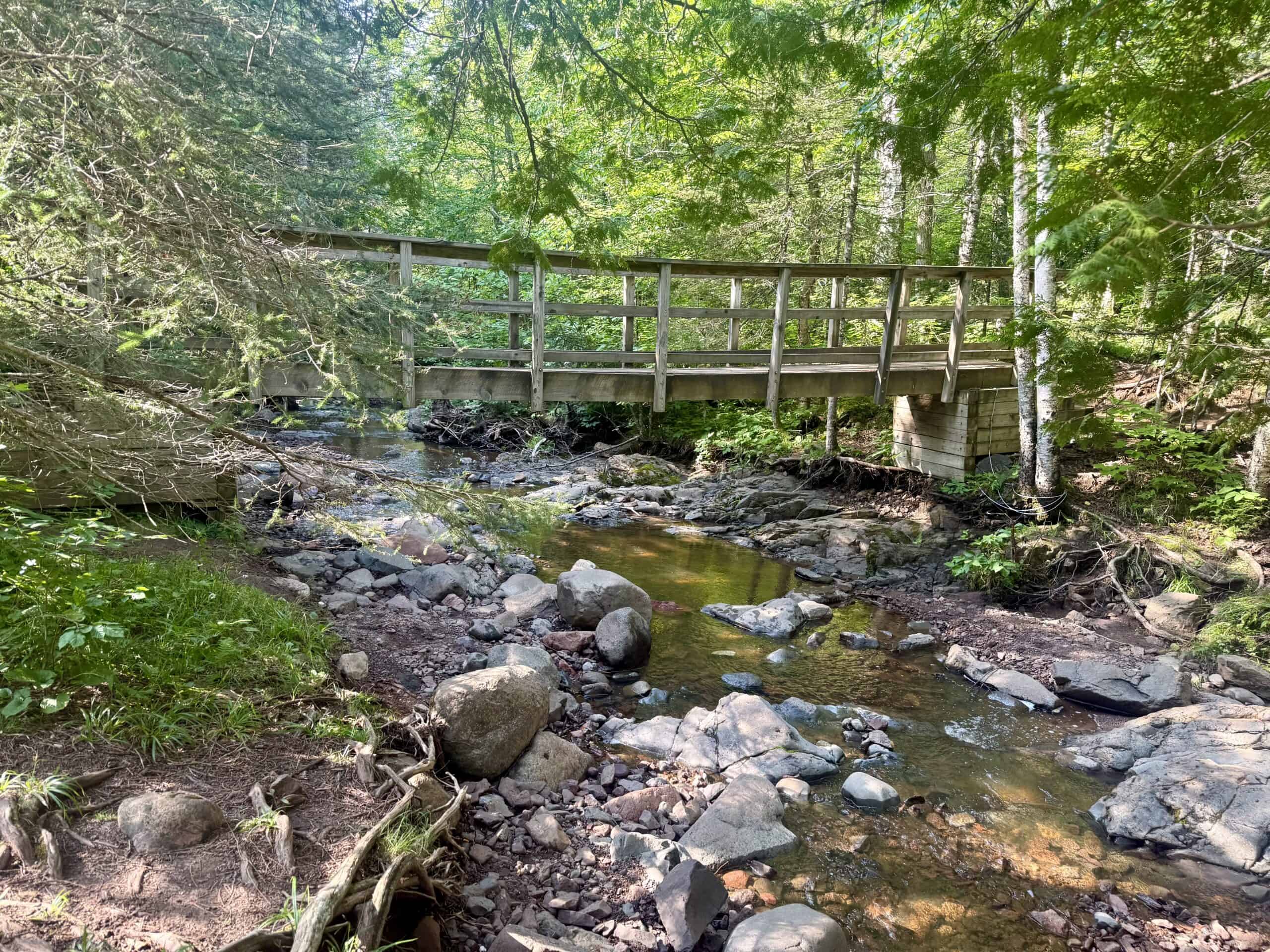
Are you short on time and/or energy? You can see lots of amazing scenery with a shorter hike, just a half-mile total. Simply follow the directions, but stop once you view the bridge and gorge pictured in the first photo, above, and turn around, returning to the parking lot.
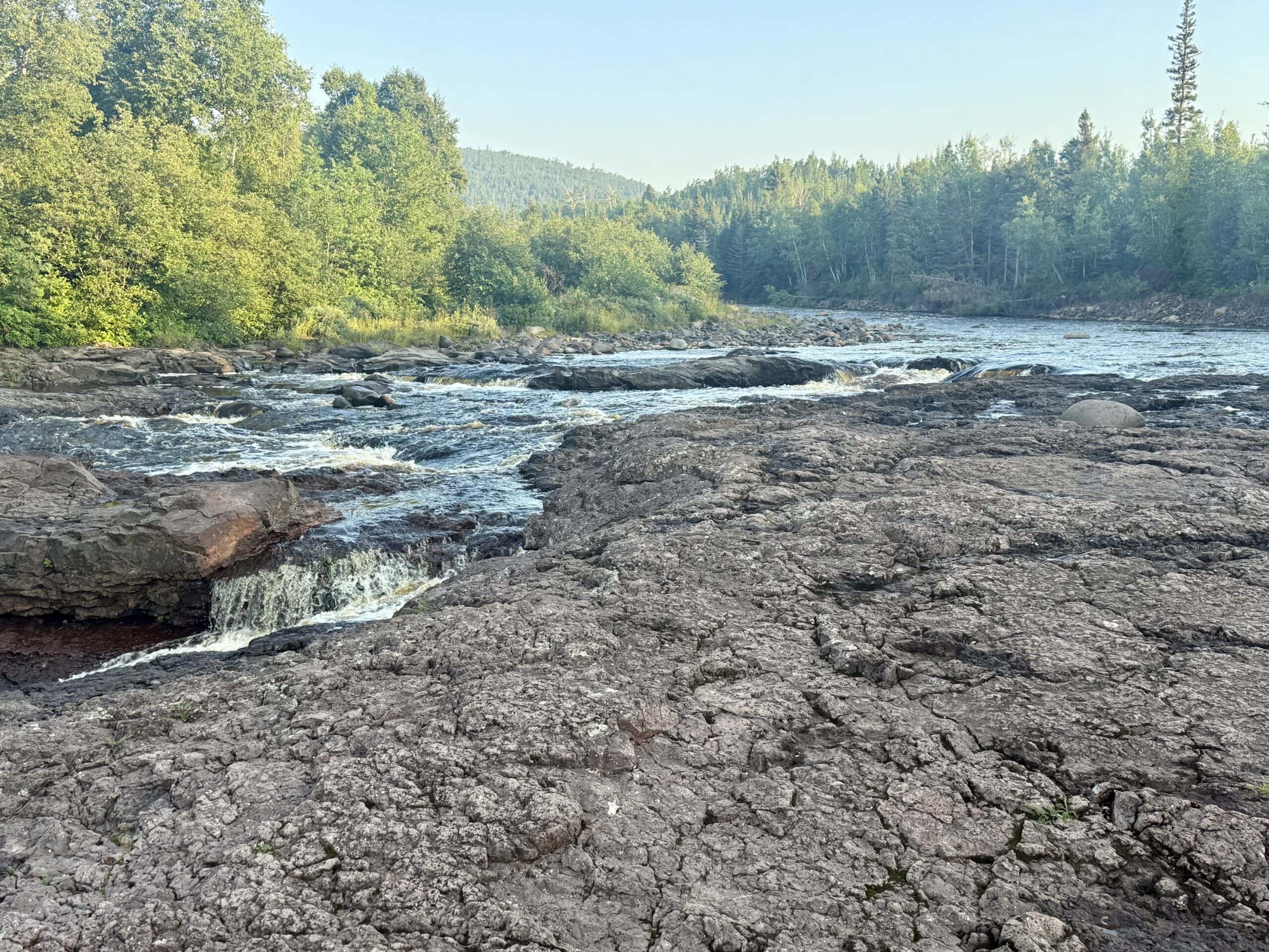
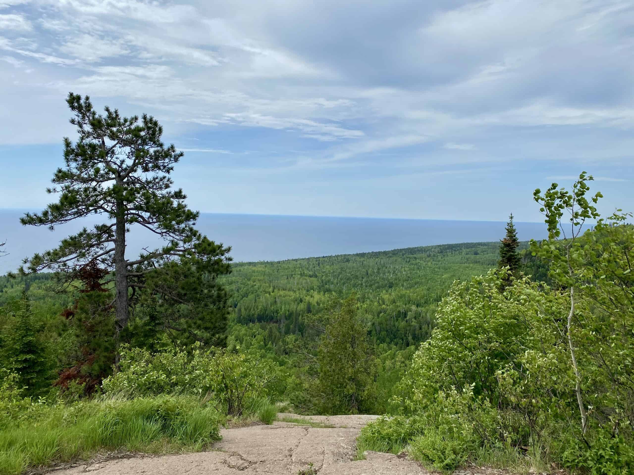
Carlton Peak at Temperance River State Park
Carlton Peak plays a role in Minnesota’s North Shore history. Because of its distinctive rocky top, commercial fishermen in the 1800s and early 1900s used it for navigation. In 1907, a new company, Minnesota Mining & Manufacturing, excavated at Carlton Peak in search of the mineral corundum to make grinding wheels and sandpaper. Instead, they found anorthosite, a relatively rare type of rock, but useless for their intended purpose. Years later, they did extract it, and it was used to construct nearby Taconite Harbor and the Tofte Ranger Station, both along Highway 61, creating growth for the then-struggling company. That company is now known as 3M!
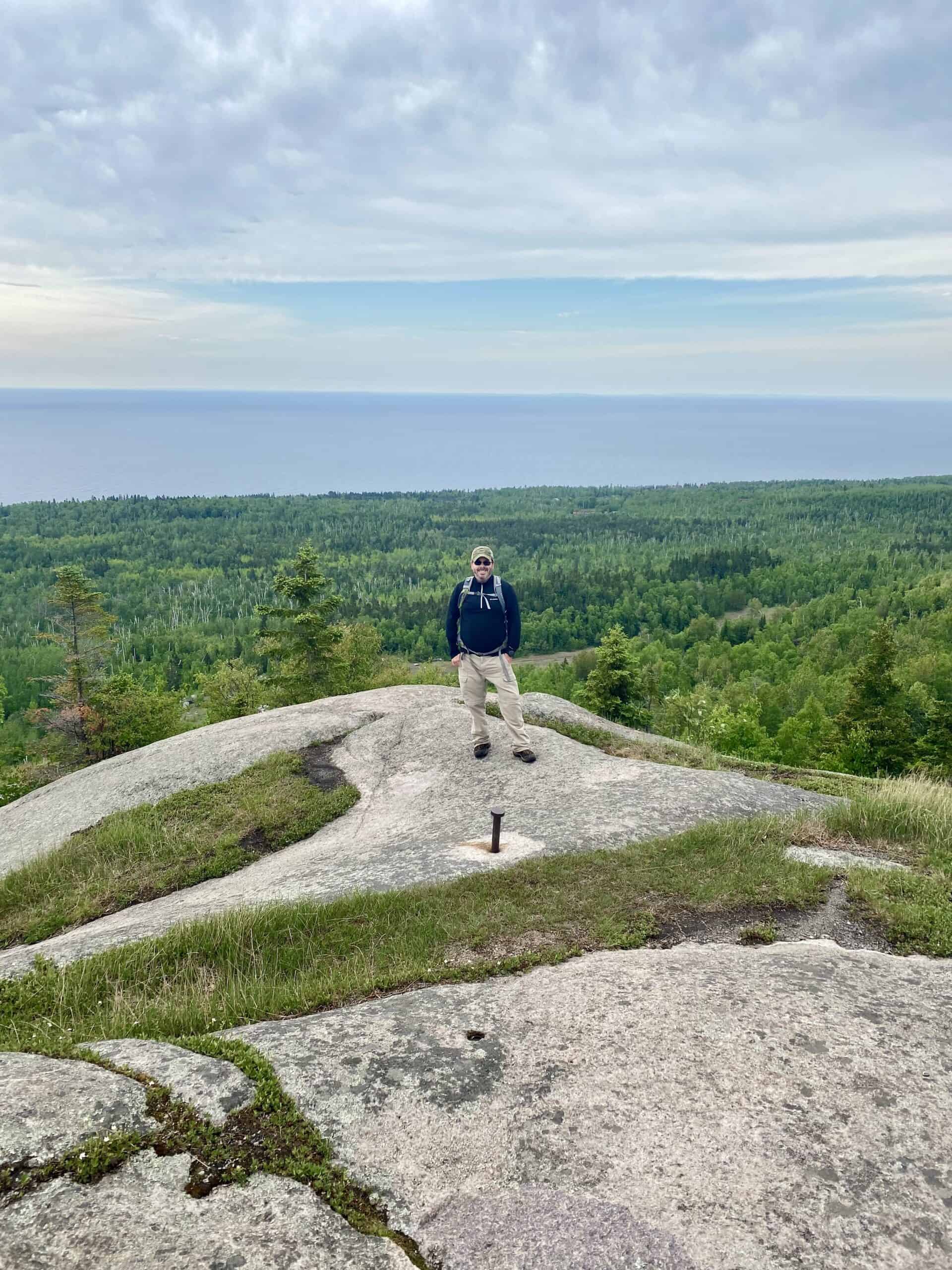
Carlton Peak is the most challenging hike on this list, in our opinion, but has views at the top that make the effort well worth it. It has a gradual climb at first, along the Temperance River, then turns into a forested area and becomes fairly steep, gaining over 1,000 feet before reaching the peak. At the top, looking down over sheer cliffs, the views of Lake Superior are magnificent.
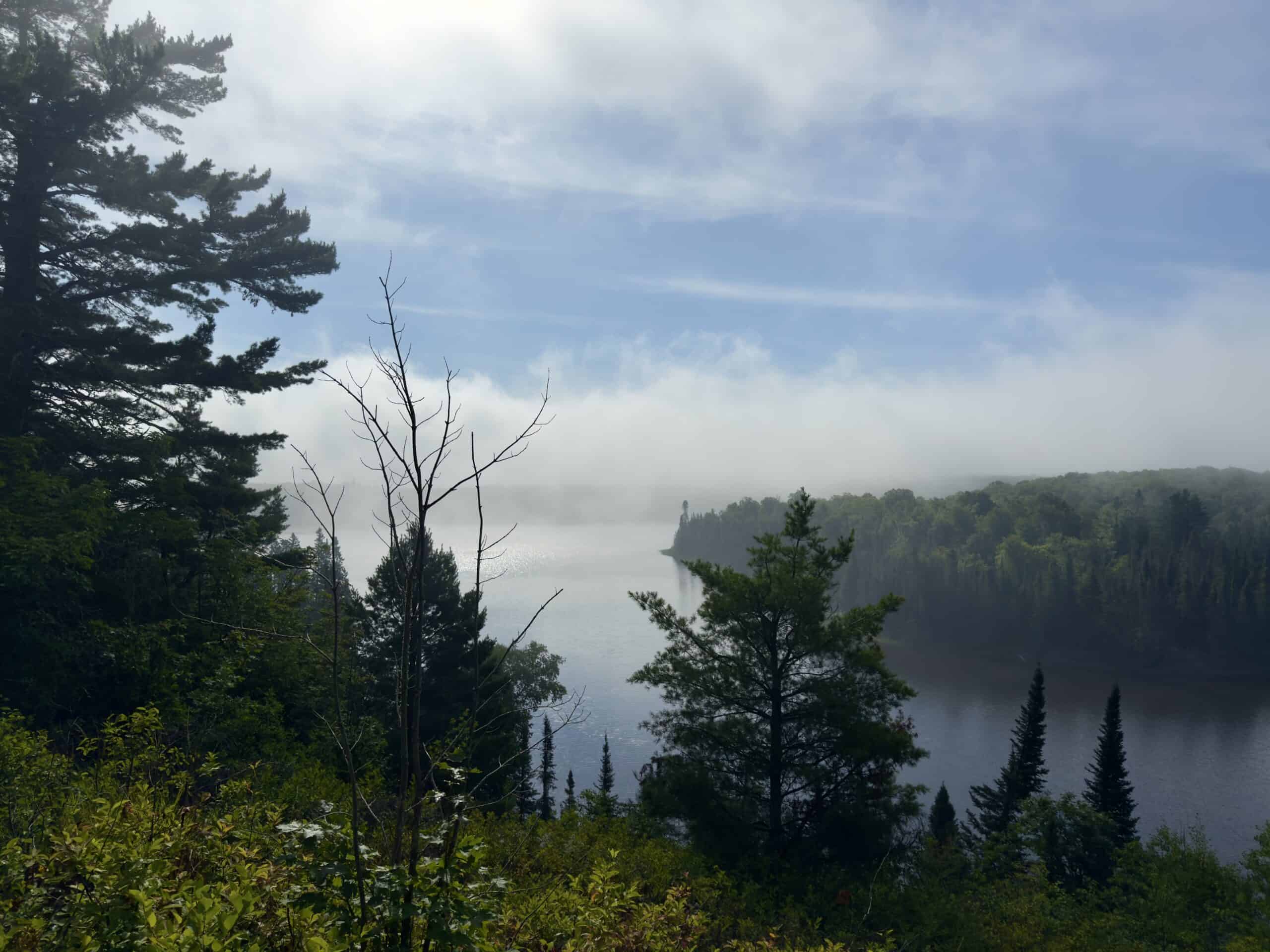
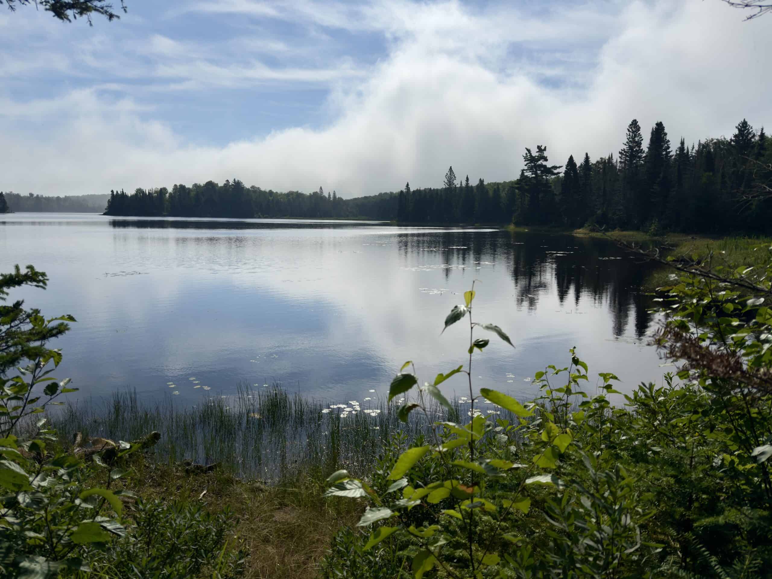
Agnes Lake Trail
This lovely hike along an inland lake is a great way to escape crowds during busy times on the North Shore.
Shortly after starting the hike, be sure to take the quick spur to White Sky Rock to the right at the fork in the road. It provides a splendid view of Caribou Lake.
Back on the main trail, it is a 15 or 20-minute walk through a pretty, shaded forest of maple trees (said to be especially stunning in the fall). As you approach Lake Agnes, the maples are replaced by pine and birch trees.
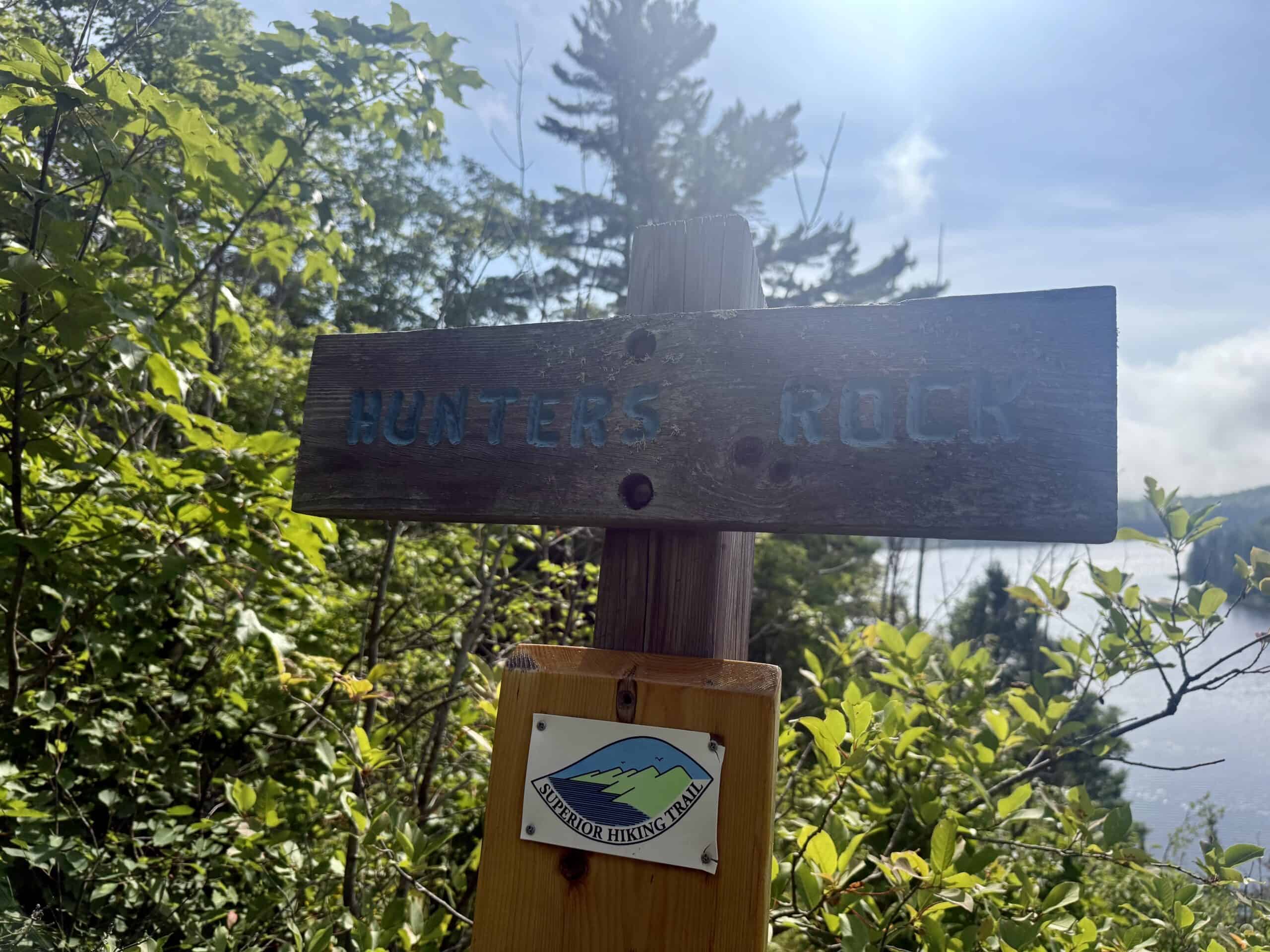
Most of the rest of the hike is along the shore of beautiful, wild, undeveloped Lake Agnes. There are opportunities to get up close and personal, and even take a dip in the water, as well as view it from above. You pass through East Agnes Campsite, which may well be the only place you encounter any other people. For a nice picnic site, watch for the sign for Hunter’s Rock after East Agnes Campsite.
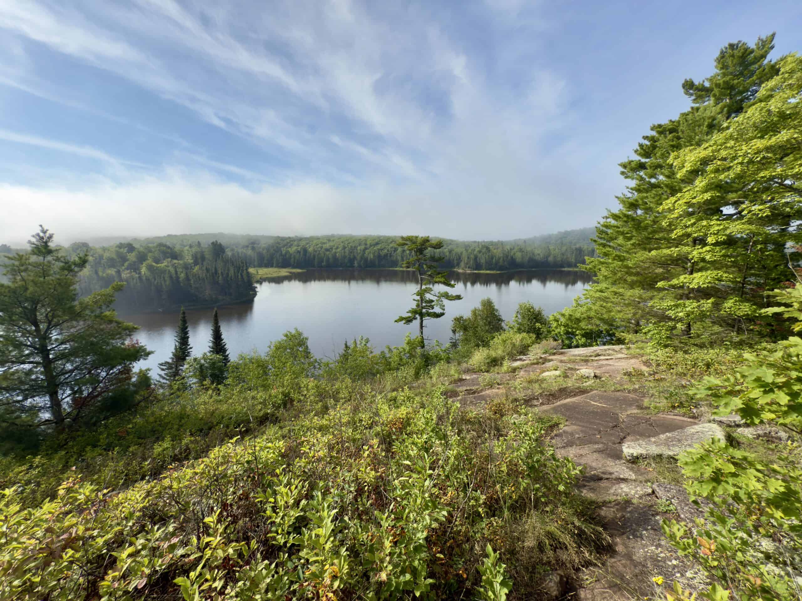
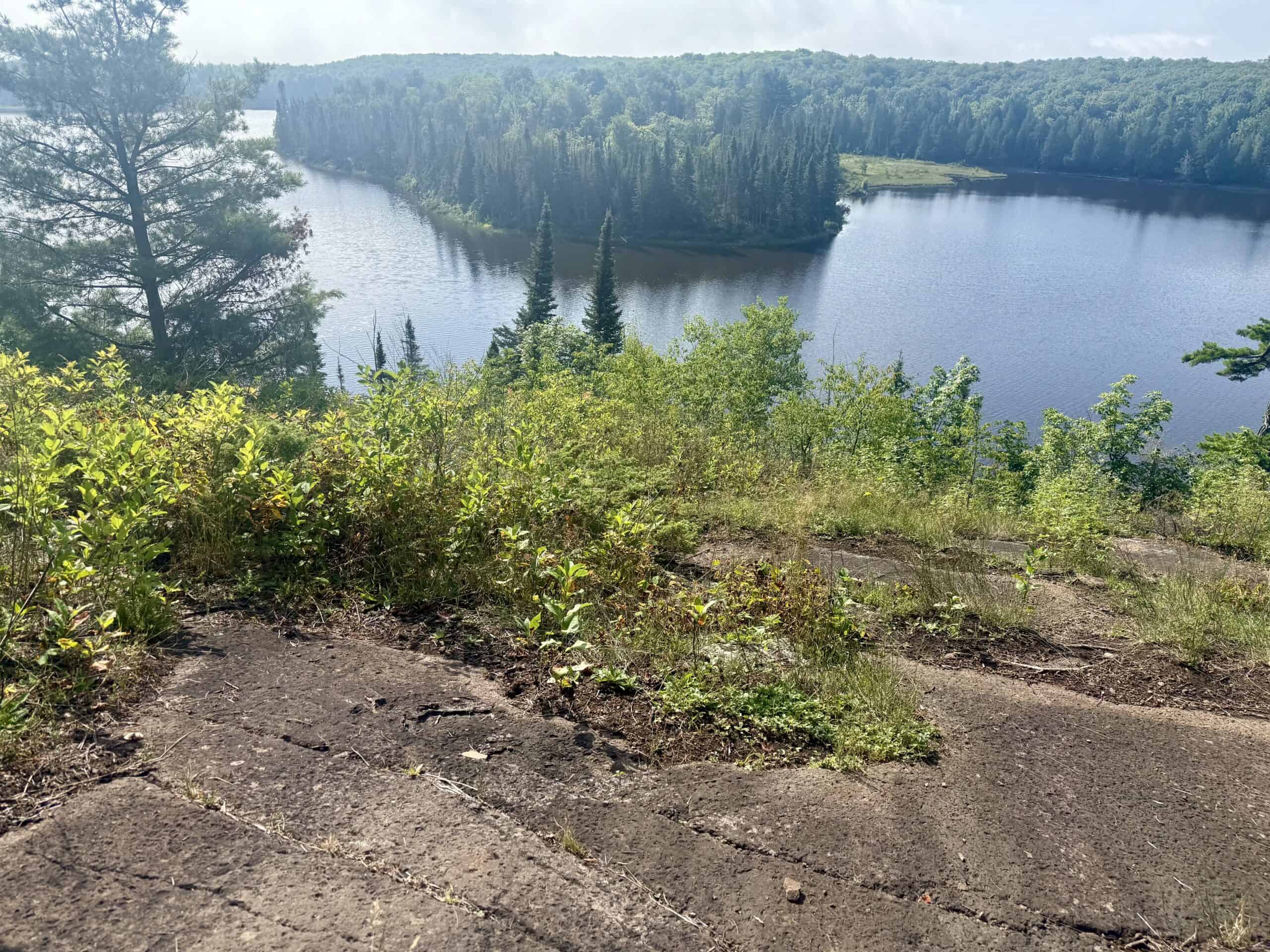
The West Agnes Lake Campground is a good turnaround spot. (Though you can extend the hike along the Superior Hiking Trail to include beautiful views over the Poplar River, or even hike all the way to the Lutsen Mountain Recreation Area.)
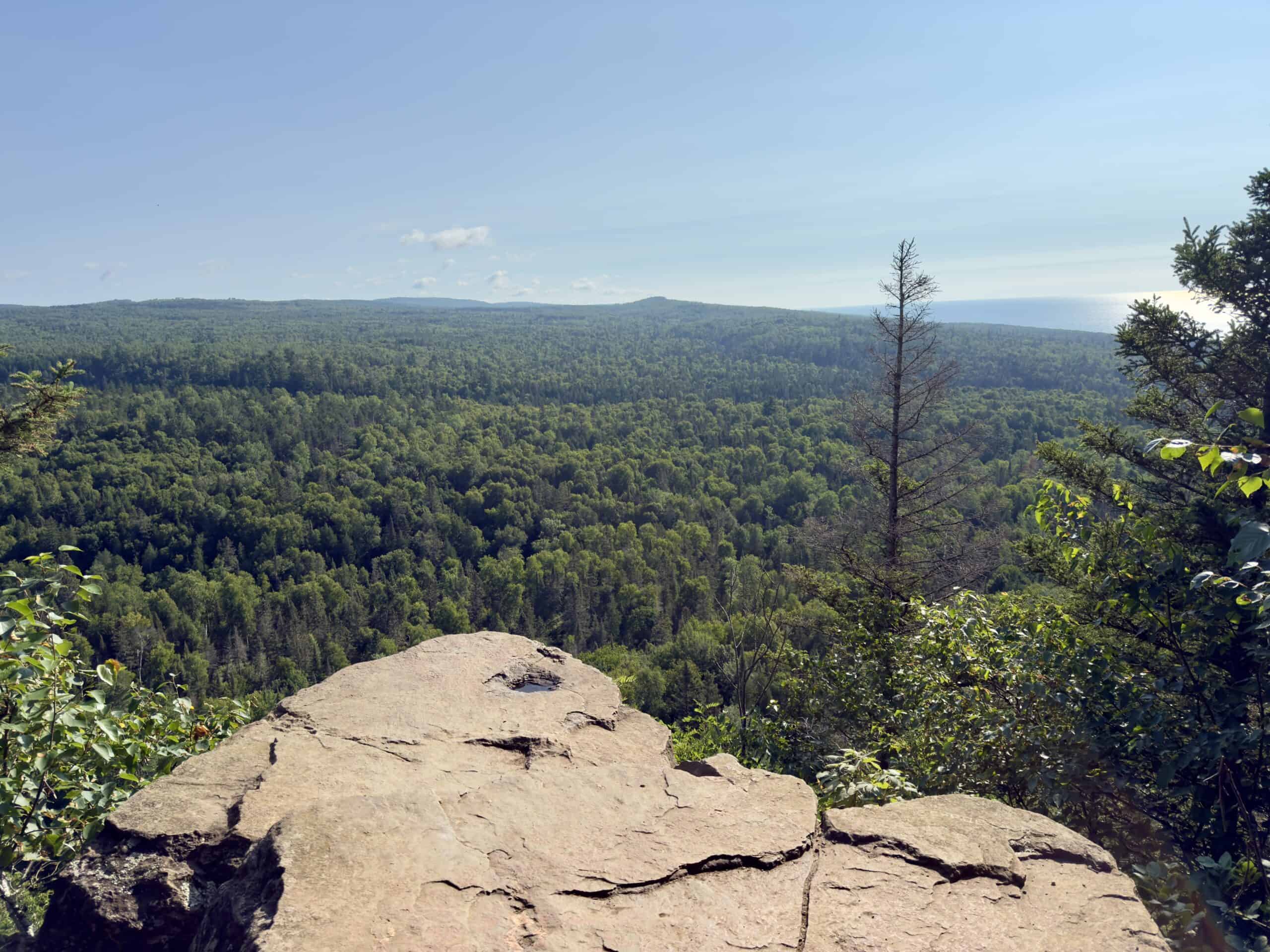
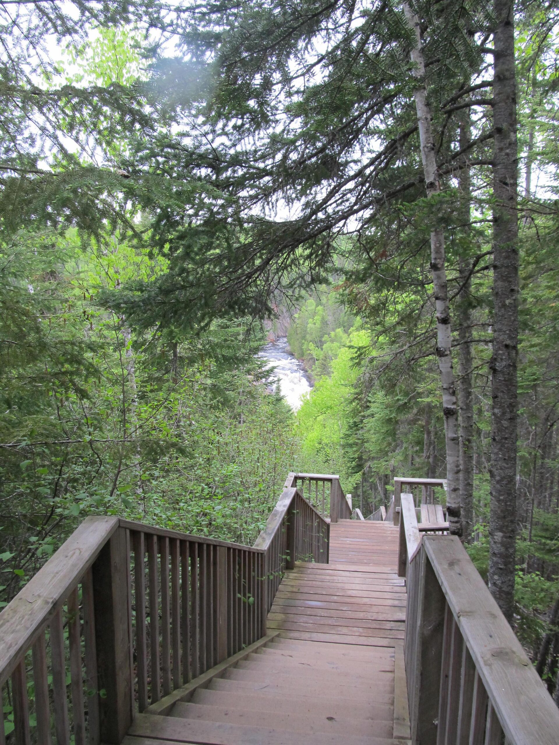
Lookout Mountain Loop at Cascade River State Park
Waterfall lovers are in for a treat! (And who doesn’t love waterfalls?) This hike is wonderful anytime, but especially in the spring, when the river flow is the strongest. The trail rewards hikers almost immediately with the beautiful Cascade Falls and several scenic overlook spots.
Just a little upriver from the first falls are “The Cascades”, a series of falls where the Cascade River plunges 120 feet through a narrow, twisting gorge on its journey to Lake Superior. There are some steep areas (with helpful staircases) along the gorge, and several side spurs, as well as a bridge, affording many opportunities for spectacular views.
This loop continues up through the birch, spruce, and fir forest, crossing pretty Cascade Creek. Becoming steeper, the trail ascends to Lookout Mountain, with sweeping views of the surrounding treetops and Lake Superior in the distance. There is an enormous rock at the edge of the cliff, and it’s tempting to walk out and sit on it, and even dangle one’s legs. I did that once, many years ago, but am way too chicken to do so now!
The loop swings back towards the creek, passing by another “secret” waterfall. Unfortunately, on our most recent visit, that route was completely overgrown and basically impassable. So we just turned around and retraced our steps.
Even if you just have 20 minutes to spare, consider a quick stop here, just off Highway 61, to take the .4 mile round-trip walk to view Cascade Falls.
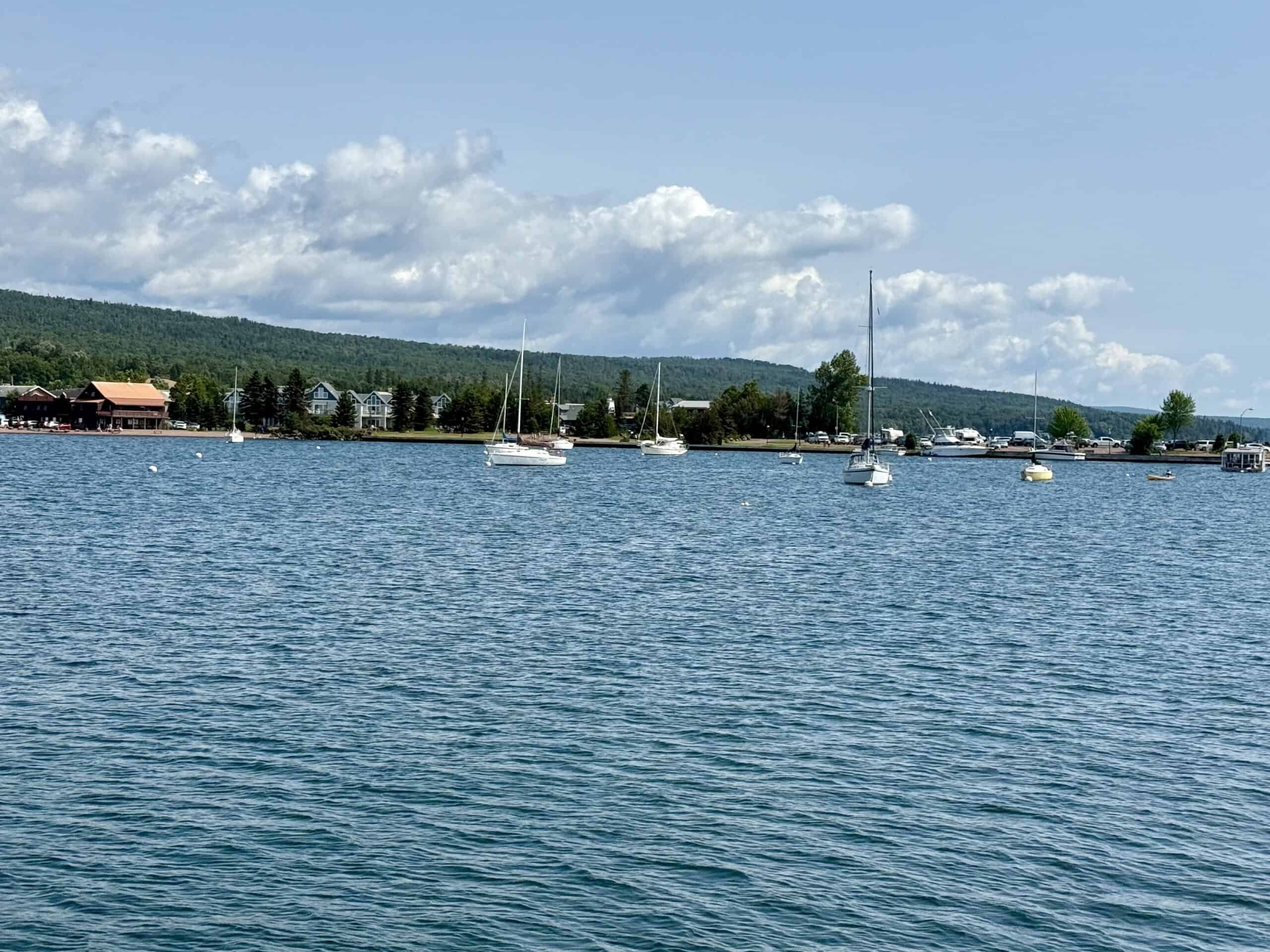
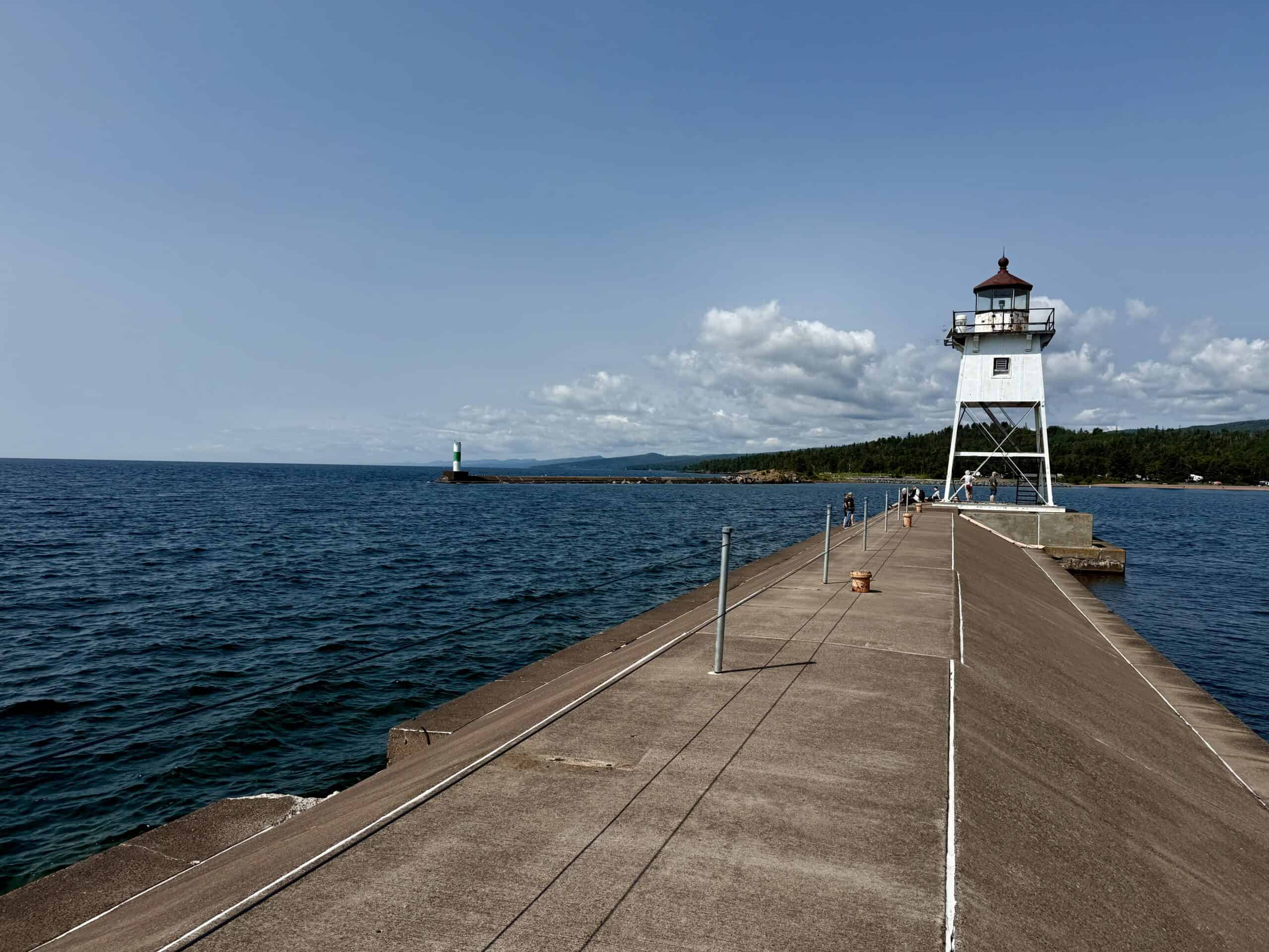
Artist’s Point & Lighthouse
This fun, short walk is right at the Grand Marais harbor, with a large parking lot available at the Coast Guard station. Though not long or steep, the trail is over uneven rock much of the time, so shoes with decent tread are helpful. Visitors can’t enter the 1884 lighthouse at the end of the trail, but can go right up to it and soak up the views of the boats, the town, and, of course, moody Lake Superior.
Before or after going to Artist’s Point, be sure to take some time to explore charming Grand Marais. The walkable town is full of restaurants, shops, galleries, and lodging options.
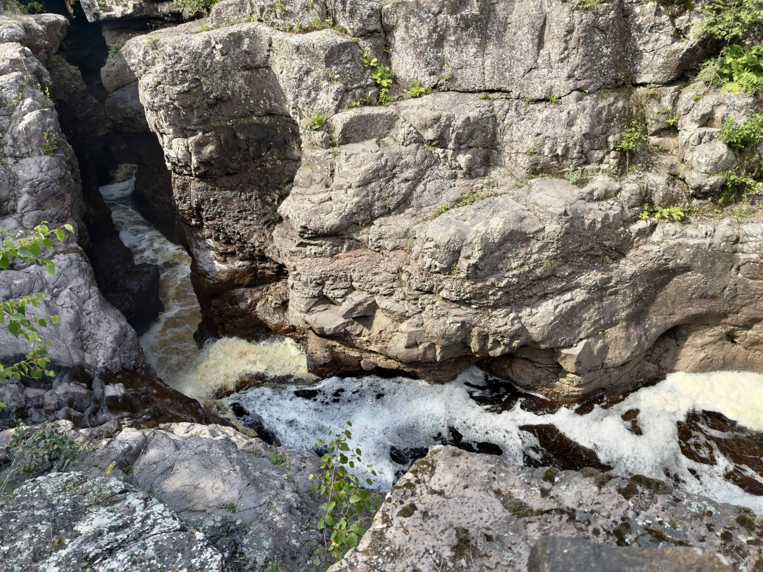
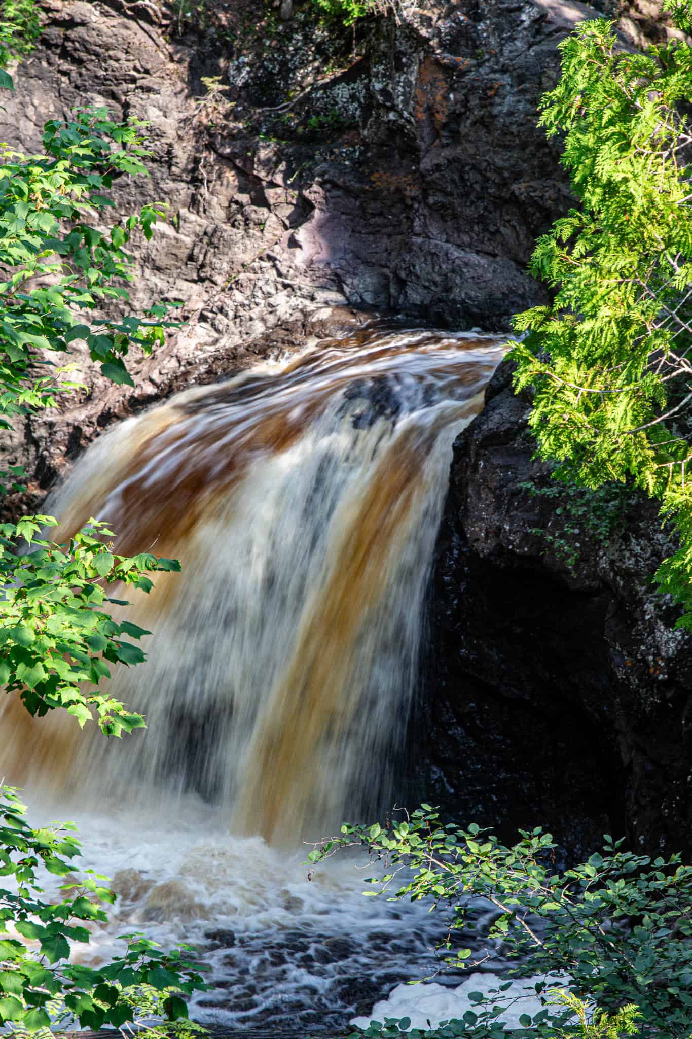
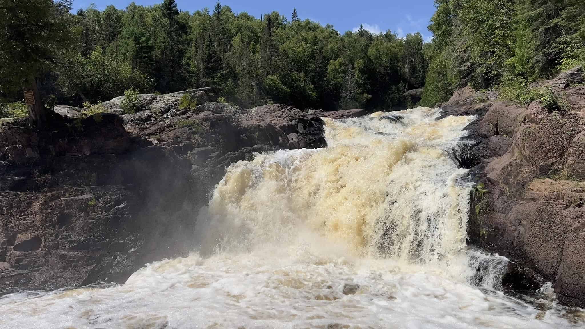
Devil’s Kettle at Judge CR Magney State Park
Located just north of Grand Marais, this trail is a delight (as long as you don’t mind lots of stairs). The highlight is the thunderous Devil’s Kettle Falls on the Brule River. The waterfall holds a mystery! The river is split at the top of the falls by a huge outcropping of volcanic rock. One side flows normally into a pool at the bottom, and continues down the river, ultimately flowing into Superior. (The longer waterfall on the right-hand side in the photo.) But the other side? It flows into a huge hole (or kettle, if you will), and then disappears.
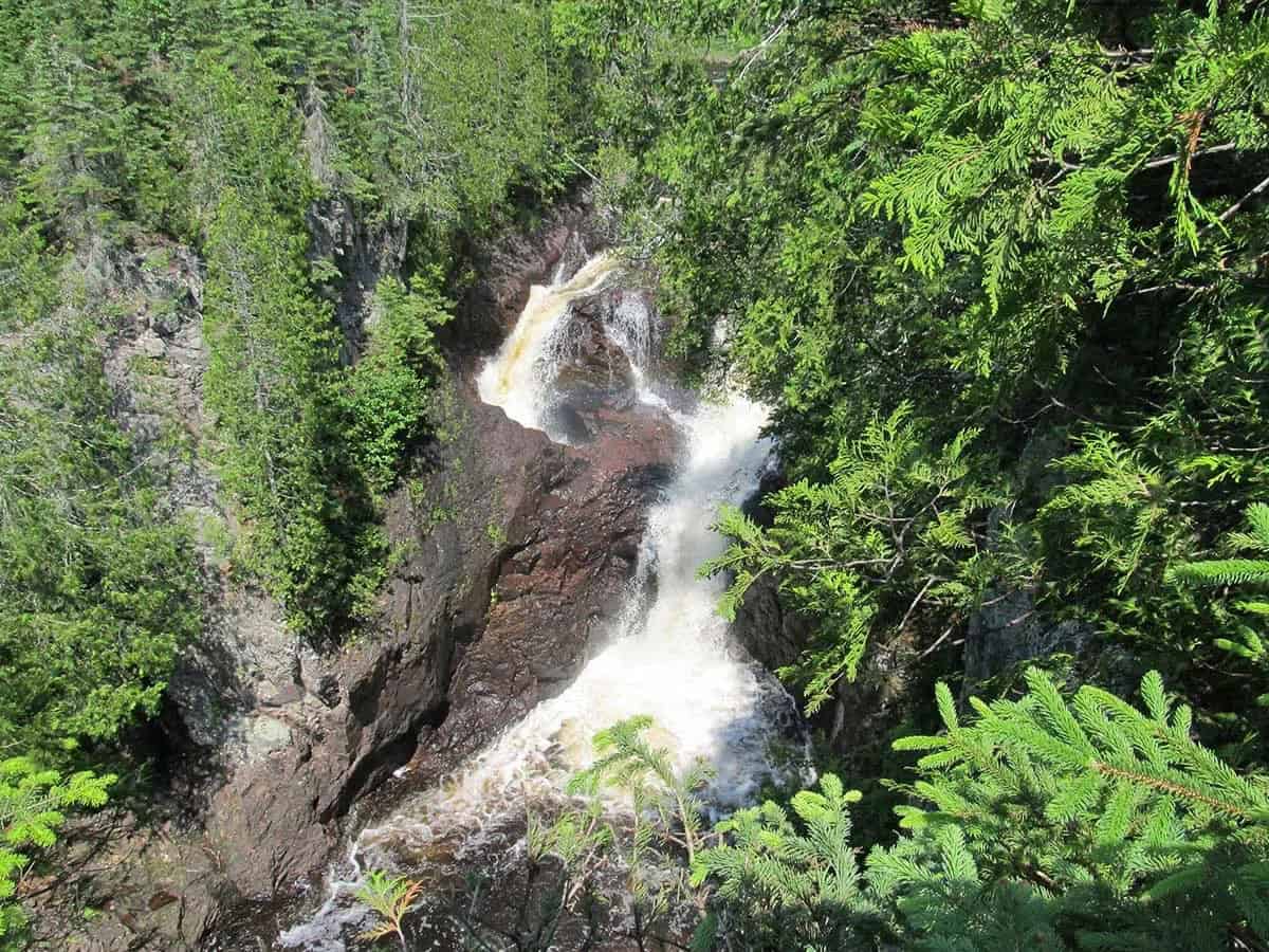
Many a curious hiker (and even scientist) has thrown things such as balls, bottles, sticks, and logs into the water to see where they come out, and seemingly, they never do. Rumor has it that an old car was pushed over the ledge into the kettle and never emerged. (Of course, it seems unlikely that anyone could get a car up there, but why ruin a good story with the facts?) Some surmise that the water just travels underground until it joins up with Superior, but geologists say that is nearly impossible. So where does the water go?
Aside from the mystery, this moderately difficult hike is about two miles round trip, and is steep in places. A series of about 190 steps is installed over the steepest part. You take the stairs down to the falls, but of course have to climb up on the way back. (Don’t forget to take the extra short set of stairs to see the thundering Upper Falls on your way back.) Mercifully, there are several benches along the way to take a break.
The trail follows the Brule River nearly the whole time, and there are calm, shallow areas where you can soak your feet or even wade a little, and enjoy a picnic lunch.
Where to Stay on Your North Shore Trip
Most towns along Highway 61 range from small to itty-bitty, so consider lodging with a kitchen, allowing you to eat in if you choose. Also, be sure to choose a place with a good view of the mesmerizing Lake Superior! Regardless of where you stay, make your reservation as early as possible, particularly from late May through September.
The Tofte/Lutsen area and Grand Marais are our favorite places to base a trip. To keep this article from getting too long, we’ve created a separate section, for those who want more information:
Where to Base Your Stay on the North Shore.
Please take a look when you’re ready to plan your trip!
Are you spending time in the Twin Cities before or after your North Shore adventure? If so, check out our article: 3 Days in Minneapolis. Or if you’re returning to the area in the winter, Embracing Winter in Duluth might interest you.
Discover more from Werthwhile Wandering
Subscribe to get the latest posts sent to your email.


Gorgeous pictures.