12 Favorite Hikes around Breckenridge
There are so many hiking opportunities in this area it is mind-boggling. We’ve picked some of our favorites below, ranking them from easiest to hardest, in our “flatlander” opinion.
Before you head out, download the free AllTrails app. With AllTrails, you’ll get driving directions, trail maps, descriptions, and lots of reviews that will reveal the condition of the trails and other information you might need. This app works all over the US and also internationally. The app offers a paid membership for a nominal fee, too. With that, you can download the maps onto your phone, which is helpful to keep you on track, particularly in areas with no cell service. Click on the title of any hike we’ve listed below, and it will take you to the All Trails information.
For any hiking in the area, consider going in the morning to avoid crowds and also common afternoon thunderstorms. Be a safe, smart hiker and a good tourist: pack a rain jacket, a snack or two, and – above all – more water than you think you’ll possibly need.
Table of Contents
Easy Walks/Hikes
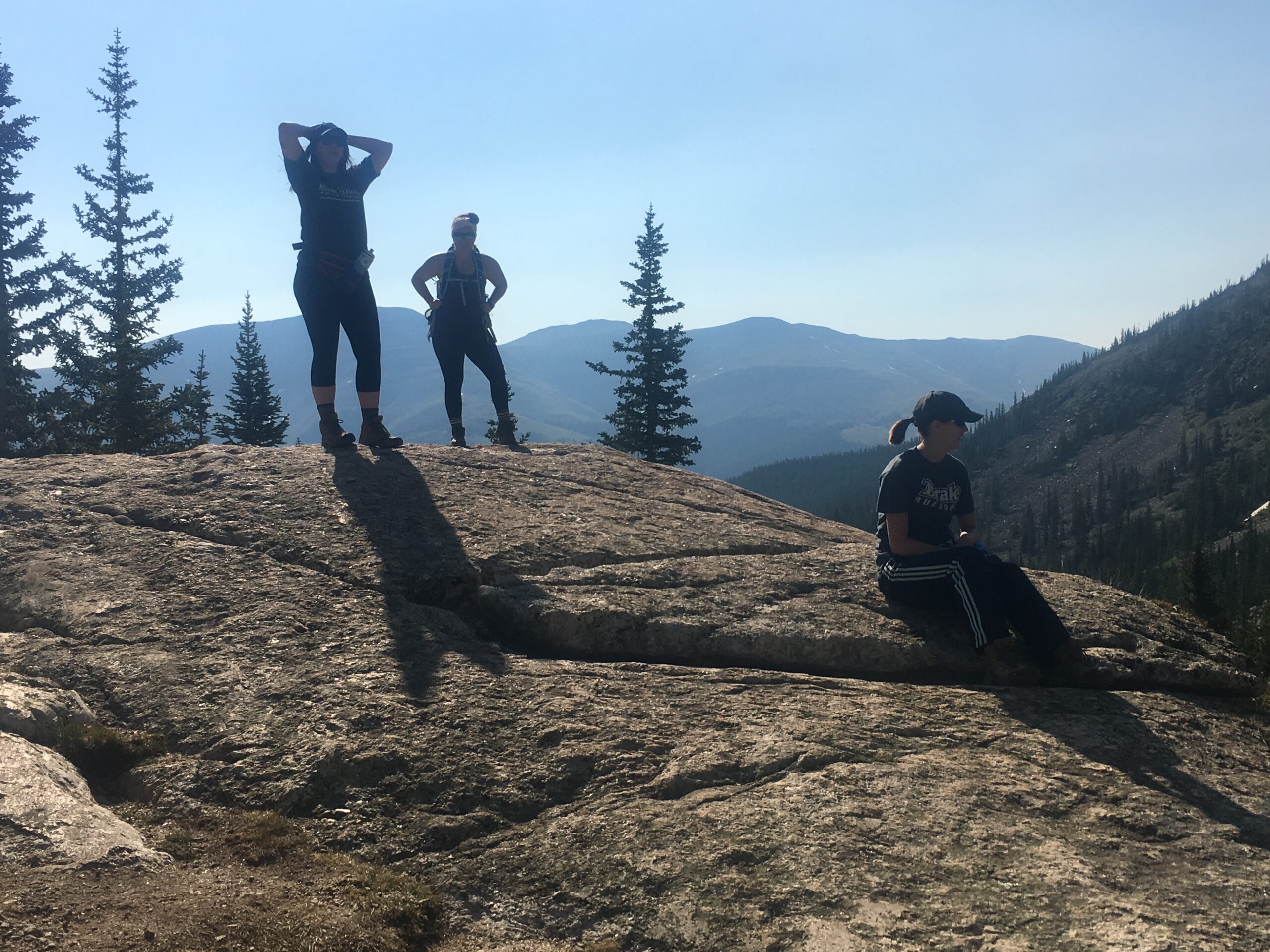
These are great to do early in your trip while you’re getting acclimated. They can all be done with regular tennis shoes, in case you didn’t pack hiking boots. These take between 30 – 90 minutes, allowing for photo stops and snacks.
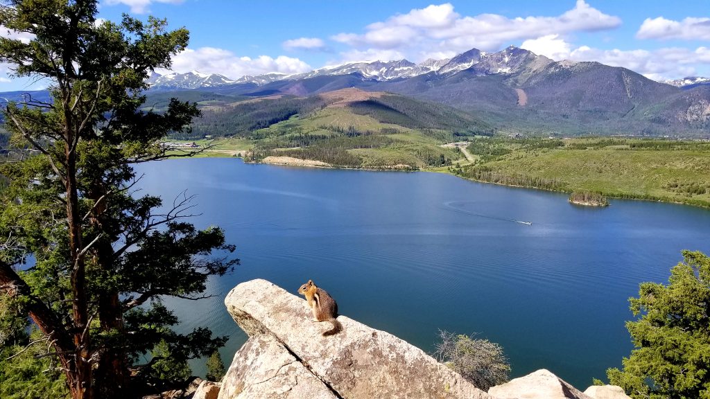
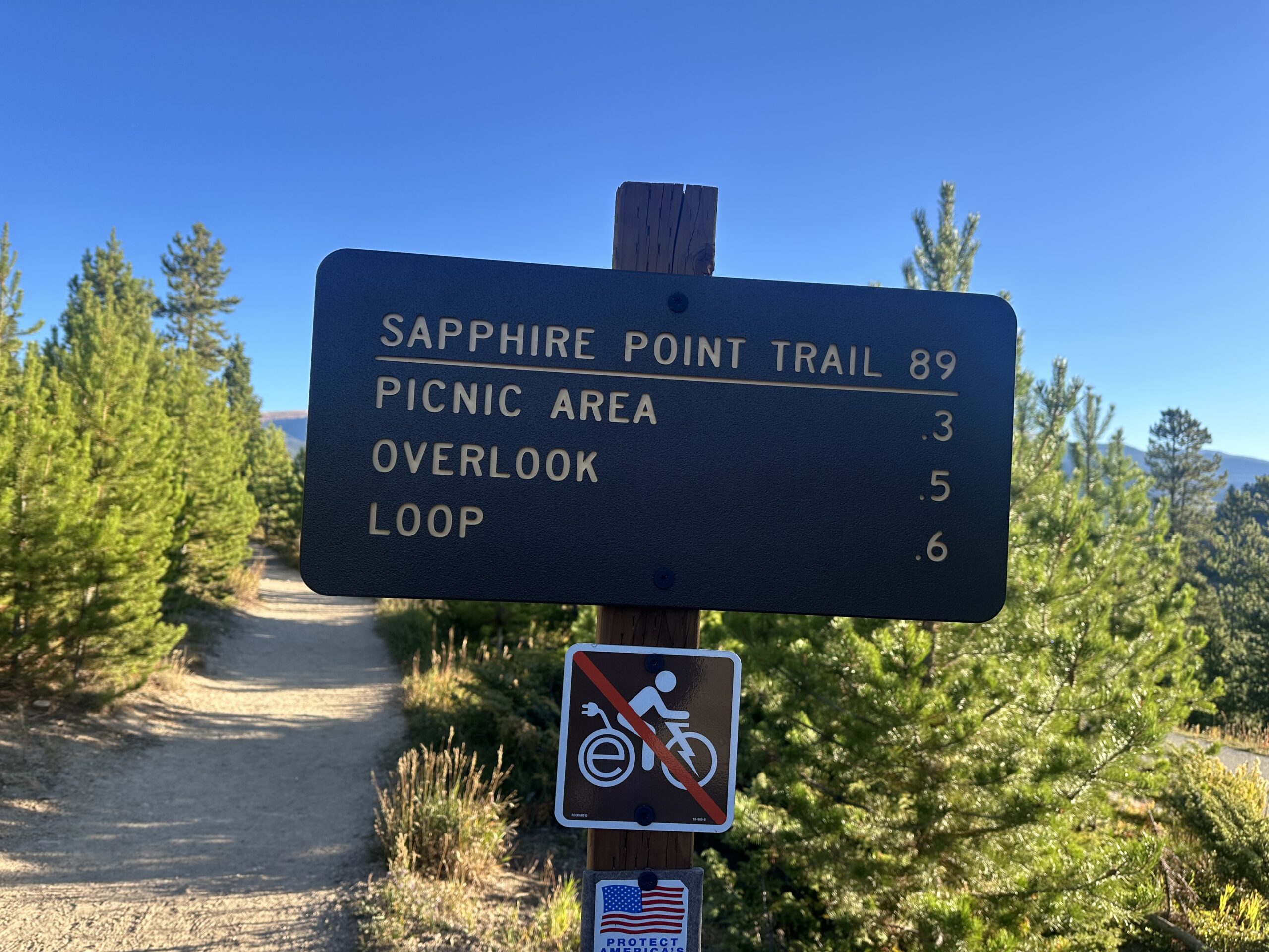
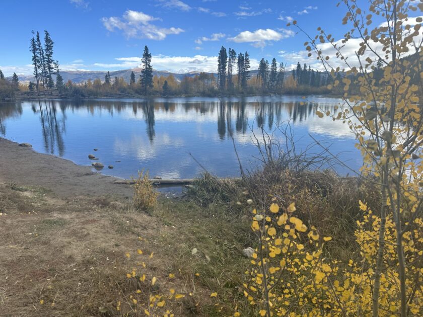
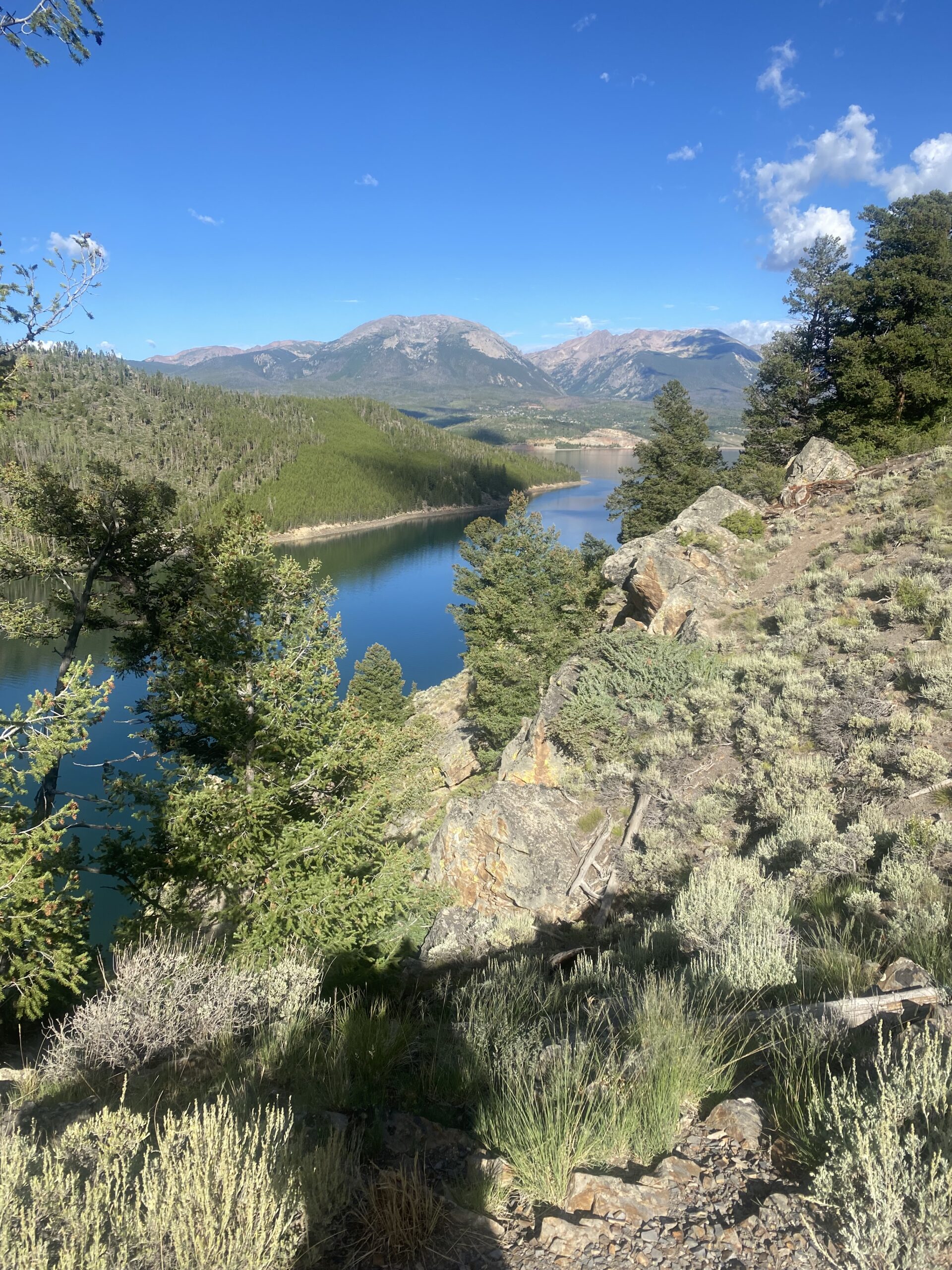
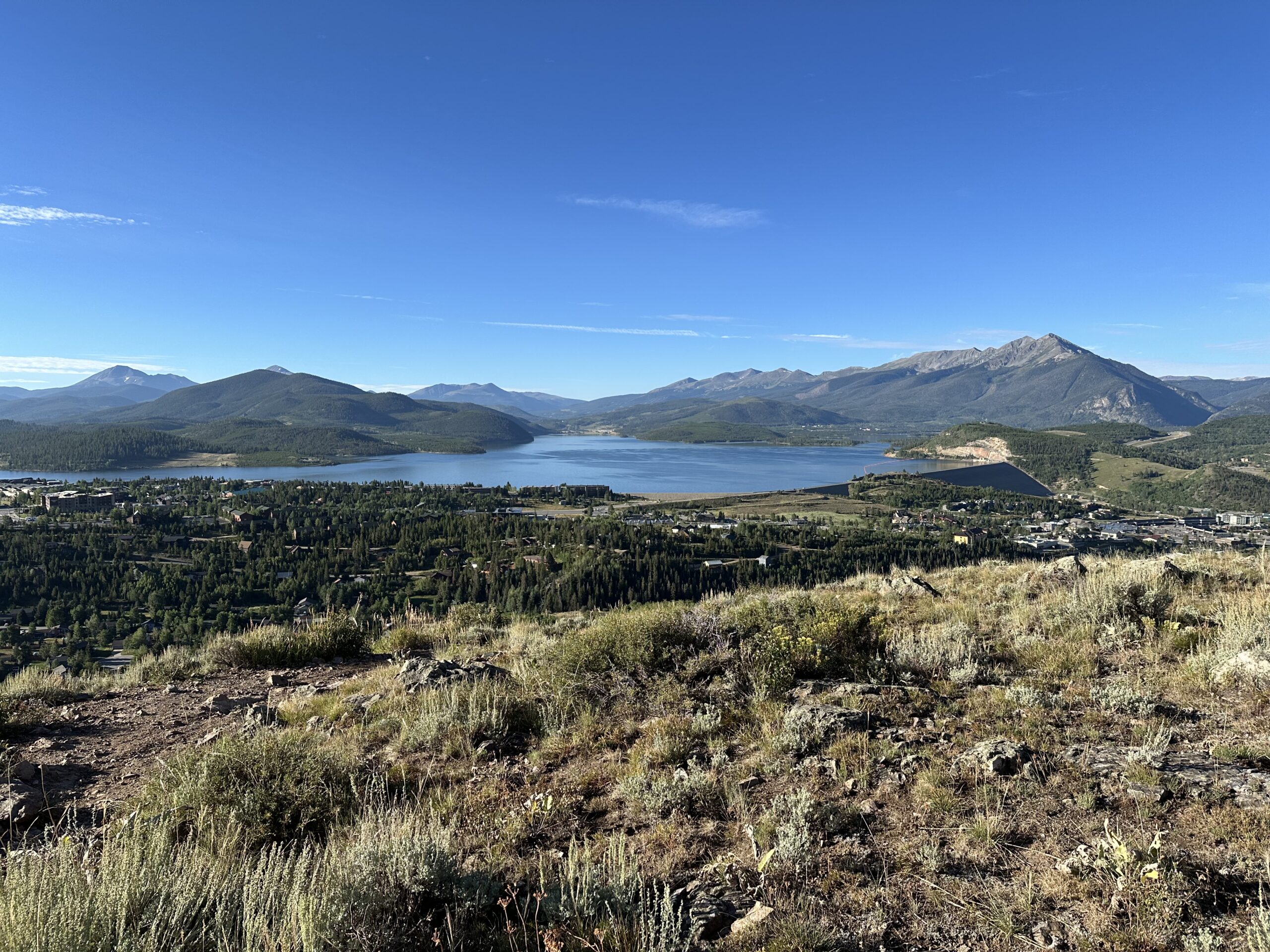
Sapphire Point Overlook – Located between Breck and Keystone along curvy Swan Mountain Road, this really isn’t a hike, but rather an easy stroll. But the rewards are exceptional: panoramic views of Lake Dillon and the surrounding mountain ranges.
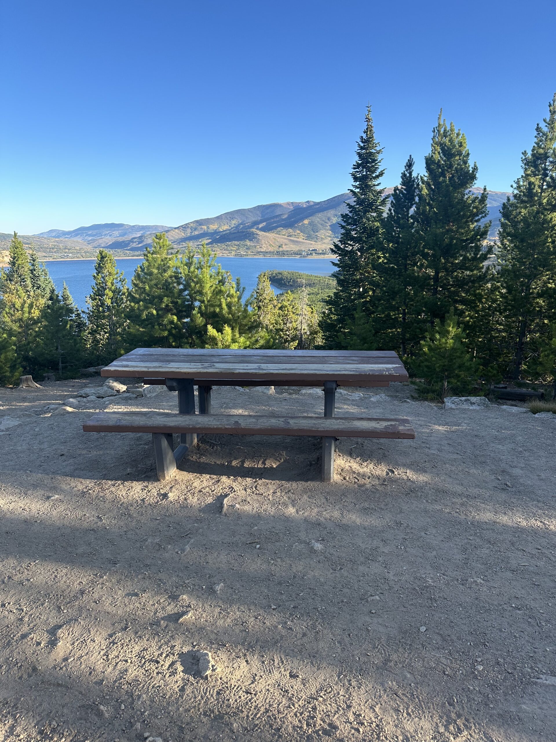
It is just a 5-minute walk to the overlook, and you can continue another 5 or so minutes to a picnic area for a roughly 15-minute loop. Of course, it turns into 30 minutes when you add in ogling and photographing time!
Aside from the views, the stars of the area are the abundant chipmunks that will beg to eat out of your hands. We haven’t yet watched a sunset there, but friends say it is an amazing experience.
Rainbow Lake Trail – Follow Peak’s Trail to the scenic Rainbow Lake for a short hike with lots of shade frequented by families with young children. There are regular moose sightings on this trail, but we’ve never been so lucky. If you feel like doing a little more, connect up with Miner’s Creek Trail climbing up higher for some nice views of Frisco. Both trails are also great for snowshoeing in the winter.
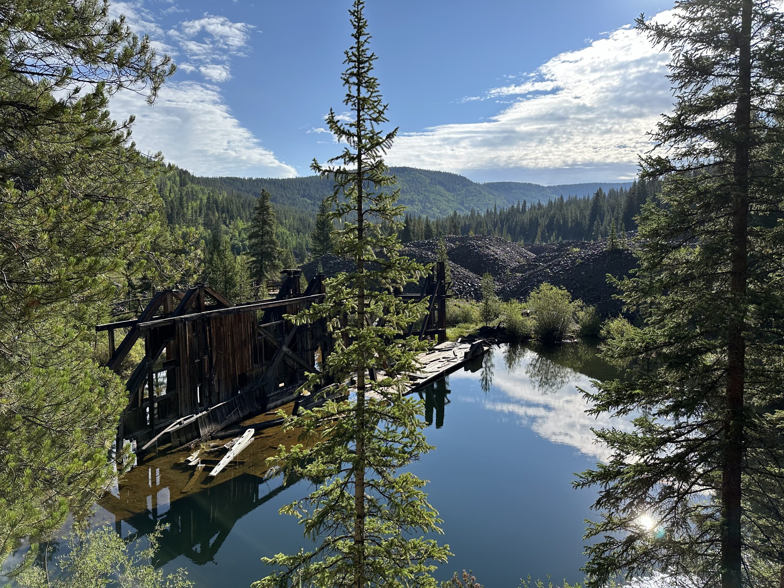
B&B to Reiling Dredge to Minnie Mine – This is a quick, fun, scenic, and mostly flat loop, just over 2.5 miles total. Hike the trail counter-clockwise for the prettiest views. You’ll encounter a large abandoned dredge in a lake with a plaque providing interesting historical information about it, a couple of old mines, wildflowers, and lots of great views of Breckenridge. This trail (like many) is also used by mountain bikers so be prepared to occasionally share the path.
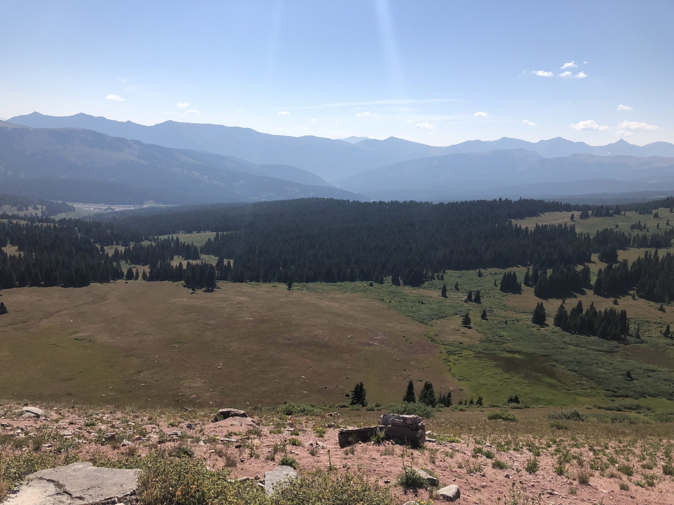
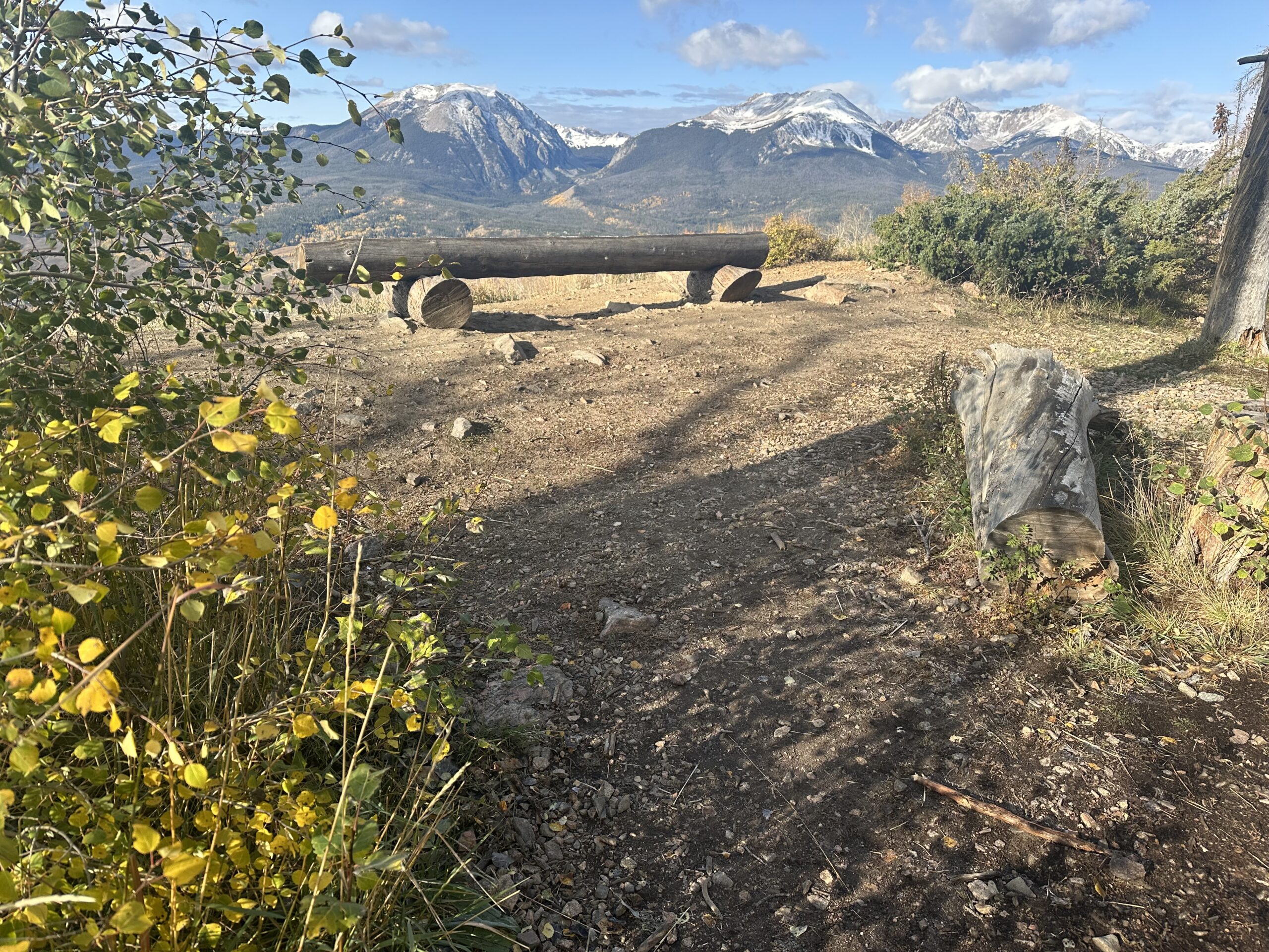
Meadow Loop and Ridge Trail – This trail has a bit more “up” than the above three, but it is worth the initial ascent to walk along the relatively flat ridge at the top, high above lovely Lake Dillon. There are plentiful expansive overlooks showcasing mountains, meadows, and pine forests, and even a few benches to sit and contemplate the beauty. At about 90 minutes, it is just the right amount of exercise to make you feel like you earned a good lunch. Surprisingly, we have never encountered many crowds on this trail.
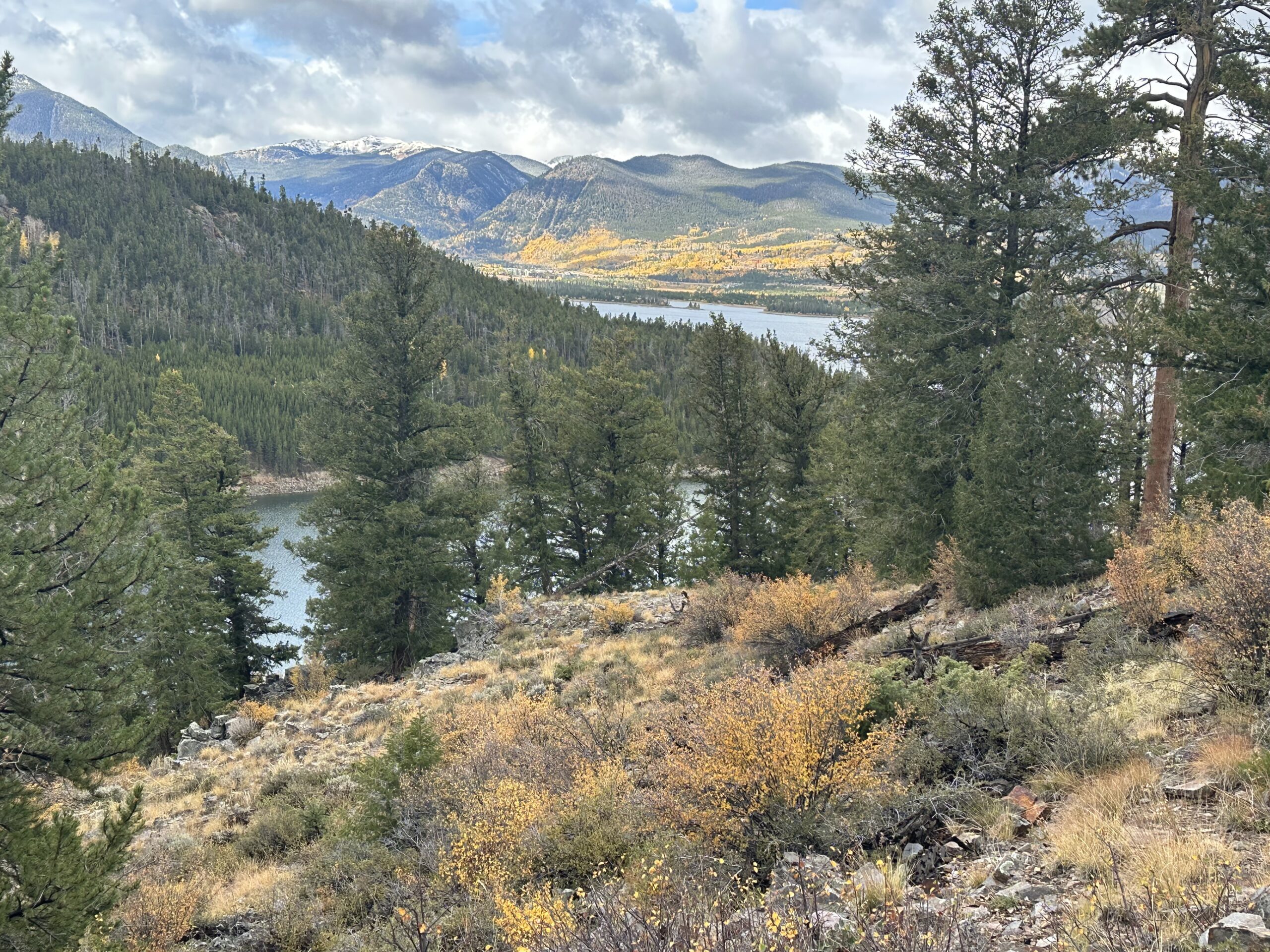
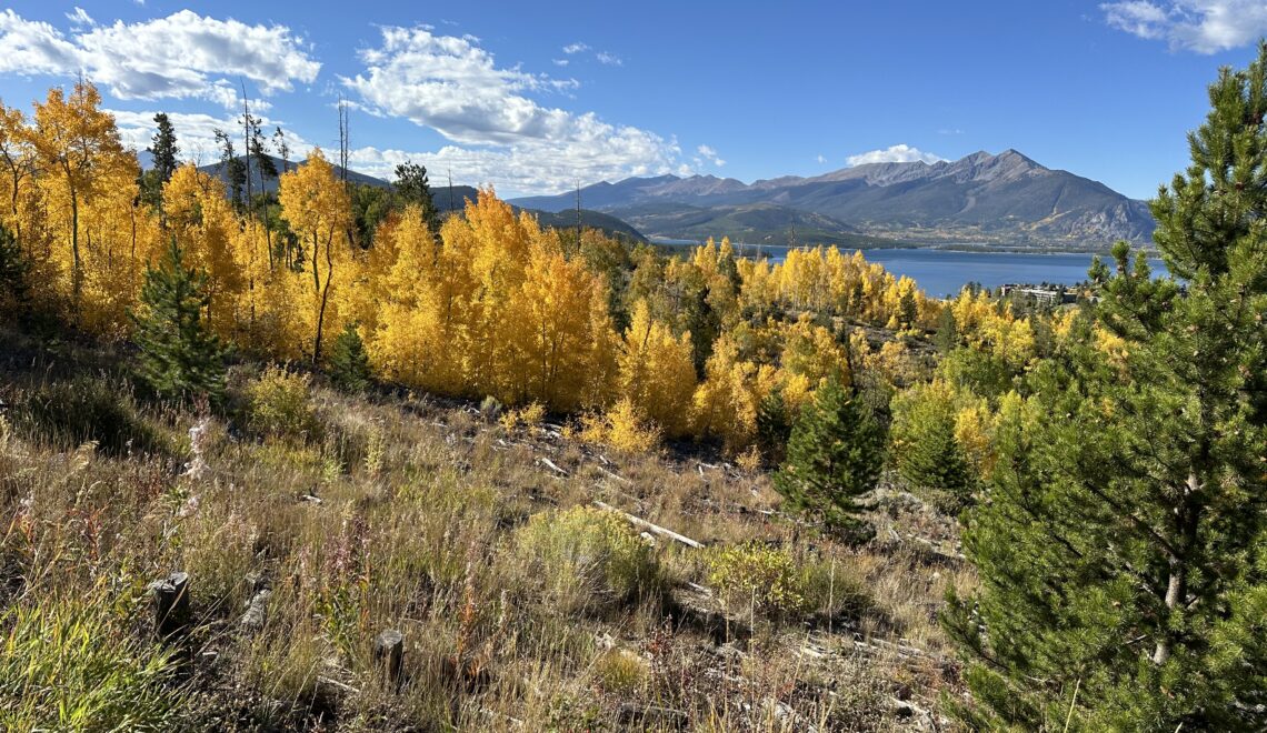
This is an especially good hike in the fall, when the trail is lined with brightly colored Aspen trees. It is also a good snowshoeing trail in the winter.
Moderate Hikes
These hikes take a little more time and effort, and hiking boots or hiking shoes are recommended. These hikes generally take 2-3 hours, allowing for stops. The last two are on the “harder” side of moderate.
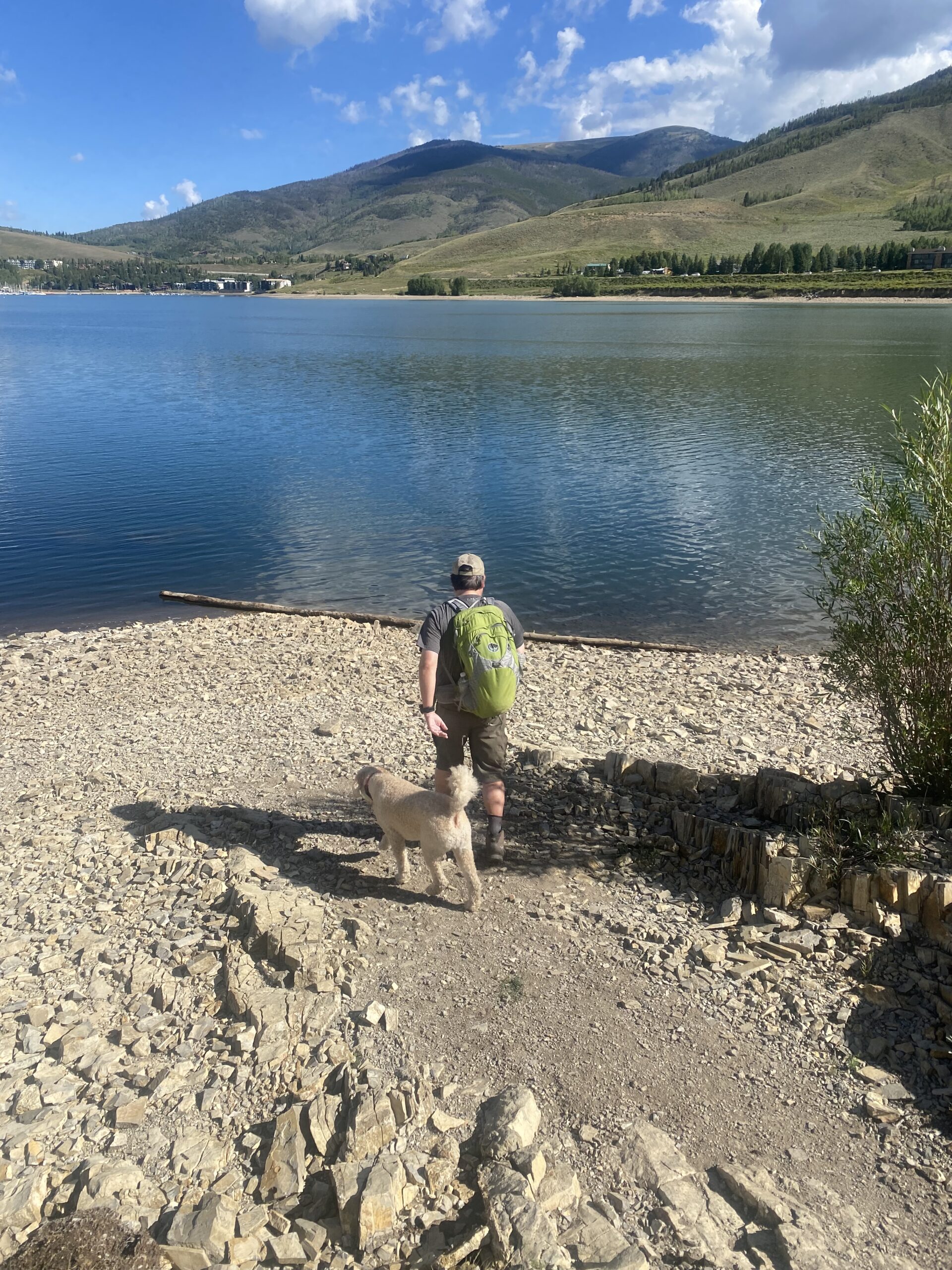
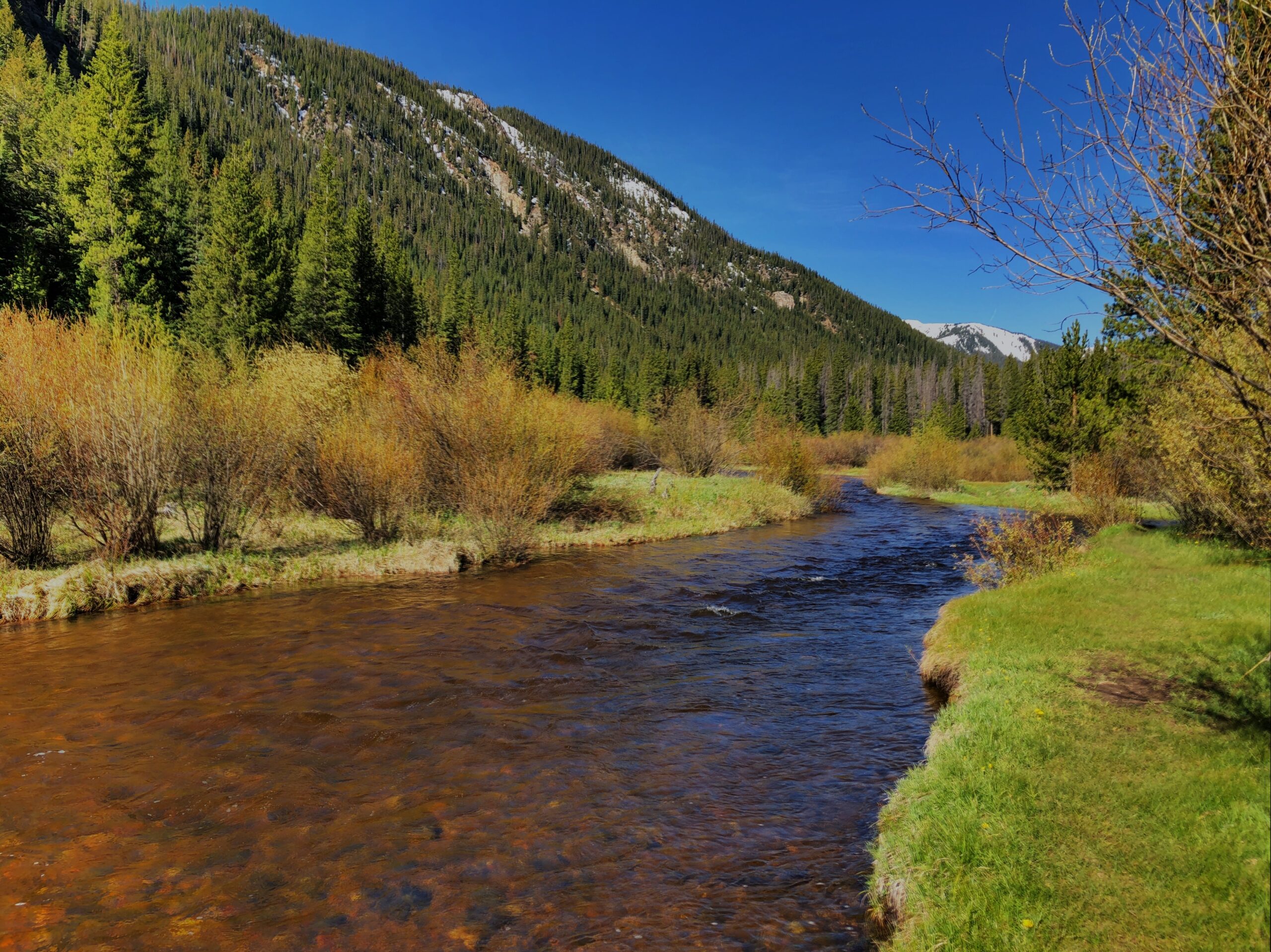
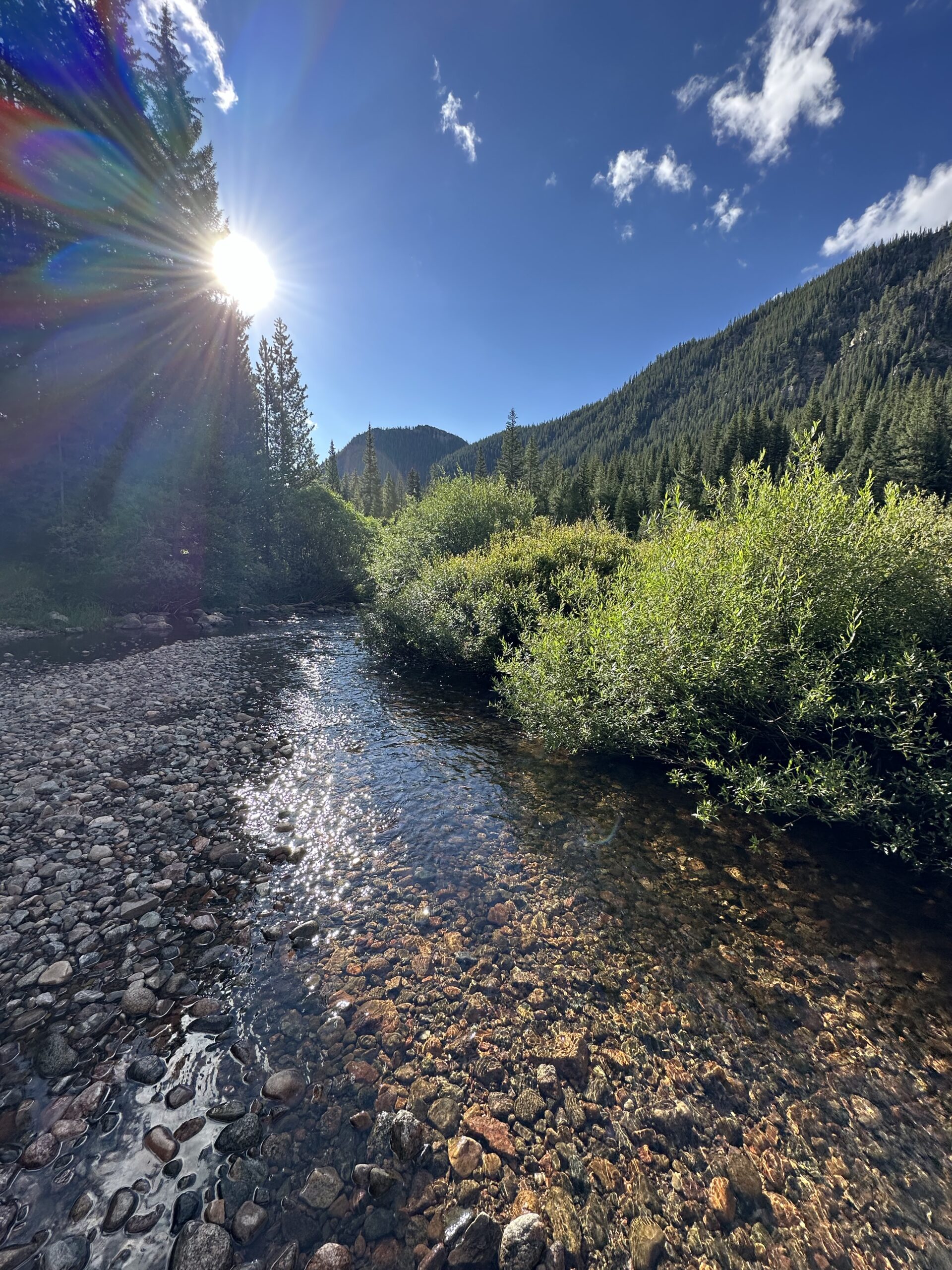
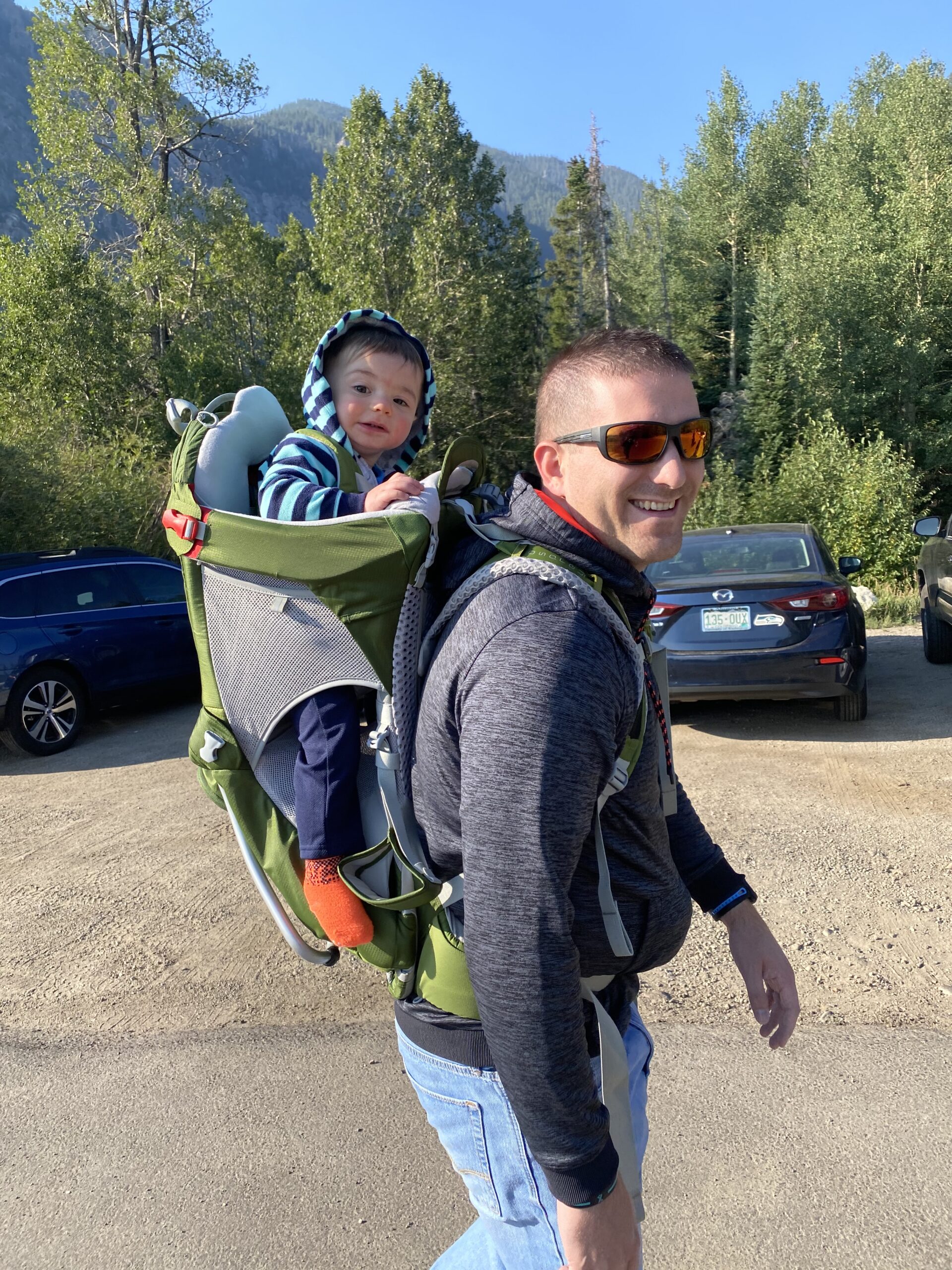
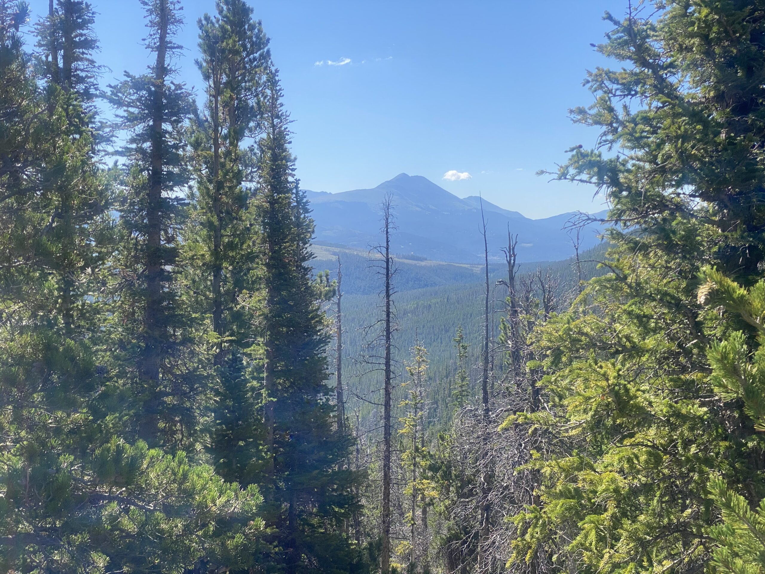
North Tenmile Creek – The description for this hike lists 6+ miles. But this trail is perfect for just walking as far as you feel like and then turning around and coming back. The first .75 miles have several significant inclines, but after that, the trail is fairly flat. At about 2.25 miles, it often gets quite muddy, so we generally turn around there, or sooner if we’re short on time or energy. The trail follows the creek the whole way and has some great mountain views.
There are numerous inlets to the creek where you can relax, let your kids wade in the water, and let your pup have a nice cool drink. North Tenmile was the first hike our grandson ever took. (Well, he was in an infant hiking backpack on his dad’s back, but he sure enjoyed the ride!)
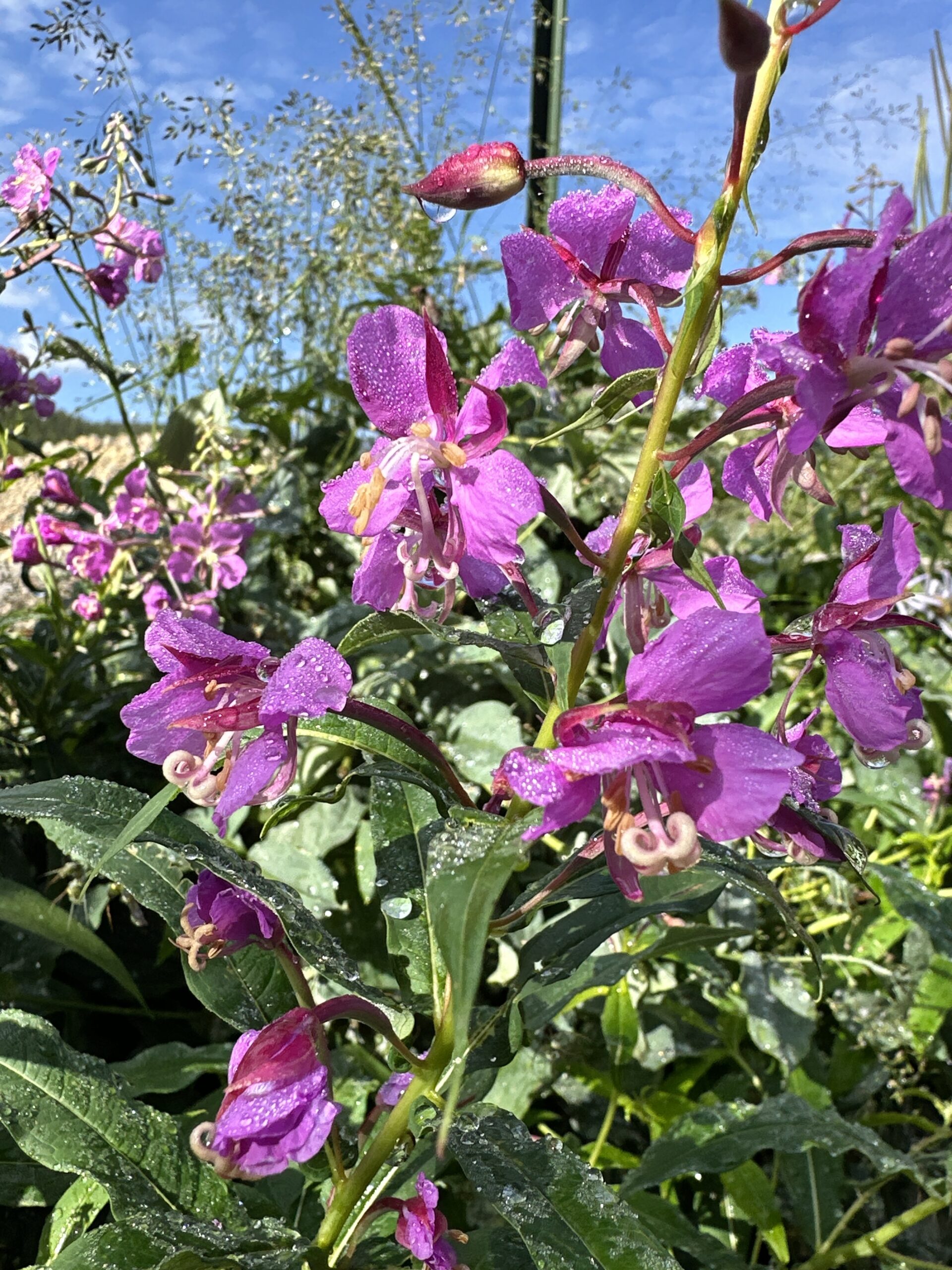
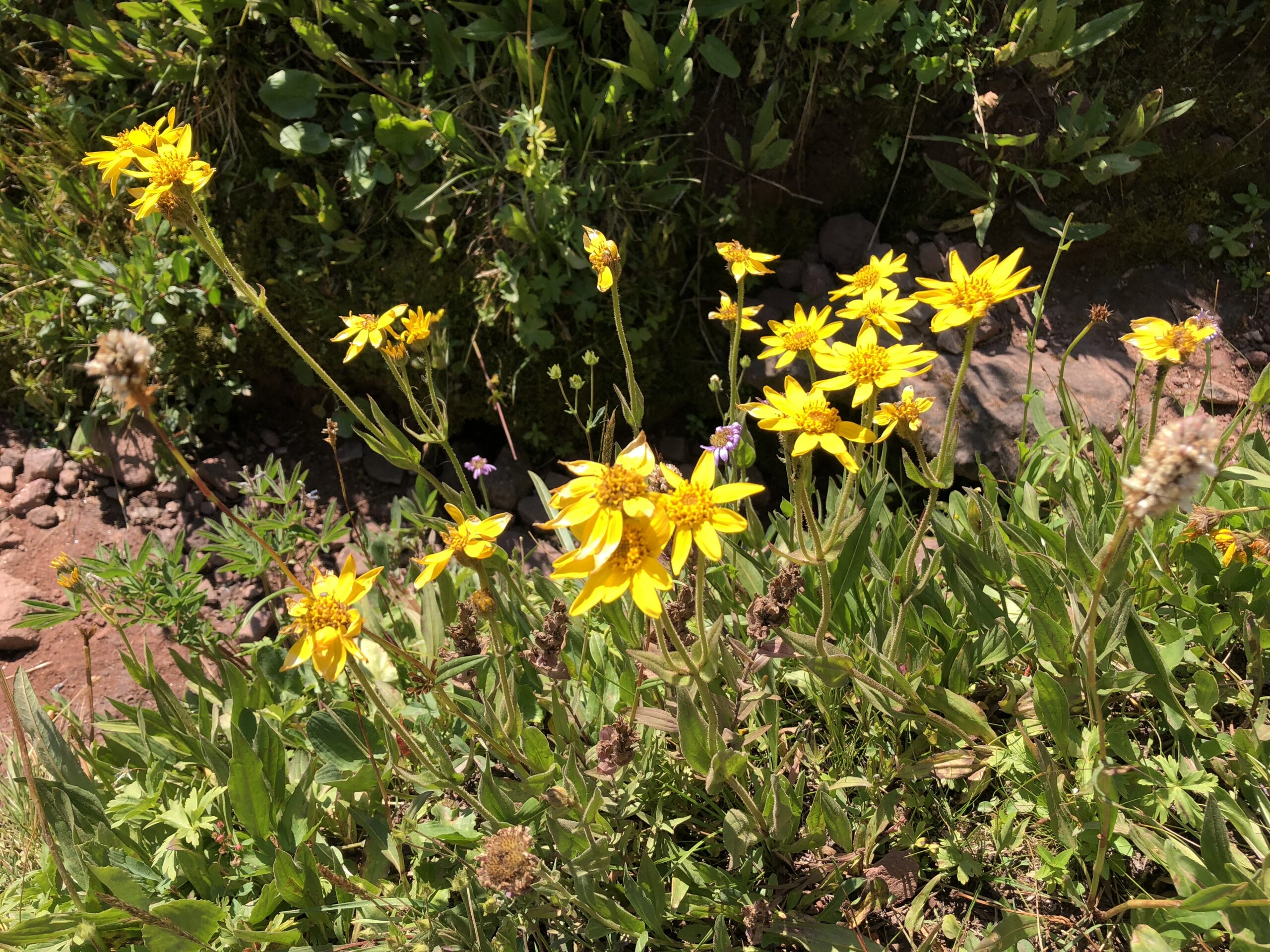
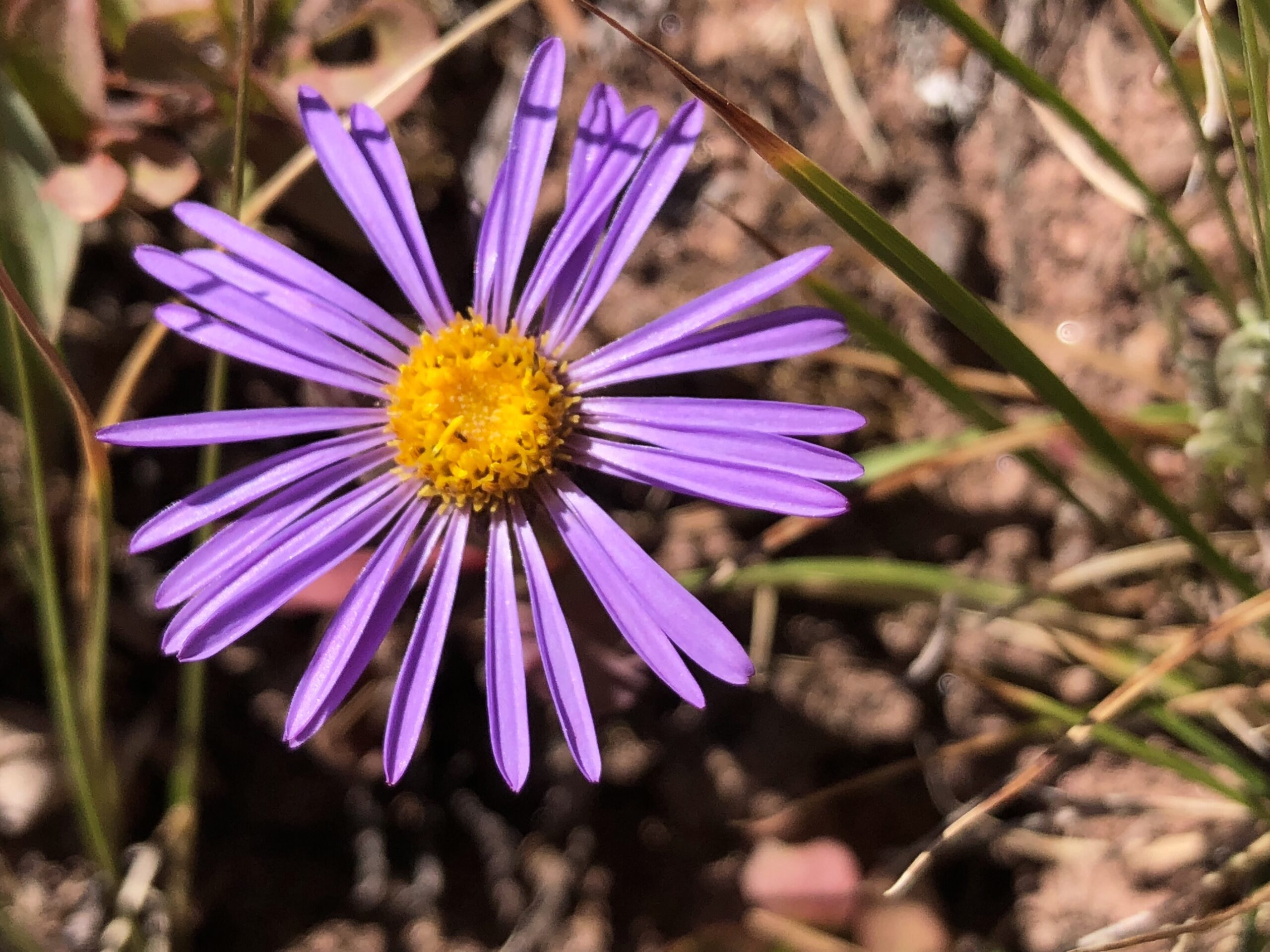
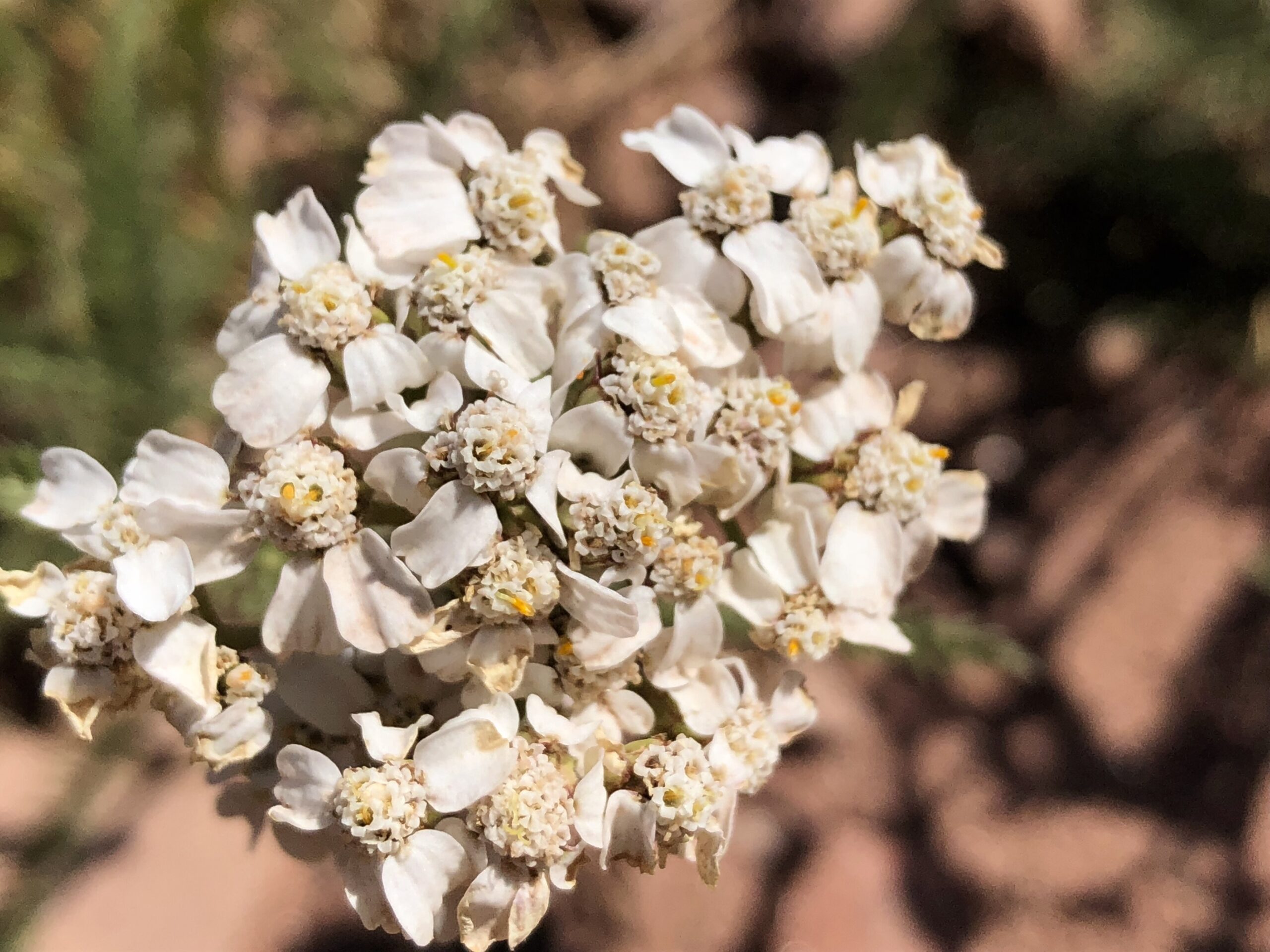
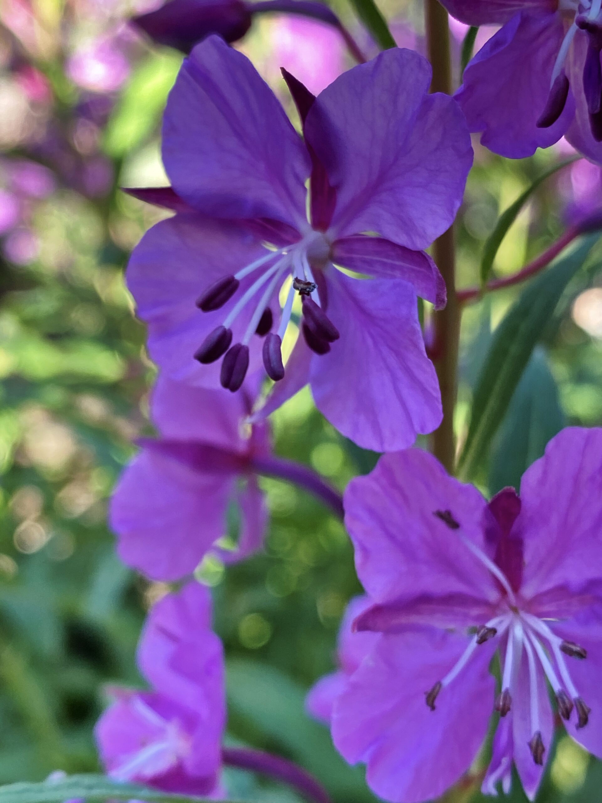
Shrine Ridge – This trail is a steady but not too strenuous climb and has great views the whole way. But when you ascend to the ridge, you are greeted with breathtaking mountain views in all directions, including the iconic 14,000’ Mount of the Holy Cross. In late July and early August, there is also an impressive display of wildflowers. After a break at the ridge to take in the views, you can continue your hike with trails to the right or left if you wish.
This trail starts at over 11,000 feet and summits at nearly 12,000 feet. So if you’re having any problems acclimating, you might want to start with one of the plentiful lower-elevation trails.
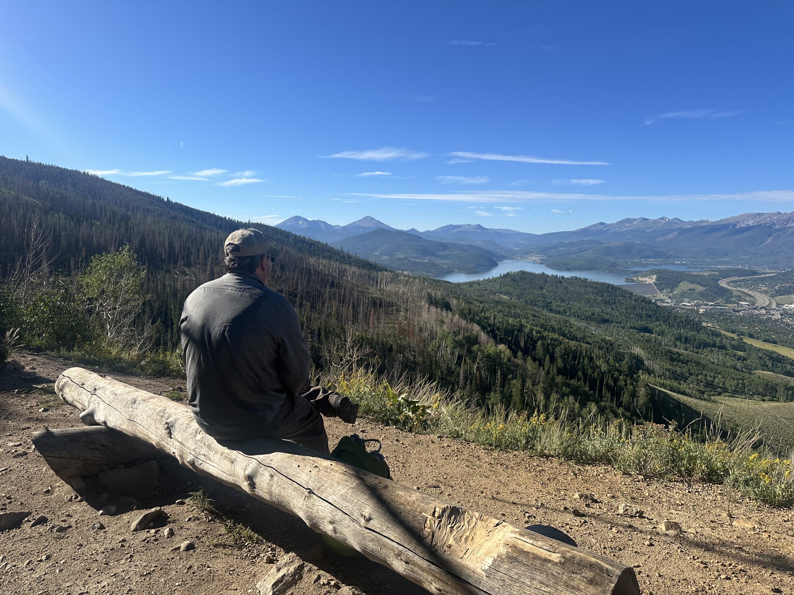
Ptarmigan Trail – This trail is punishingly steep for the first .6 mile or so in full sun. (Don’t forget to turn around and admire the view when you stop to catch your breath and gulp down some water.) But after that, it flattens out for most of the rest of the trail is shaded and rewards you with forests, meadows, wildflowers, and two benches at the top to sit and admire the gorgeous view of dozens of mountain peaks and Lake Dillon. Worth it.
Upper Straight Creek – This hike starts, kind of awkwardly, atop the Eisenhower Tunnel along I-70. It seems intimidating to get to, but it is easy peasy. You take the exit just before the tunnel (eastbound) and follow the short, easy, paved road up over the tunnel, and park in the area just before the westbound entrance ramp so you’re set up to head back after your hike.
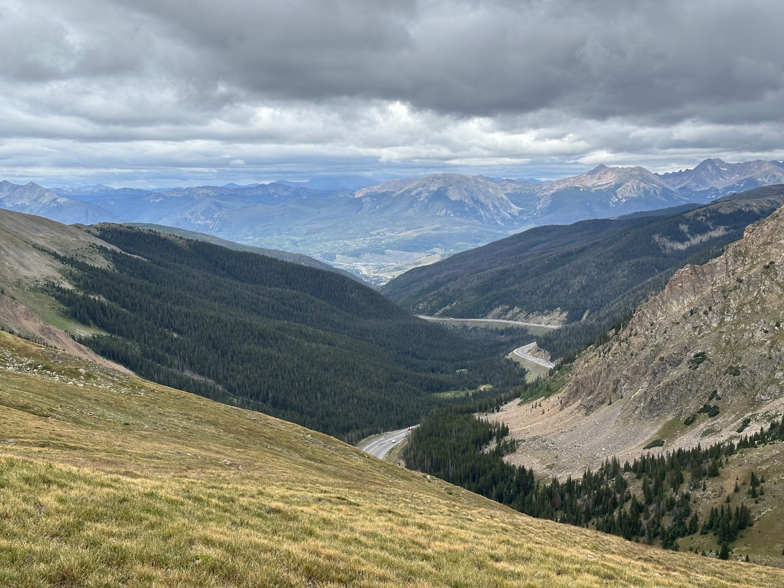
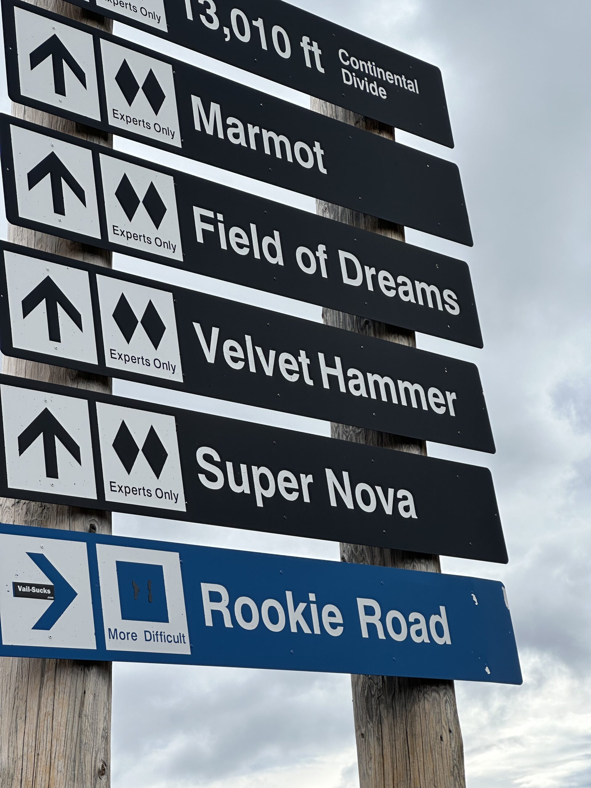
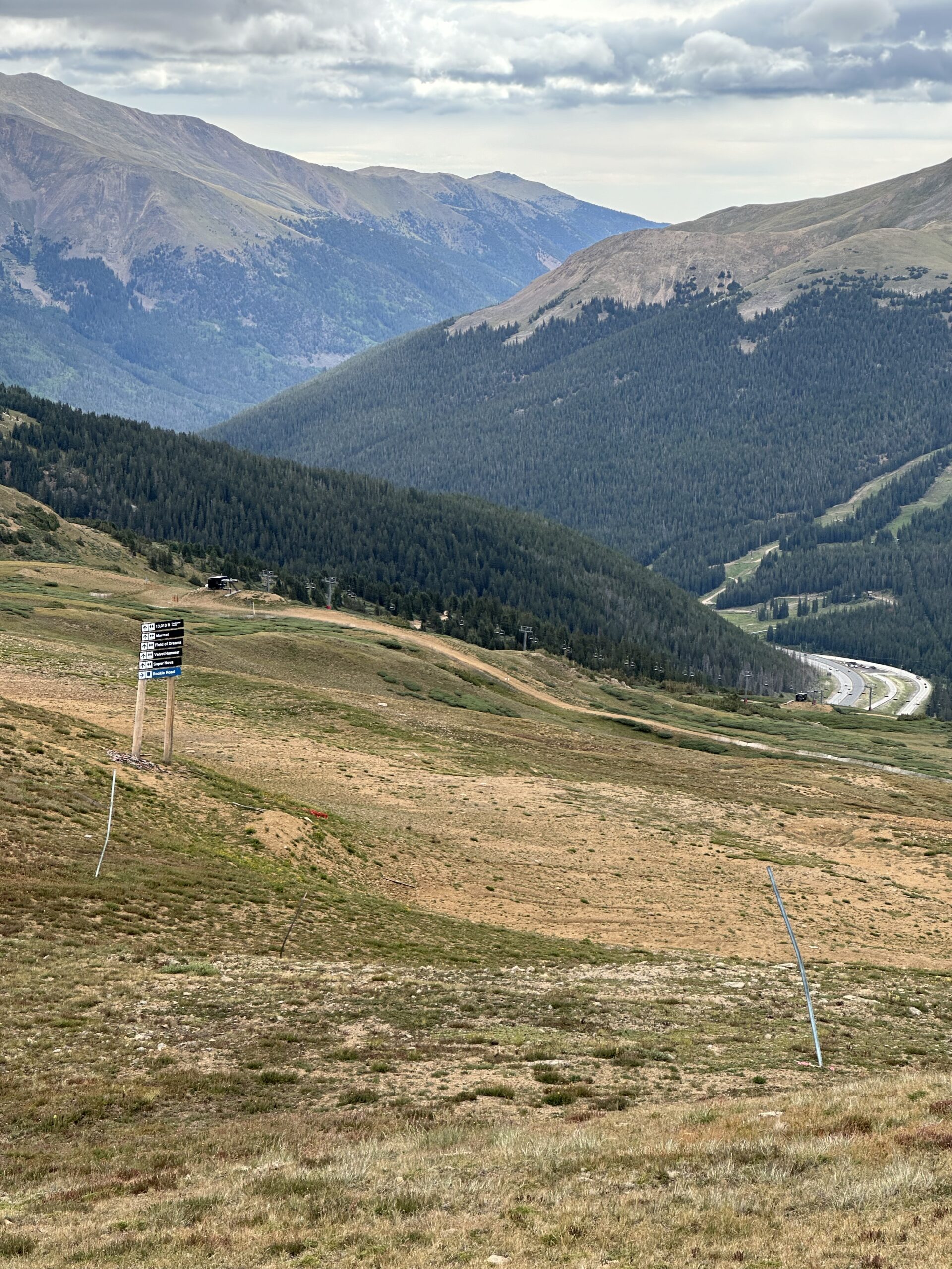
Every time we do this hike, as we climb the relentless switch-backs to the top, we ask “Why are we doing this to ourselves?”. But then we reach the top, and there are jaw-dropping views in every direction as far as the eye can see. It ends at a whopping 12,500 feet in the middle of the Loveland Ski area, where you can even see signs for various ski runs.
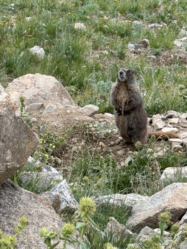
The area is home to a large and vocal marmot population. They will definitely let you know if you’re getting too close to their den!
This hike is one that’s best done as early in the morning as possible as there is almost no shade the entire way. In our experience, it is rarely crowded, at least not before 11 am or so. Bring an extra layer, as it is much cooler at the top, and nearly always quite windy.
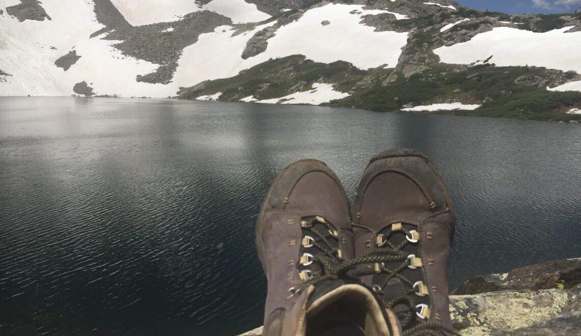
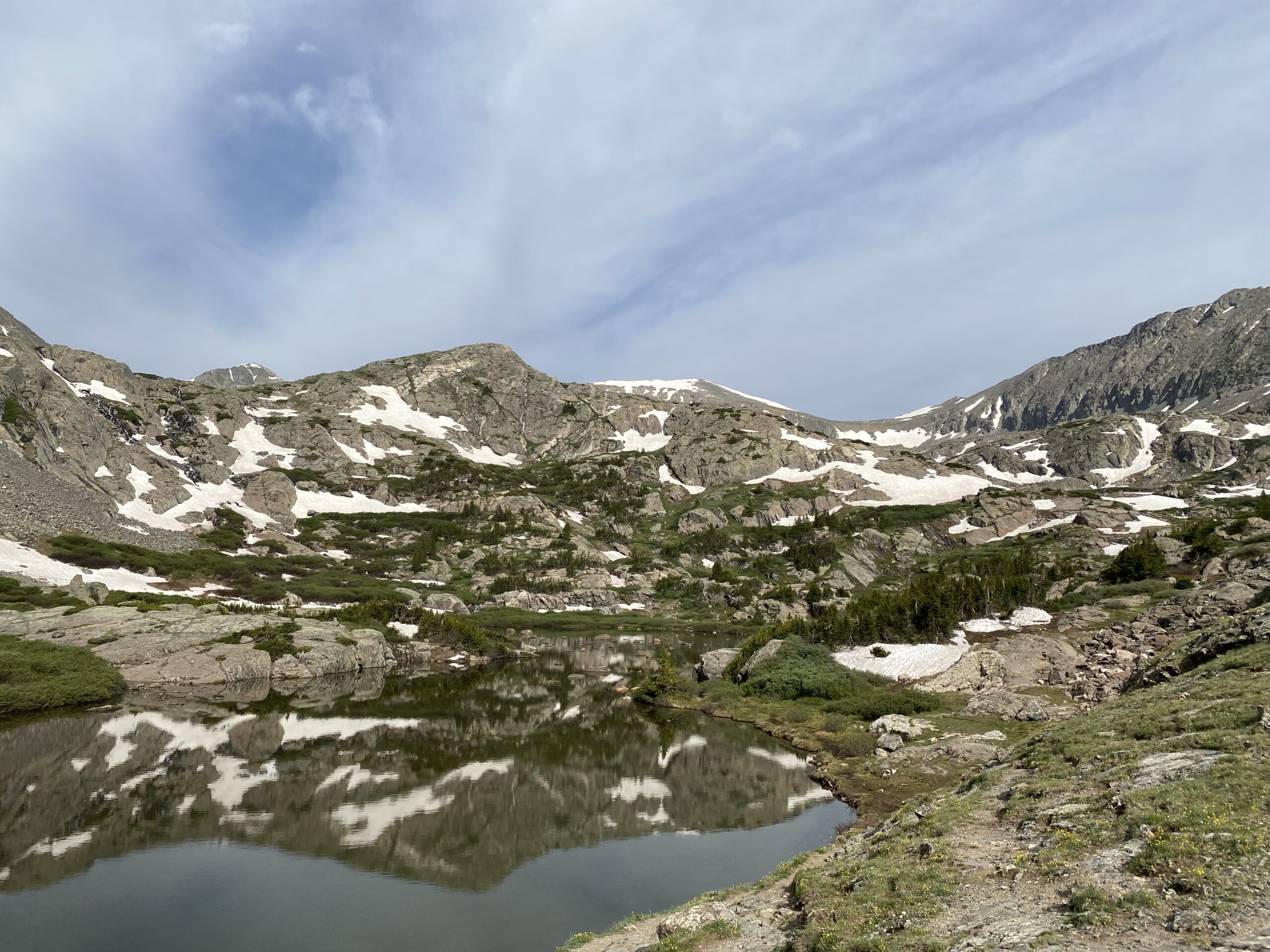
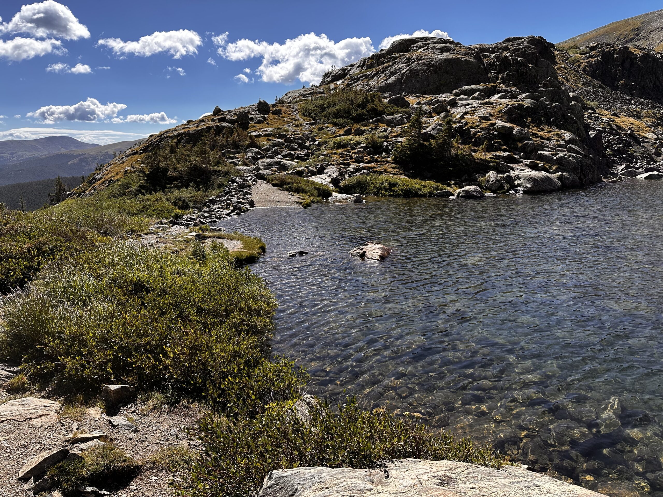
McCullough Gulch – This hike is one of our absolute favorite hikes anywhere and we have done it dozens of times over the years. It has everything: beautiful wildflowers, breathtaking scenic overlooks, giant rocks, caves, a rushing creek, a huge multi-tiered waterfall, and a crystal-clear lake at the top inviting you to enjoy a picnic lunch to celebrate your achievement.
The trail is steep at the beginning (like so many of them!) but it evens out in the middle until you reach the spectacular waterfall. It is a huge area with lots of places to rest, observe, or just poke around.
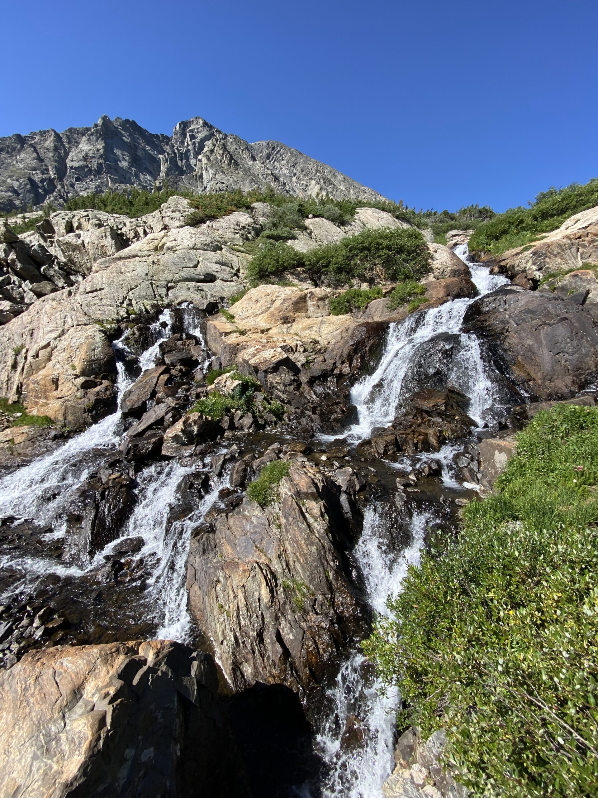
At this point, it is perfectly respectable to turn around and go back if the altitude is getting to you. But if you have a little gas left, make your way up the short, but quite steep & rocky trail to the splendid mountain lake that feeds the falls below. On sunny days, the surrounding mountains reflect in the lake. I promise it’s worth the climb! Then take some time to relax and even unlace your hiking boots and put your tired feet in the refreshing (but very cold) water.
**Caveat: The trail got a little too popular in recent years, so now you must plan a bit in advance to take a quick and inexpensive shuttle from downtown Breck, or drive and park at the Quandry parking lot and take a free shuttle to get closer to the trailhead. (Dogs are permitted on both shuttles!) Here is a link for transportation: McCullough Gulch Shuttle Info. Though it is kind of a pain to make arrangements in advance, the silver lining is that this magnificent trail is rarely crowded.
More Difficult Hikes
We tend to save these for toward the end of a week-long trip, when we’re more fully acclimated. We find these to be challenging for the distance, the altitude gain, or both. Trekking poles are recommended, and are helpful heading both up and down. Hiking boots are a must.
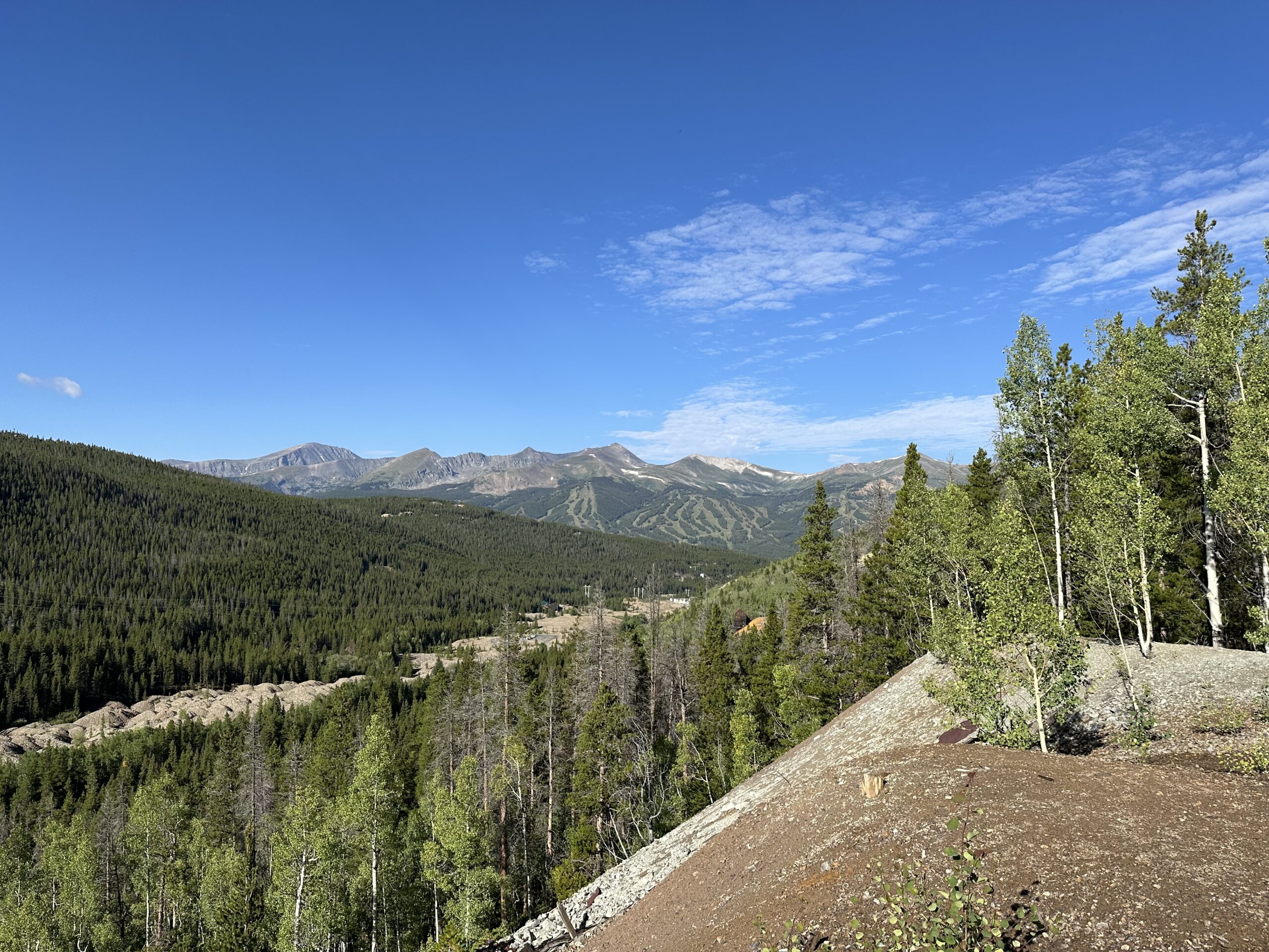
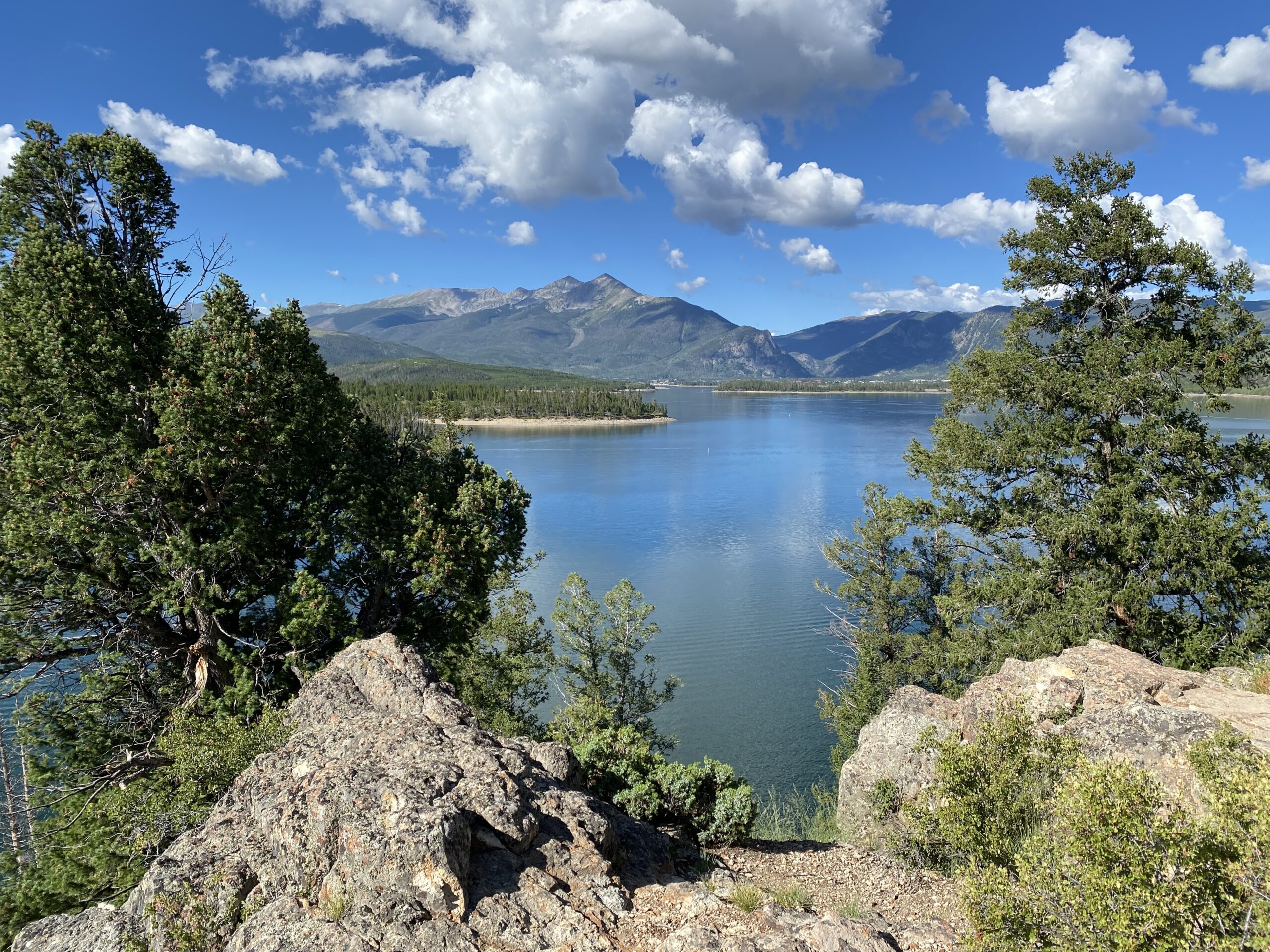
Mount Royal – If you want a challenging hike but don’t have too much time, this is a great option. You gain a whopping 1300’ in less than two miles on a rocky trail. There is almost no flat part on this trail until the area at the summit – it is just up up, and more up.
At the top, there is a nice long, flat ridge where you can take your time and enjoy brilliant 360-degree views of the mountain ranges, the town of Frisco, and Lake Dillon.
The climb down is even more difficult in some ways due to the steep terrain and loose rocks. Once down, head into the charming town of Frisco and grab a well-earned lunch!
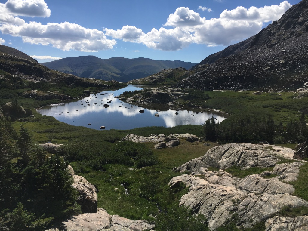
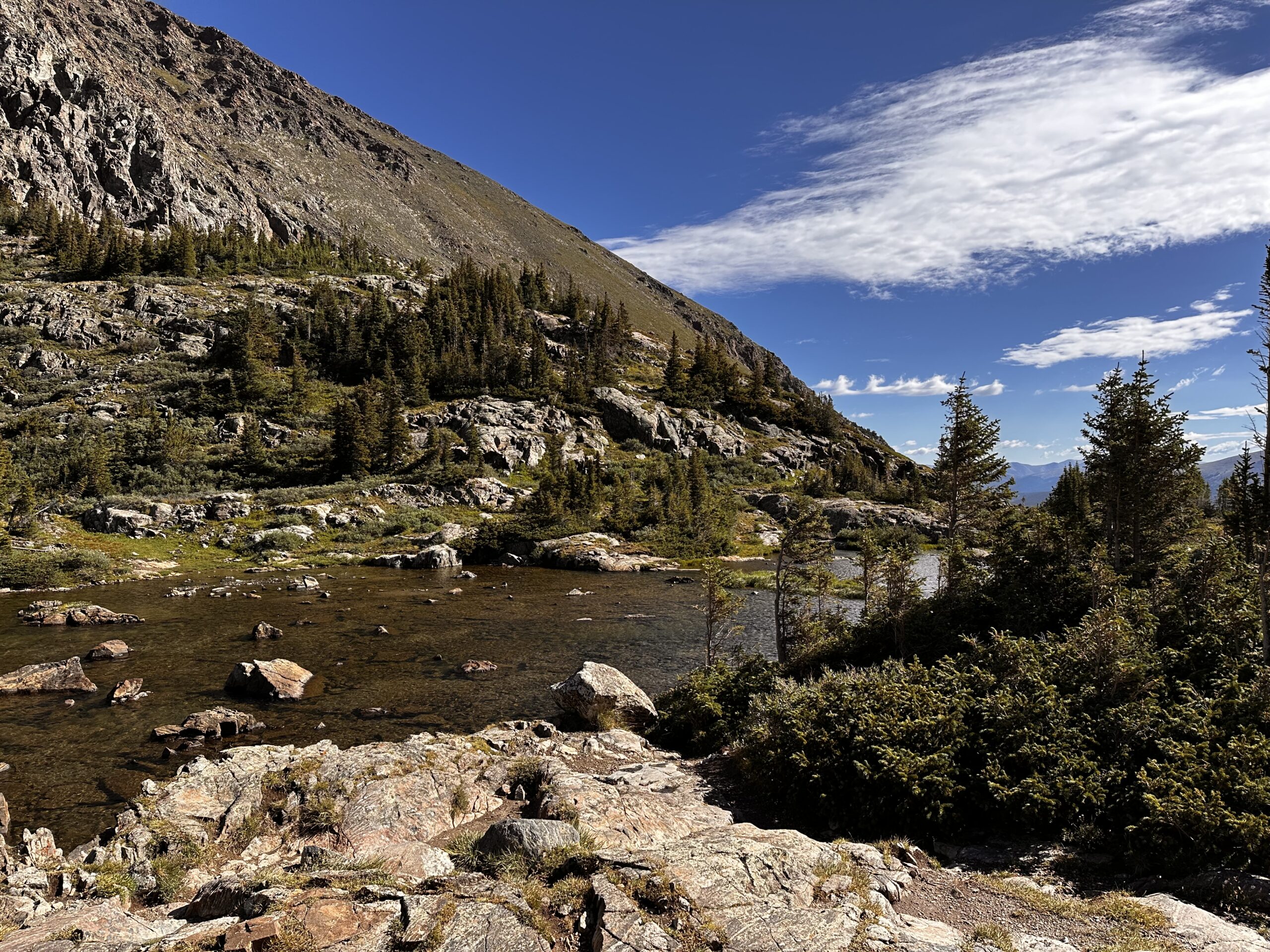
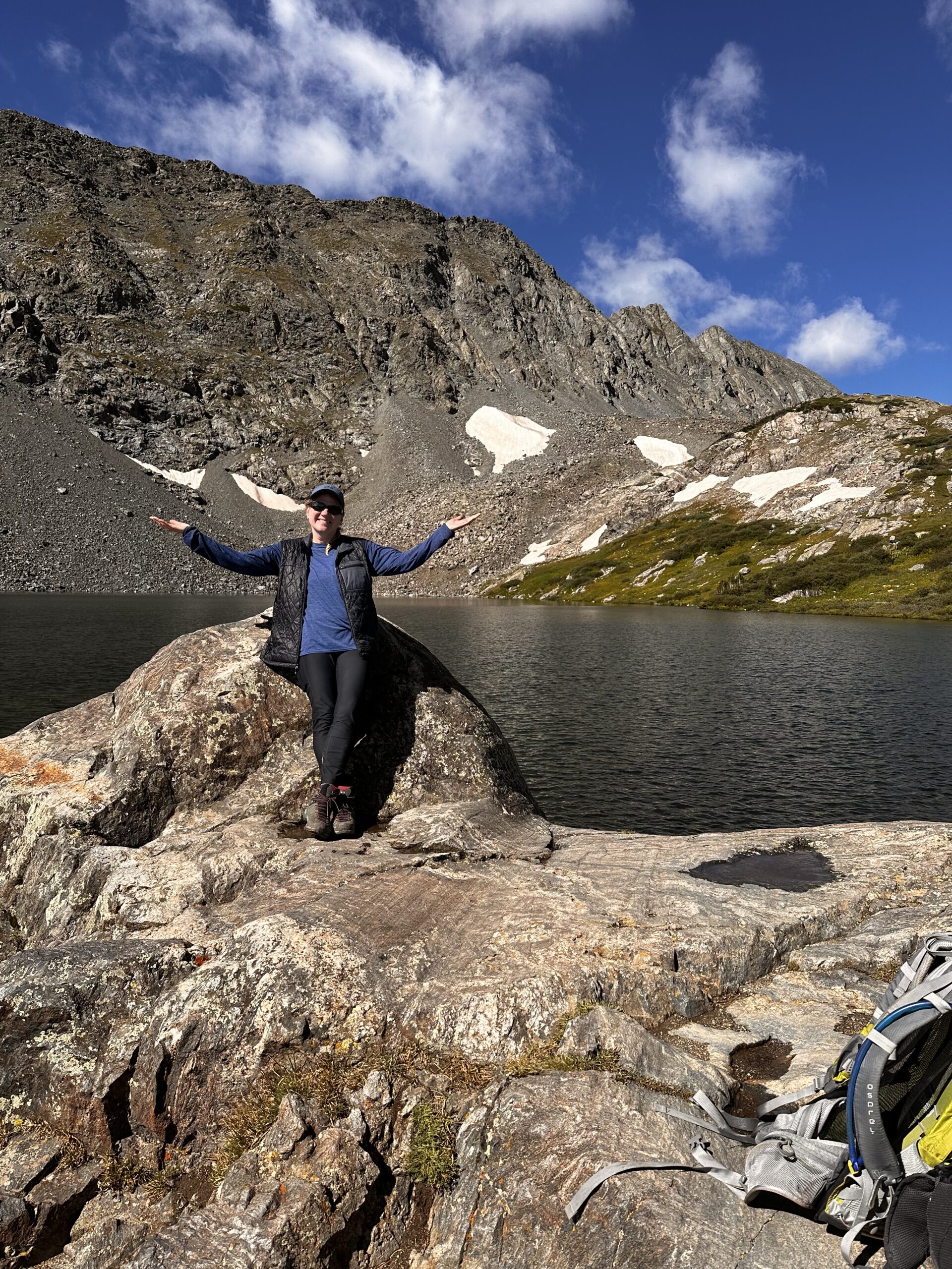
Spruce Creek Trail to Mohawk Lakes – This hike is comparable to McCullough Gulch in steepness but is harder because there is a two-mile walk (each way) on Spruce Creek Road to access Mohawk trailhead. The Spruce Creek Road trail is mostly shaded through a pretty forest and is not difficult, but it does make this hike four miles longer.
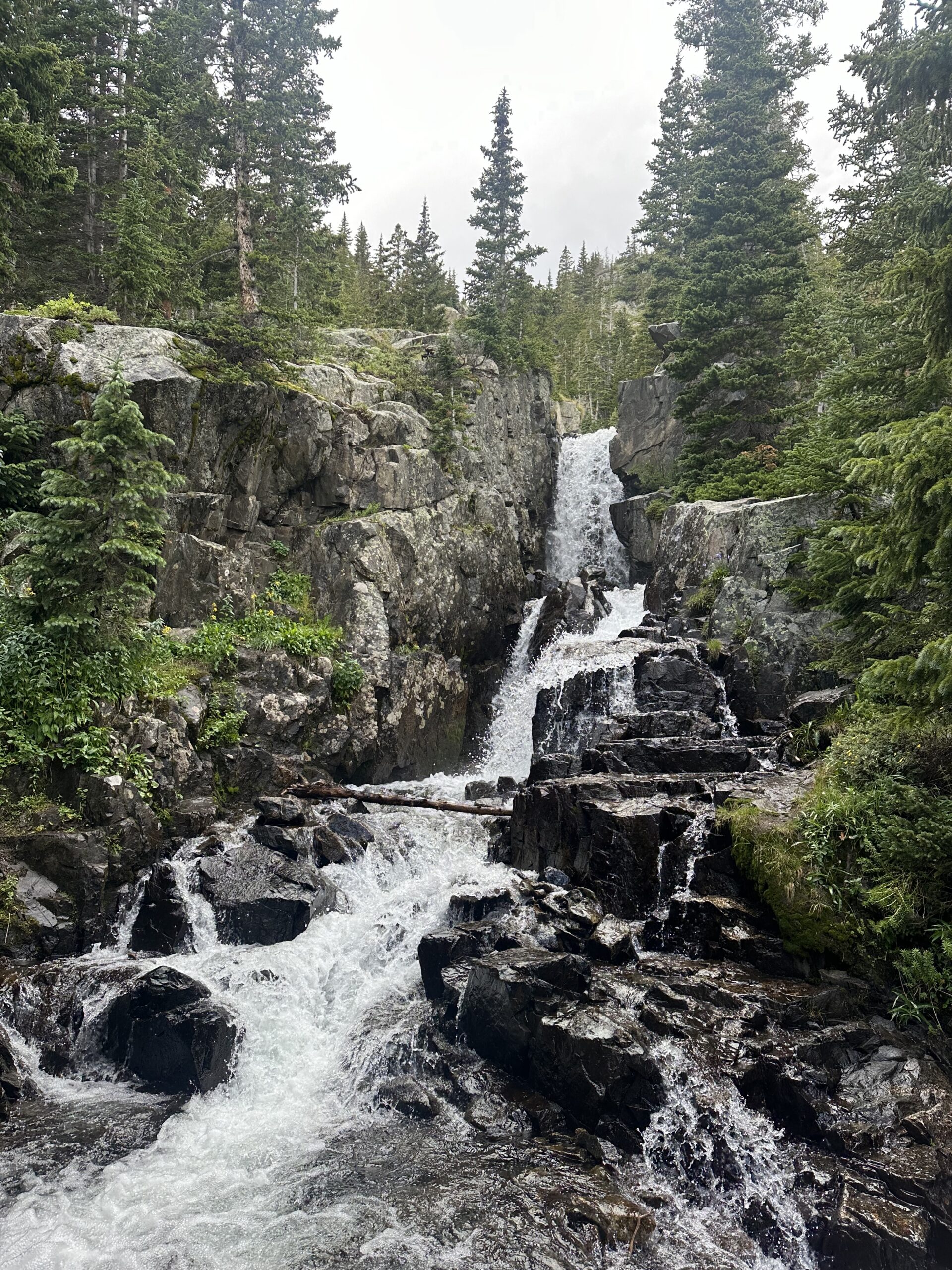
That said, this hike, like McCullough, is among our absolute favorites. Once you finish the Spruce Creek Road section and get to the Mohawk trail, you’re in for a treat. A treat you’ll huff and puff to earn, but a treat nevertheless. Heading toward the lakes, you will start to hear the distinct sound of a granite rock waterfall: Continental Falls. Don’t miss it! A quick jaunt from the main trail will take you to a couple of overlooks. Go ahead, try to get all of that giant, gorgeous waterfall in one photo! (This photo only shows about 3/4 of it.)
From there, the trail intensifies as you head past a couple of old mining structures toward the lower lake. Finally, the trail evens out and you’ll see a little waterfall with a small pond. Lovely. But just continue for another minute and voila! You’re at the lower lake. There are dozens of rocky areas to go take a seat, catch your breath, and soak up the beauty in all directions. It’s the kind of spot that sometimes makes me feel emotional and want to break out singing “Rocky Mountain High”.
The upper lake isn’t too much further, but it is a bit of a scramble. Just do it! At about 20 minutes in, you’ll be exhausted, climbing a hill with thick vegetation and, looking straight ahead, and you are suddenly at eye level with the upper lake! With each step up you can see more and more until you are on even ground with the magnificent lake surrounded by cliffs and mountains. Extraordinary.
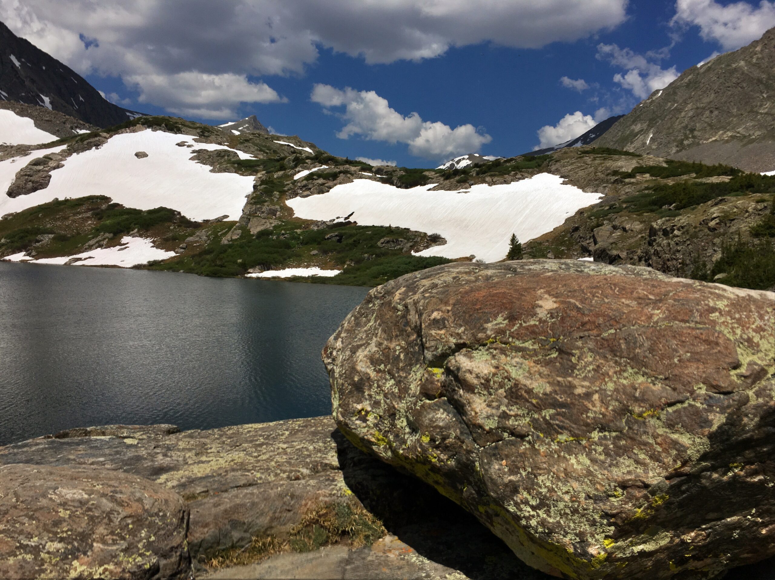
Unless a storm is moving in, you’ll want to take a good long time to chill out up here. There are lots of spots to wander and explore. Often you’ll see mountain goats hanging out up on the cliffs. You can even climb a bit further to two more lakes. We’ve not done this yet, but plan to do so soon.
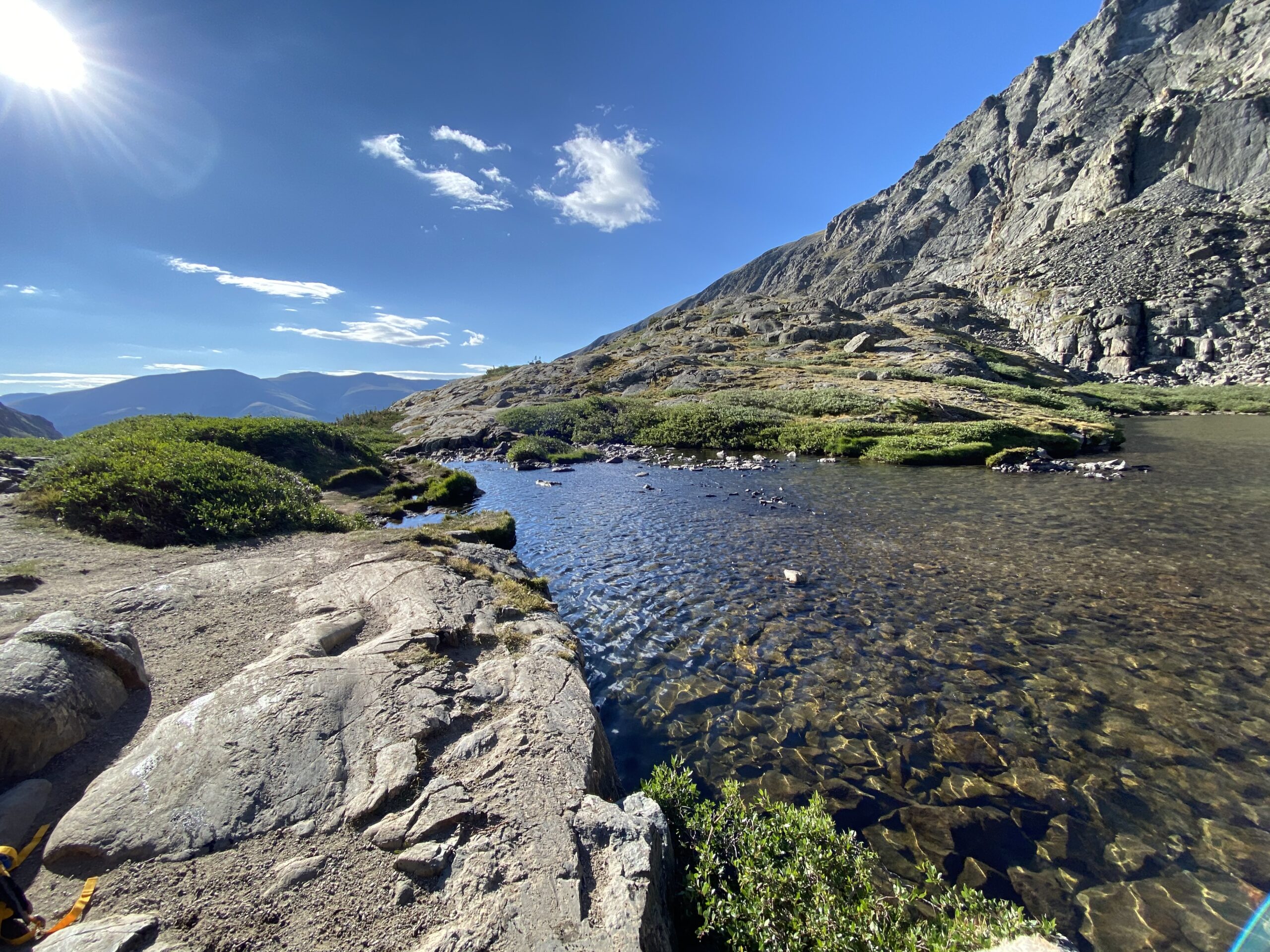
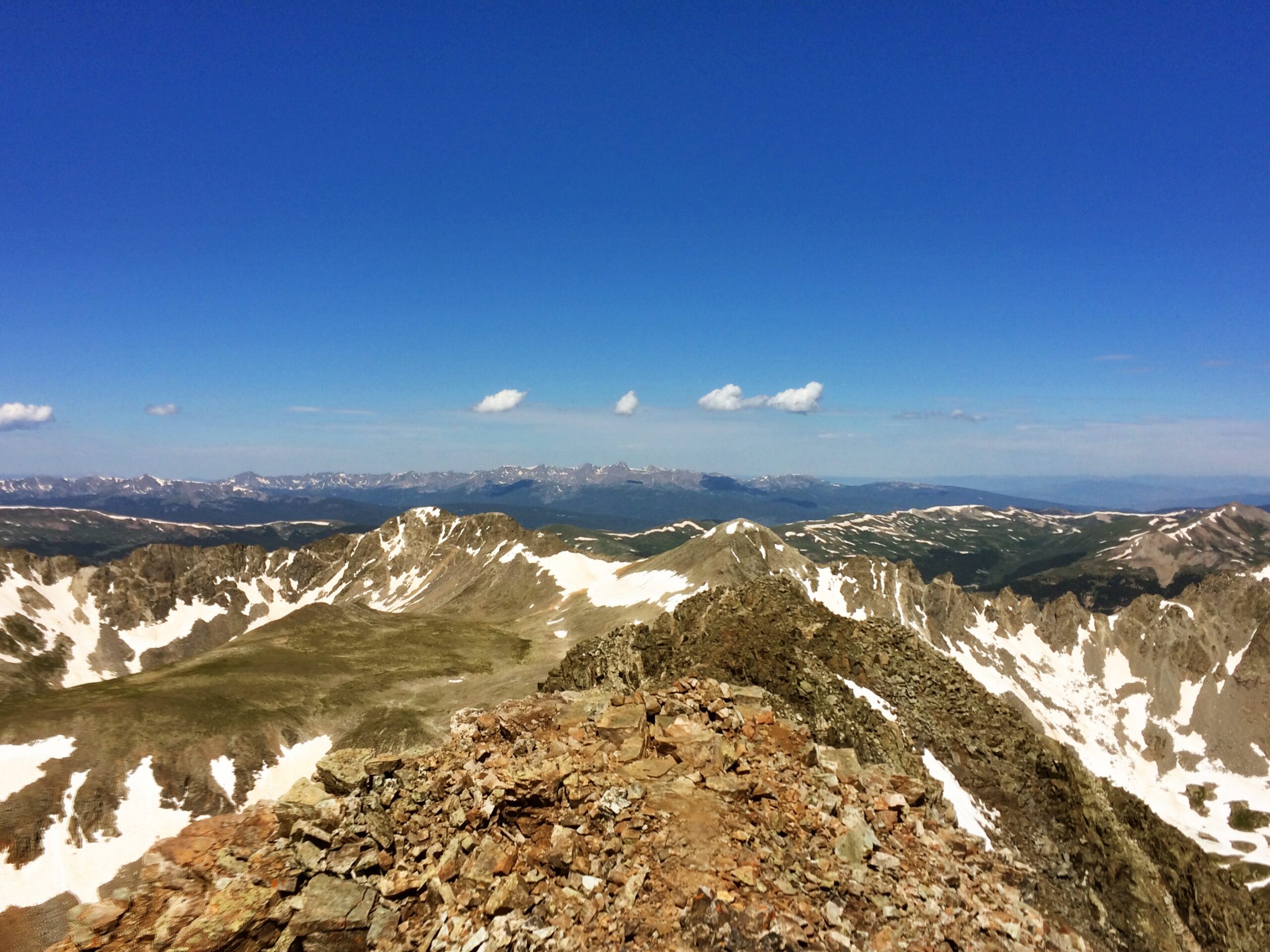
Quandary Peak – Climbing a 14,000+ foot mountain is a big deal. There is not much air up there! Some impressive folks make a sport of “bagging” as many 14ers as possible – dozens in some cases. But for most mere mortals, climbing one is a serious accomplishment. Quandary is the closest 14er to Breckenridge and is categorized in the least difficult class, partially because no technical skills are needed. But honestly, everything is extremely difficult at that altitude!
It is important to start as soon as possible after sunrise. You will be climbing far above the tree line, and want to get to the top and back down before any thunderstorms move in. The elevation gain is 3300’, and the constantly thinning air makes the climb even more challenging.
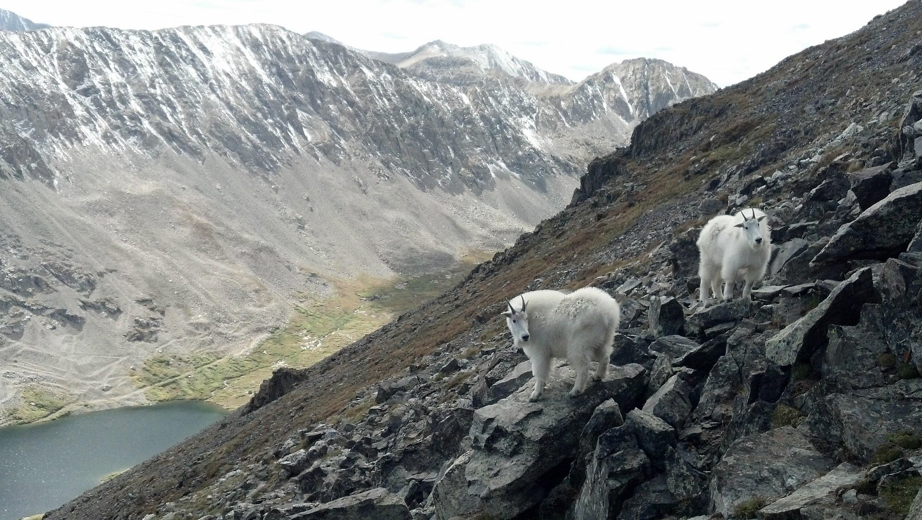
Particularly after you reach 13,000 feet, it becomes more difficult to breathe, and I experienced some nausea. By 13,500 feet, I was taking frequent breaks, forcing myself to drink more water, and chatting with the abundant and fearless mountain goats. To add insult to injury, there is a “false peak”. So you think you’re ascending to the summit only to discover you’ve still got a bit to go! Rude.
Happily, shortly after that you reach the real summit – and all the fatigue, frustration, and nausea melt away in an instant as you realize you are truly on the top of the world.
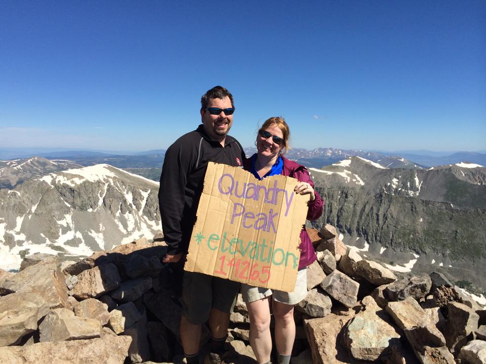
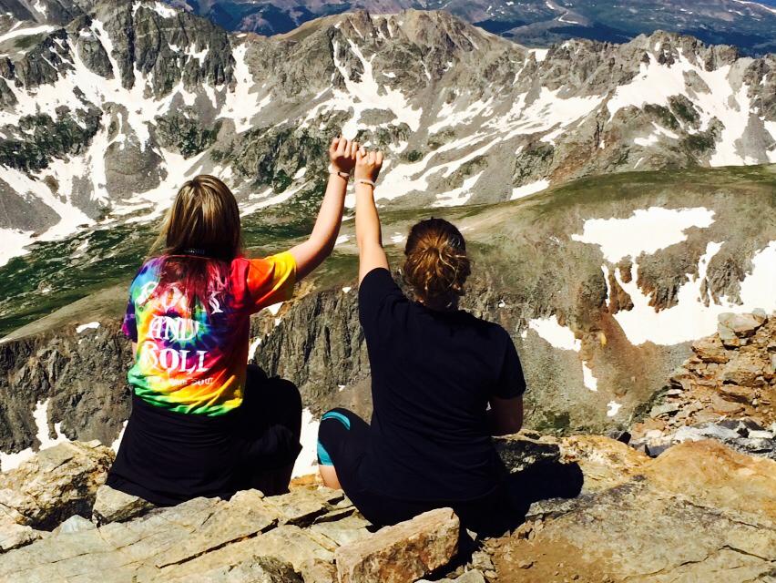
The view is 360 degrees of epic. It is a large summit, so once you’ve signed the registry to prove you’ve conquered the mountain, there is plenty of room to meander about, chat with your fellow exuberant hikers, take photos, have a few bites to eat, and generally feel grateful for the opportunity to experience something so overwhelming and incredible.
If you’re lucky enough to be in Breck in the latter half of September or first part of October, as the leaves are turning, there are some hikes that rise above the rest. (I guess that means they’re not just amazing but super-duper-amazing!). Read about them here: Fall Hikes in Summit County
More Hiking Ideas
Not tired yet? Looking for more trails? Here are some more we really enjoy:
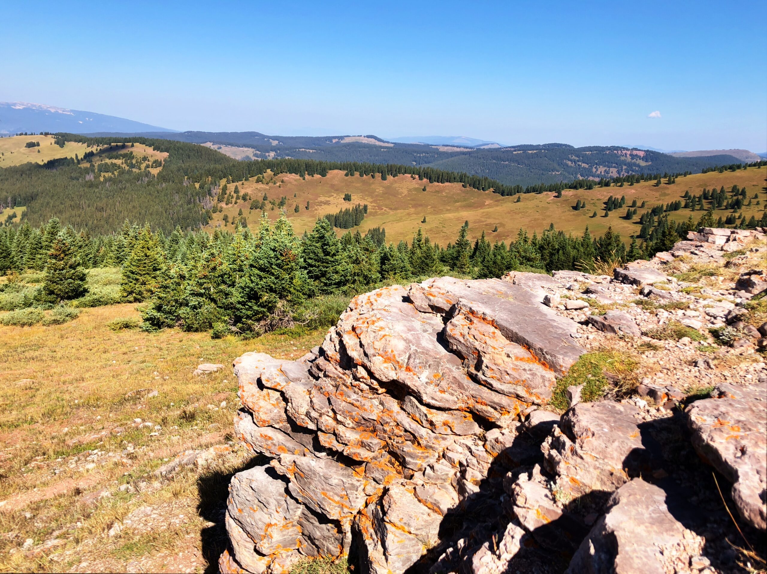
Sally Barber Mine (easy) – This is a fun trail for hiking or snowshoeing with nice views at the top. The destination is a very cool abandoned mine worthy of some time to explore. There is also a plaque with a good amount of historical information.
Lilypad Lakes (easy/moderate) – This trail was one of our kids’ favorites when they were…well, kids. There are a few inclines, but most of the trail is mild and shaded. At the end are two lakes, one of which is often completely covered in lily pads. It’s a good idea to bring bug spray on this trail.
Willow Creek Falls – (moderate due to the length) – At 7 miles, it does take a bit of time to complete this trail. There are nice views the whole way, and most of the trail is not difficult. The waterfall at the end is a real treat, particularly in late spring/early summer.
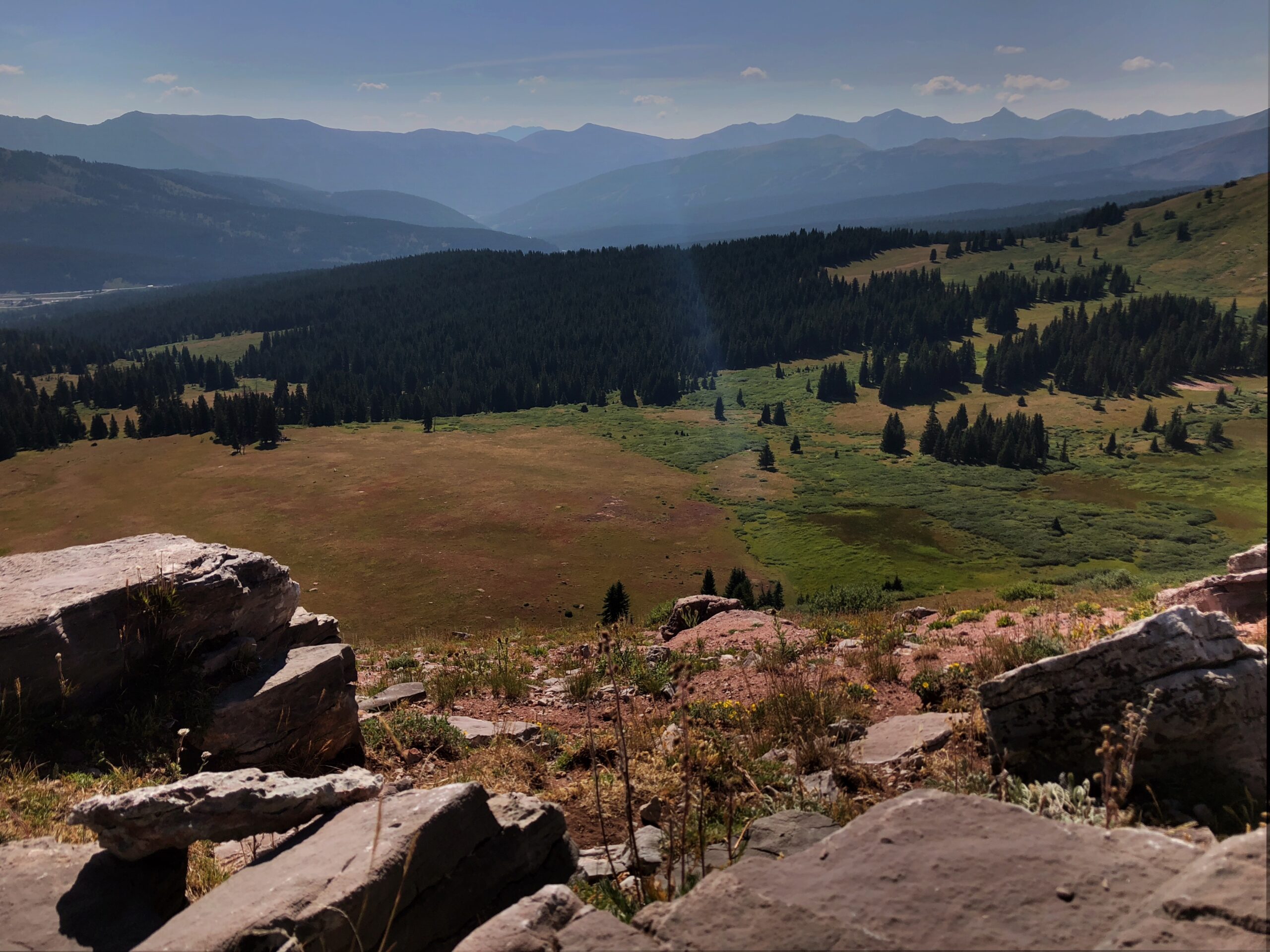
Mayflower Gulch (moderate) – The description shows 6 miles, but it is very rewarding to just hike to the former mining camp and back, about 4 miles. The camp is fascinating and a perfect place to stop for awhile and explore or have lunch. Once we even brought a kite up there to fly in the wide-open space surrounded by mountains!
Mount Democrat (difficult) – Did you conquer Quandary and find yourself craving another 14er? Democrat is reasonably close to Breck, and is even a little shorter. It is, however, a little bit more technical and there is no real trail in many places. When hiking this with my mountain-man dad, I became a bit distraught at about 13,000 feet, having no idea where to go. He looked at me, perplexed, and said: “Just go up!”. Ha! Sound advice, though sometimes easier said than done.
Like Quandary, and all 14ers, the view is unbelievable from the top. The area at the summit is much smaller, though, than Quandary. But there is enough room for a registry to sign to prove you were there, and for a couple of people to pose for a photo.
Is your tummy rumbling after all that activity? Check out our post: Eating Well in Breckenridge.
Discover more from Werthwhile Wandering
Subscribe to get the latest posts sent to your email.


If you enjoy skiing as well as hiking climbing to the top of peak 8 was one of the most thrilling and rewarding experiences of my life. It truly is beautiful up there and a nice benefit is the thrill as you ski down!
Wow! That sounds like an amazing experience. We’ve seen the people hiking up, but never tried it. Maybe next winter!