Chasing Waterfalls: Spectacular Stops Along Northern Minnesota’s Highway 61
Northern Minnesota is a waterfall-lover’s dream. Scenic US Highway 61 follows the Lake Superior shoreline from Duluth to the Canadian border, and there are dozens of places to stop along the way and admire nature’s splendor. Take your pick of falls located just a few minutes’ walk from the highway, and others located along longer trails.
Some of the places listed below are within the well-maintained Minnesota State Parks. An inexpensive vehicle permit is necessary for most of them. Daily or yearly permits can be purchased online through the Minnesota DNR.
Table of Contents
* Please note that this page contains affiliate links, meaning we may earn a very small commission if you book through them (at no extra cost to you).
When to Visit
One of the best times to see waterfalls is in the spring, when the snow and ice have melted, and they are at their most broad and powerful. (Also, as a bonus, there are far fewer mosquitoes if you go before the last week in May!)
Nevertheless, most of the falls we list remain spectacular all year, until they freeze in the winter. In fact, seeing the same falls at different times of the year can provide completely different experiences. It is a rewarding trip at any time.
Where to Stay
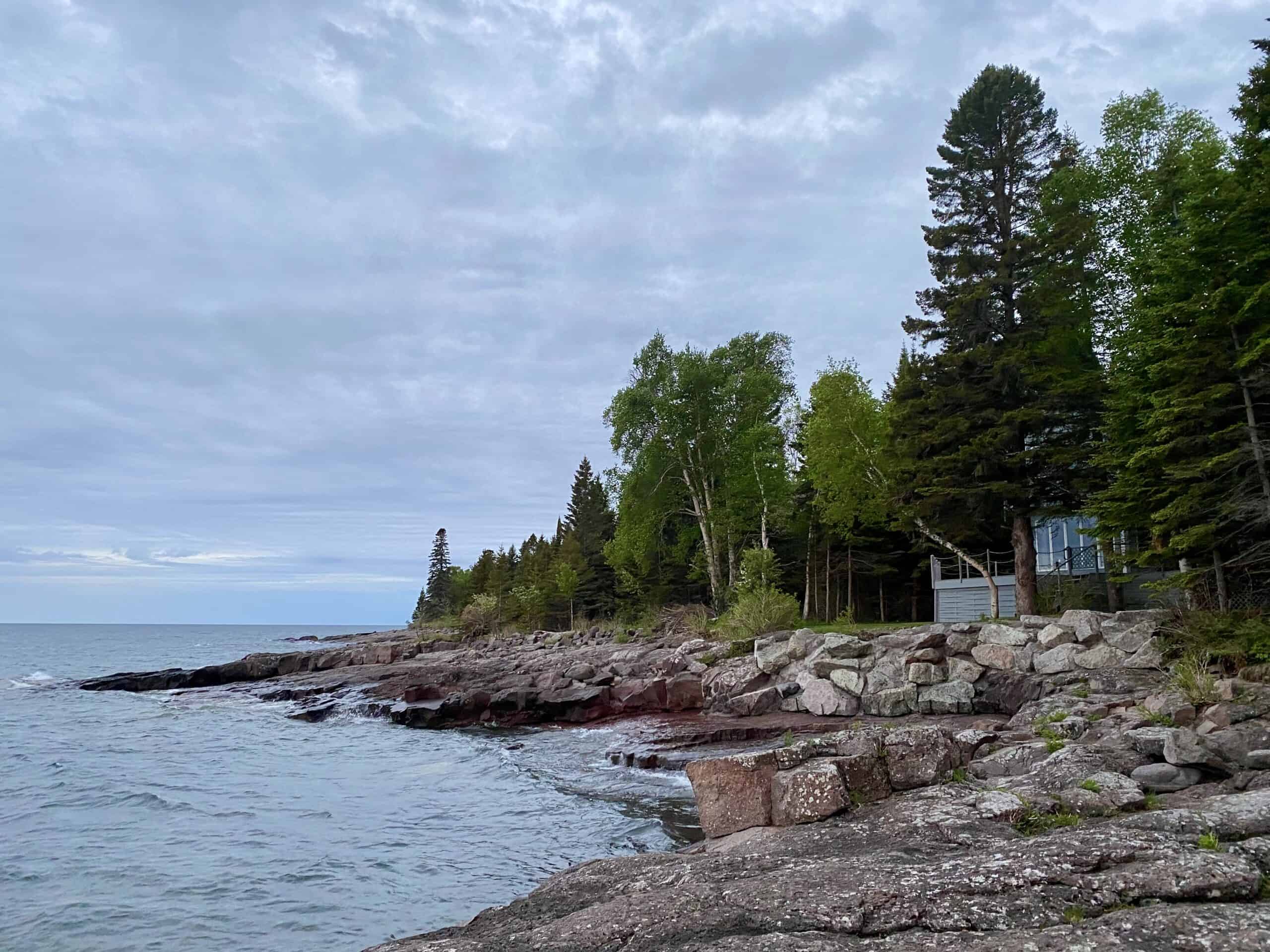
Most towns along Highway 61 range from small to itty-bitty; tourist services can be a bit sparse. For us, two requirements for lodging are: a kitchen/kitchenette, and a great view of moody Lake Superior. Wherever you stay, make your reservation as early as possible, particularly for travel from late May through September.
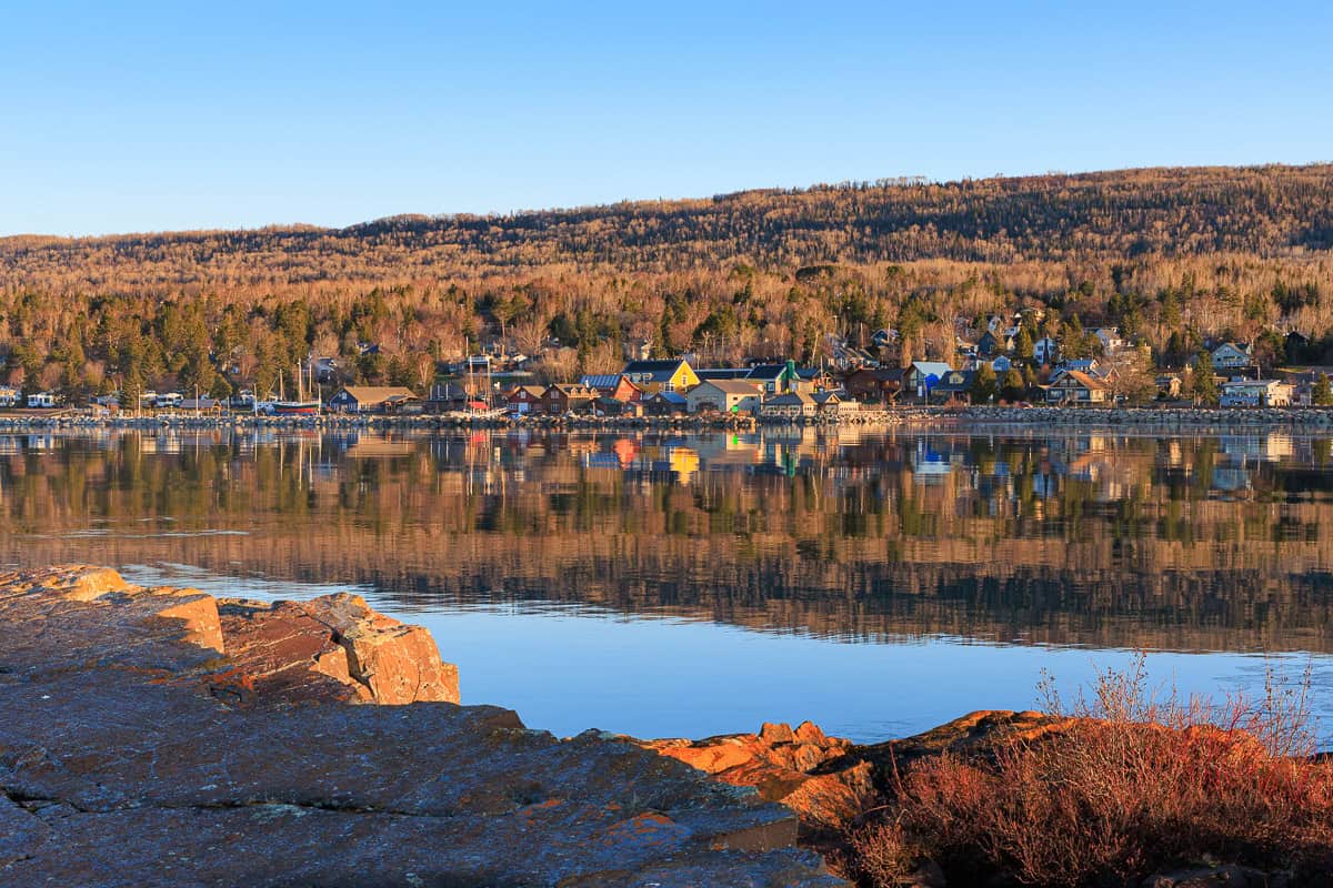
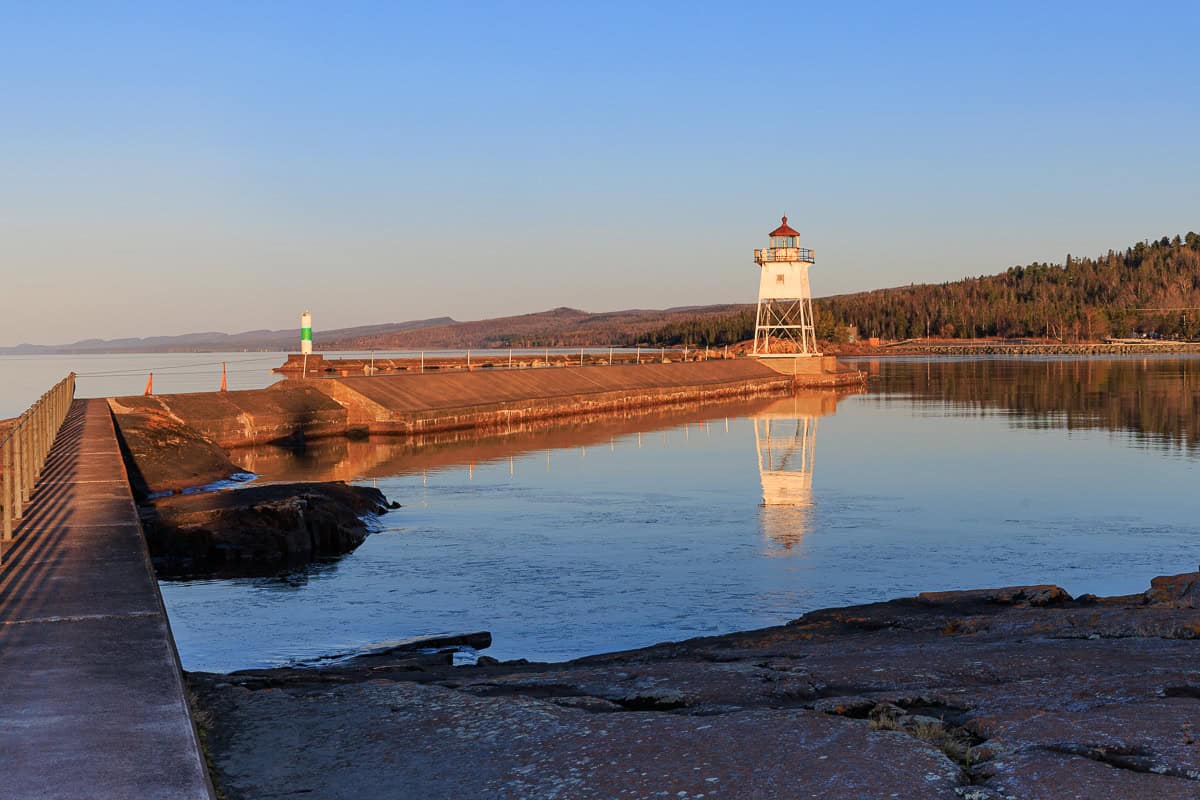
The Tofte/Lutsen area and Grand Marais are our two favorite places to base a trip. To keep this article from being too long, we’ve created a separate lodging section for those who want more information:
Where to Base Your Stay on the North Shore.
Please take a look when you’re ready to plan your trip! Teaser photos of Tofte (left) and Grand Marais (middle and right) are below.
The Waterfalls
There are so many! These are our favorites, listed geographically, starting from Duluth and driving up to (and over) the Canadian border on Highway 61.
Tischer Creek Falls at Congdon Park
34-acre Congdon Park, a hidden wonderland right in Duluth, was donated to the city by Chester and Clara Congdon, prominent Duluthians of Glensheen Manor fame, in 1908. The donation was contingent upon the city’s commitment to cease using Tischer Creek, which runs through the park, as an open sewer. So, thank you Congdons for saving this urban oasis!
Read more about the Congdons and Glensheen Manor in our Duluth article here.
All Trails provides directions to a gravel trail through the park. But be sure to immediately follow one of the sets of rugged stone steps to your right, descending into a deep gorge of red-rock cliffs, to see all of the waterfalls. You can return via the gravel trail if desired.
Walk along the cascading creek through the narrow park, over wooden footbridges, past stone staircases and tall white pine and cedar trees, seeing multiple waterfalls along the way. Crossing 4th Street, the park continues upstream, ending at Vermillion Street. The entire trail takes about an hour round trip at a leisurely pace.
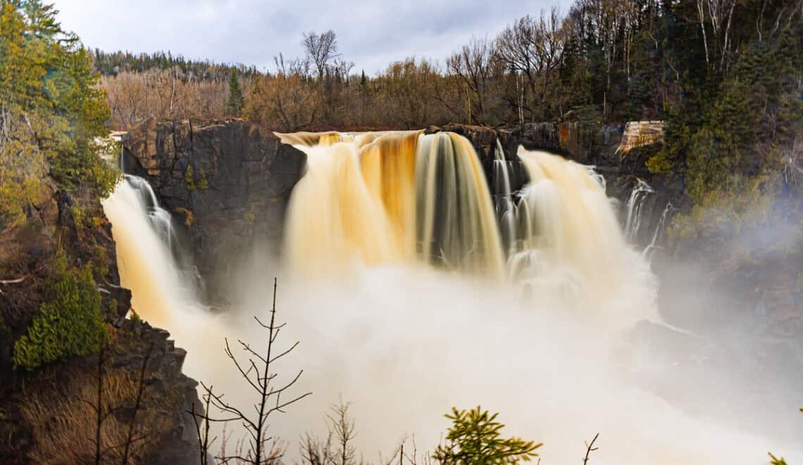
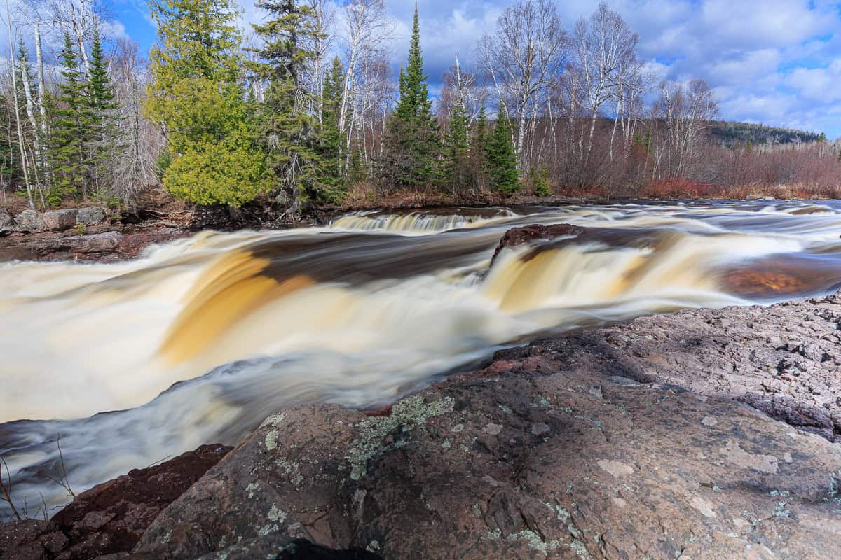
Gooseberry Falls
Just a 45-minute drive from Duluth is Gooseberry Falls State Park. In general, we find the waterfalls further up Highway 61 to be the most beautiful. But the falls at Gooseberry defy that preference and are undeniably magnificent.
The park is user-friendly with a large visitor center and paved pathways nearly everywhere. The walk to the lower and then middle falls takes about half an hour round-trip. Though on a hot summer day, you may want to spend another hour playing in the pools around them! Visiting the gorgeous upper falls adds another 20-30 minutes, and the more remote Fifth Falls adds another hour to the tour. (Middle and upper falls shown below.)
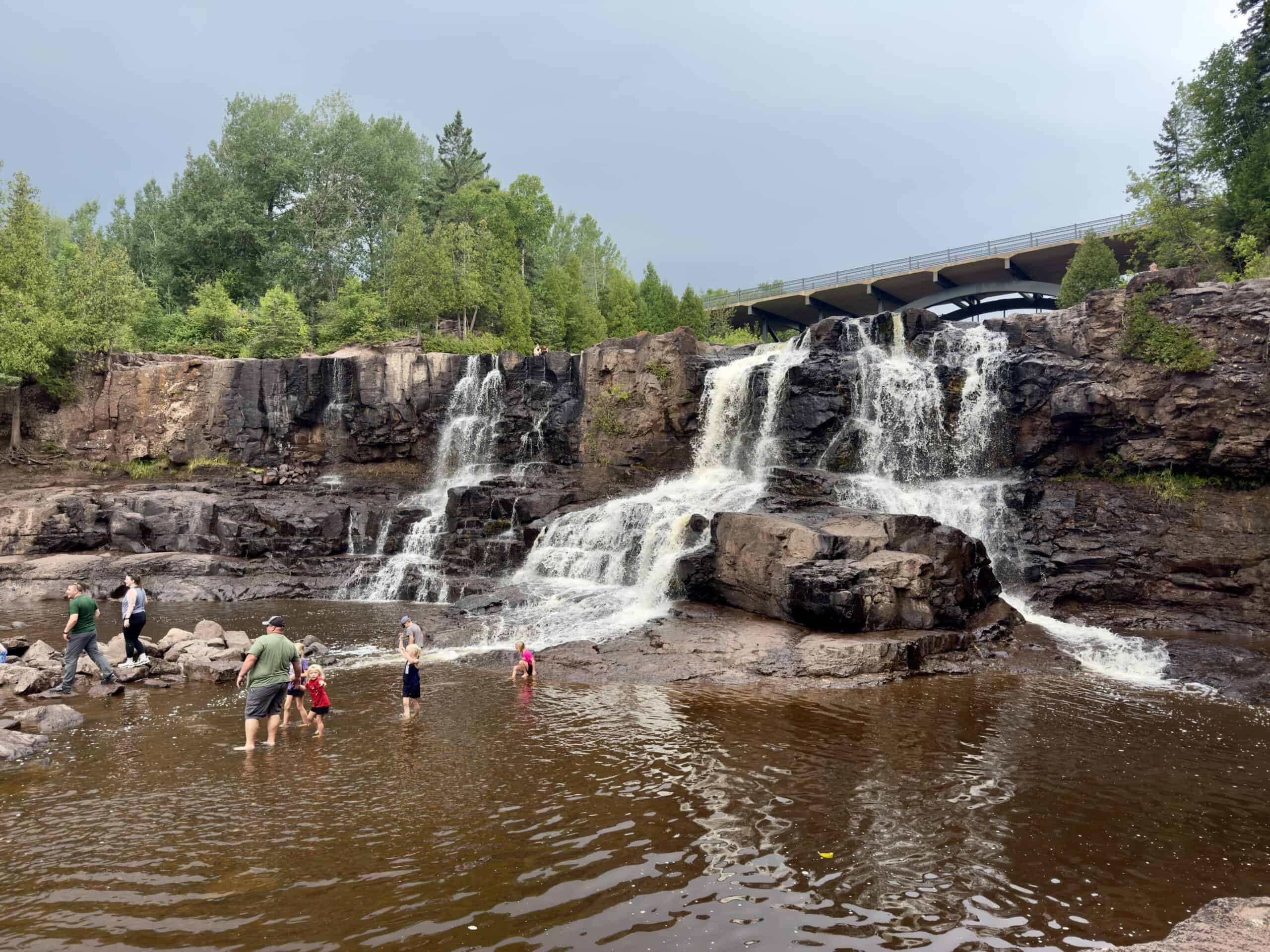
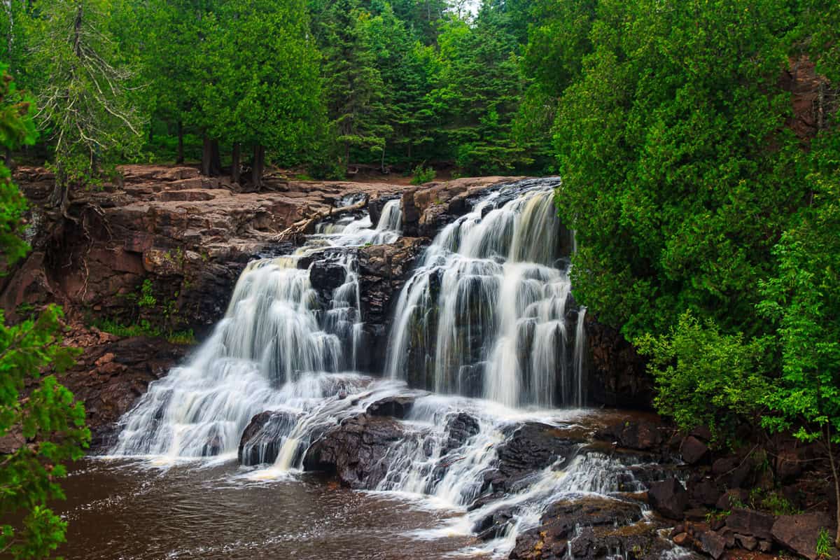
This park doubles as a rest area, so no permit is required. With free, easily accessible beauty so close to the big cities, Gooseberry Park can be extremely crowded, particularly on weekends in the summer. If possible, visit off-season or on a weekday.
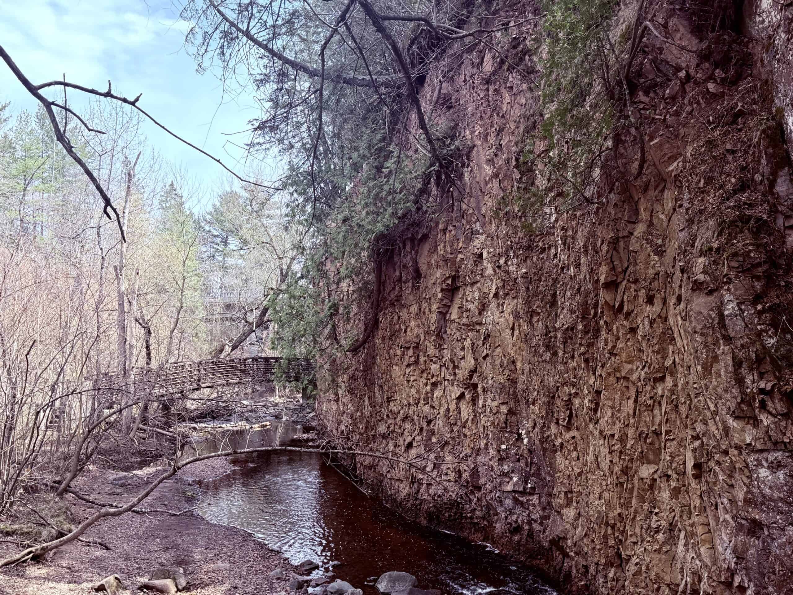
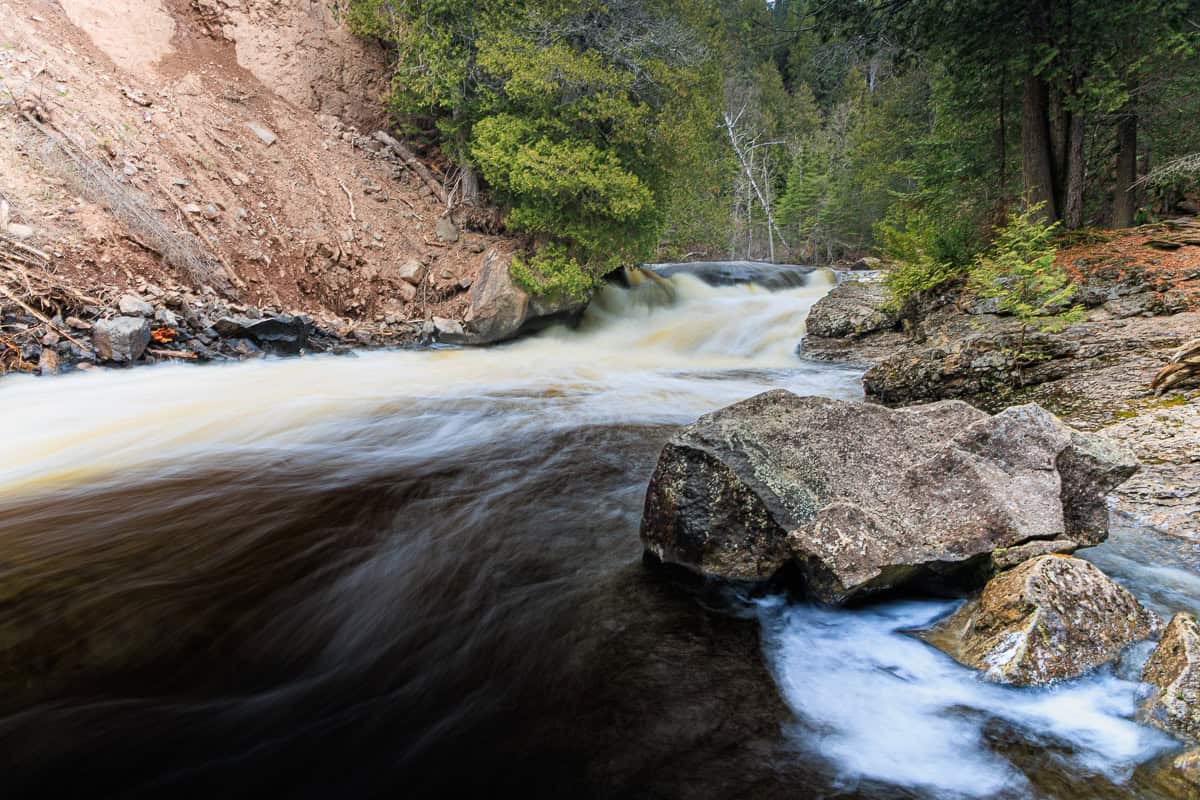
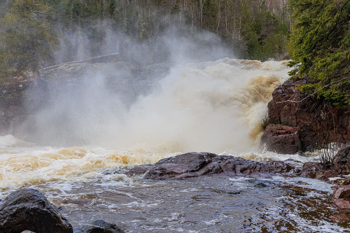
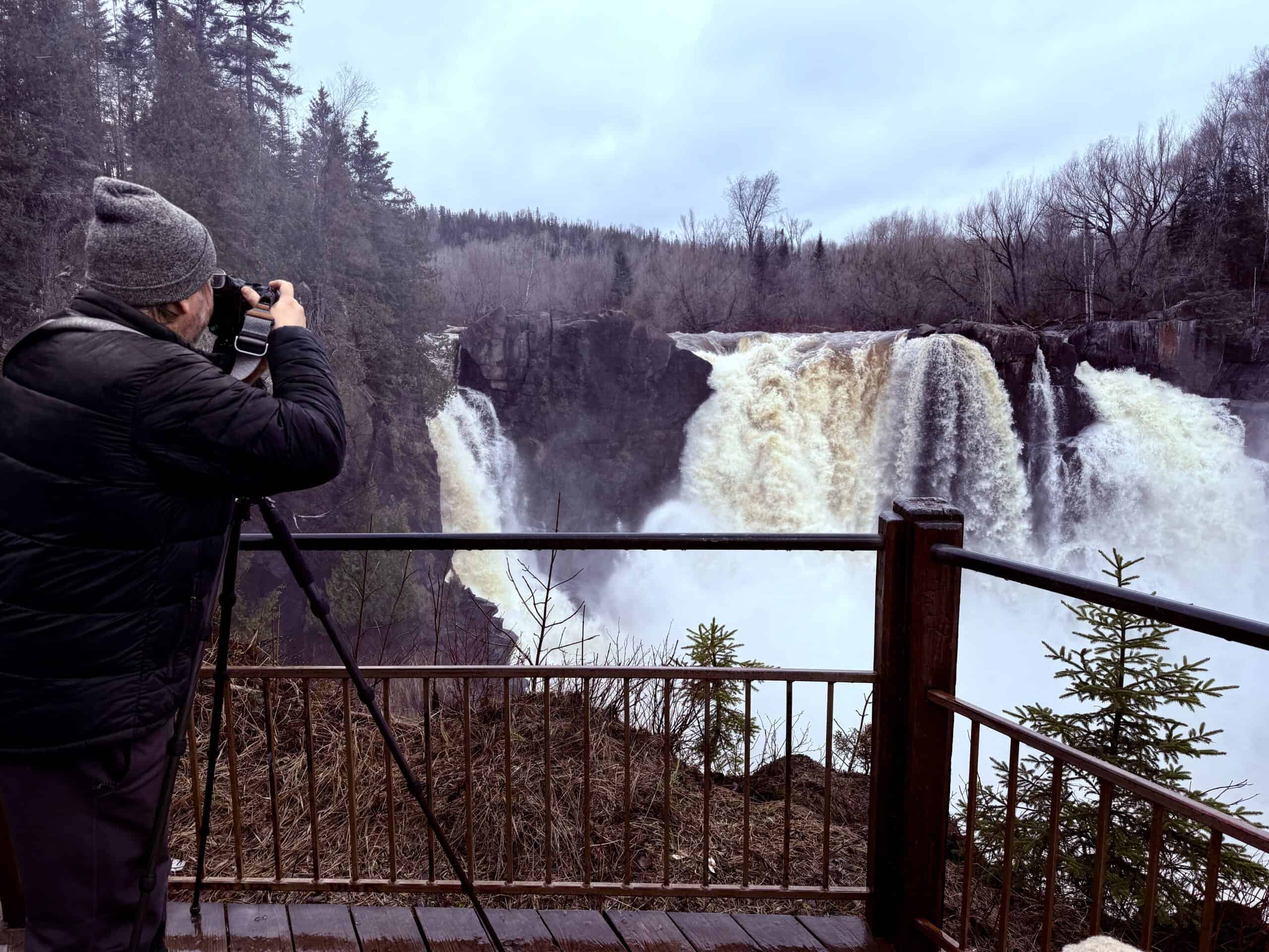
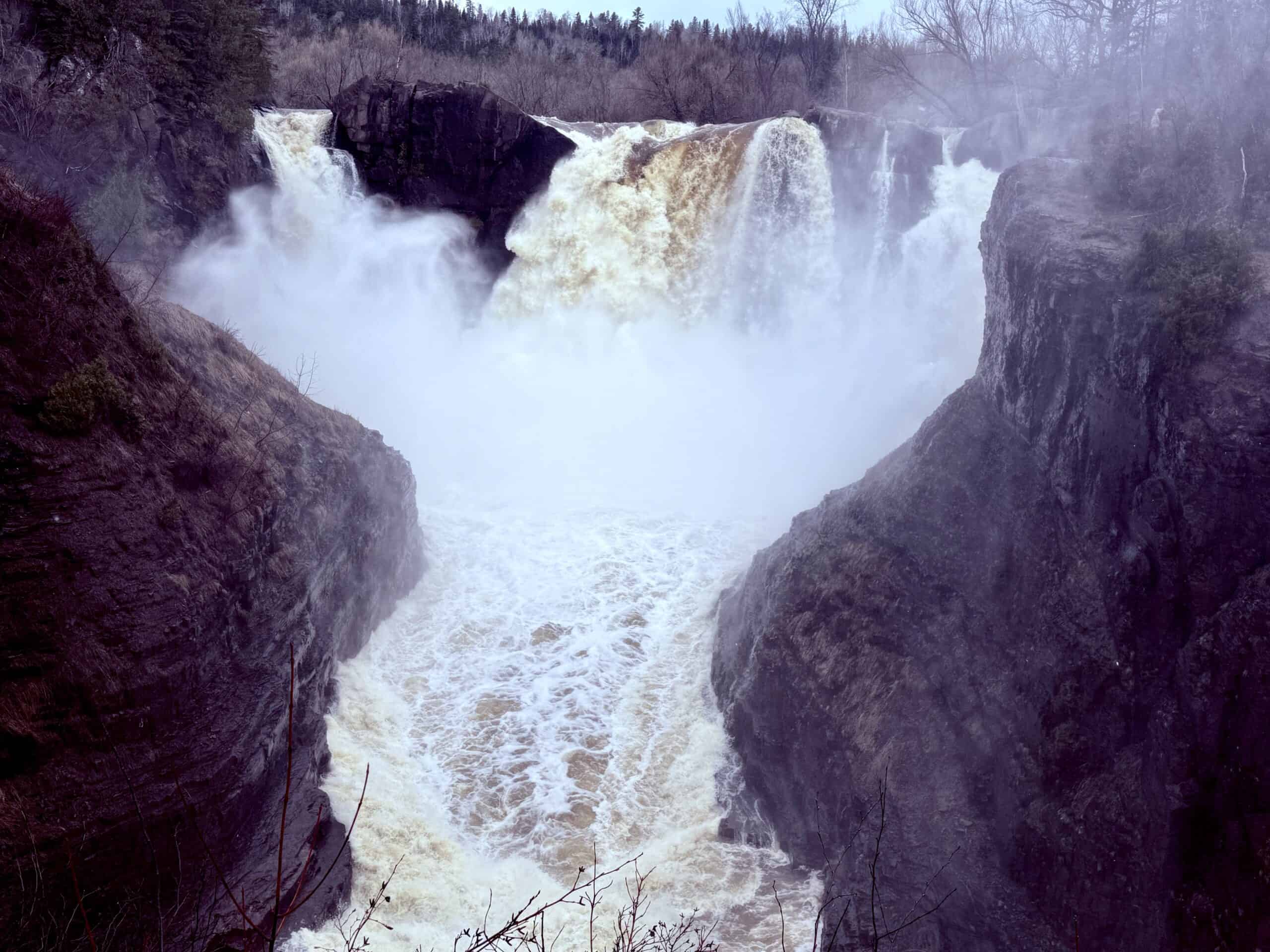
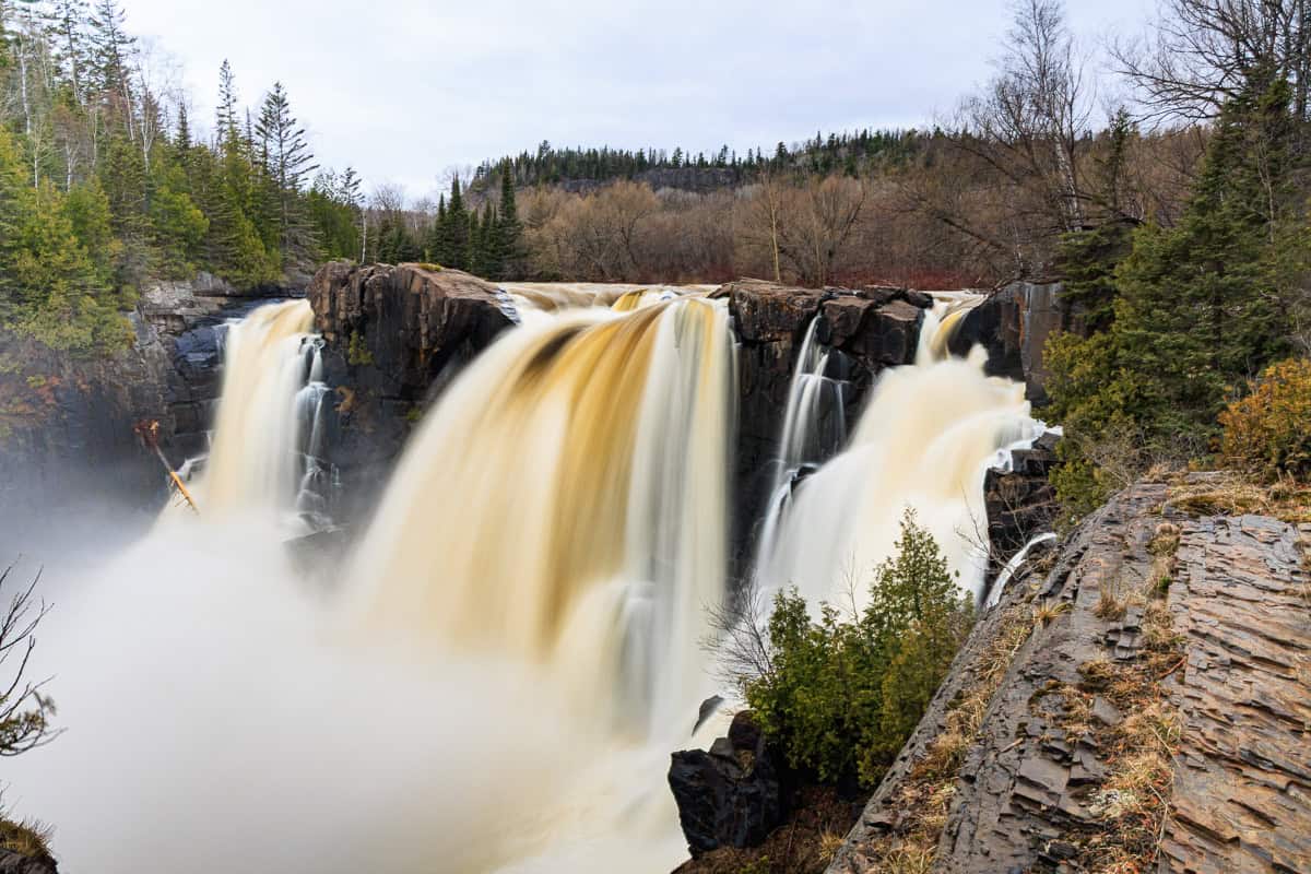
High Falls at Tettegouche State Park
Continuing up Highway 61, stop at Tettegouche State Park, just past mile marker 58. This glorious place offers 20+ miles of hiking trails, high cliffs overlooking Lake Superior, 4 inland lakes, the mouth of Baptism River, 4 waterfalls, and an informative visitor center. A person could spend days here.
But if you have to pick just one thing to do, choose to walk to the impressive High Falls on the Baptism River. Starting from the camping/trailhead parking lot, it is about 1.4 miles round-trip on a well-maintained, but sometimes muddy, trail with lots of boardwalks and staircases. (You may see a sign for the trail at the visitor center, but if you start there, it doubles the distance.)
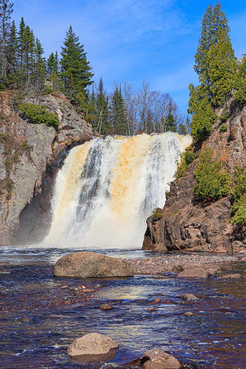
The trail has two overlooks to view the falls from above, but the real payoff is when you cross the (brand new*) pedestrian bridge and climb down the abundant steps to the edge of the river. There, you stand face-to-face with the falls, feeling their mist as they plunge 70′ down into the pool below. It is a marvelous vantage point.
*The new $1M flood-resistant bridge opened in November 2025 and replaces the old suspension bridge, severely damaged by flooding in 2022.
TIP: If you have a spare 45 minutes and a little more energy, the Shovel Point trail, beginning at the visitor center, offers some of the most breathtaking Lake Superior views in the area.
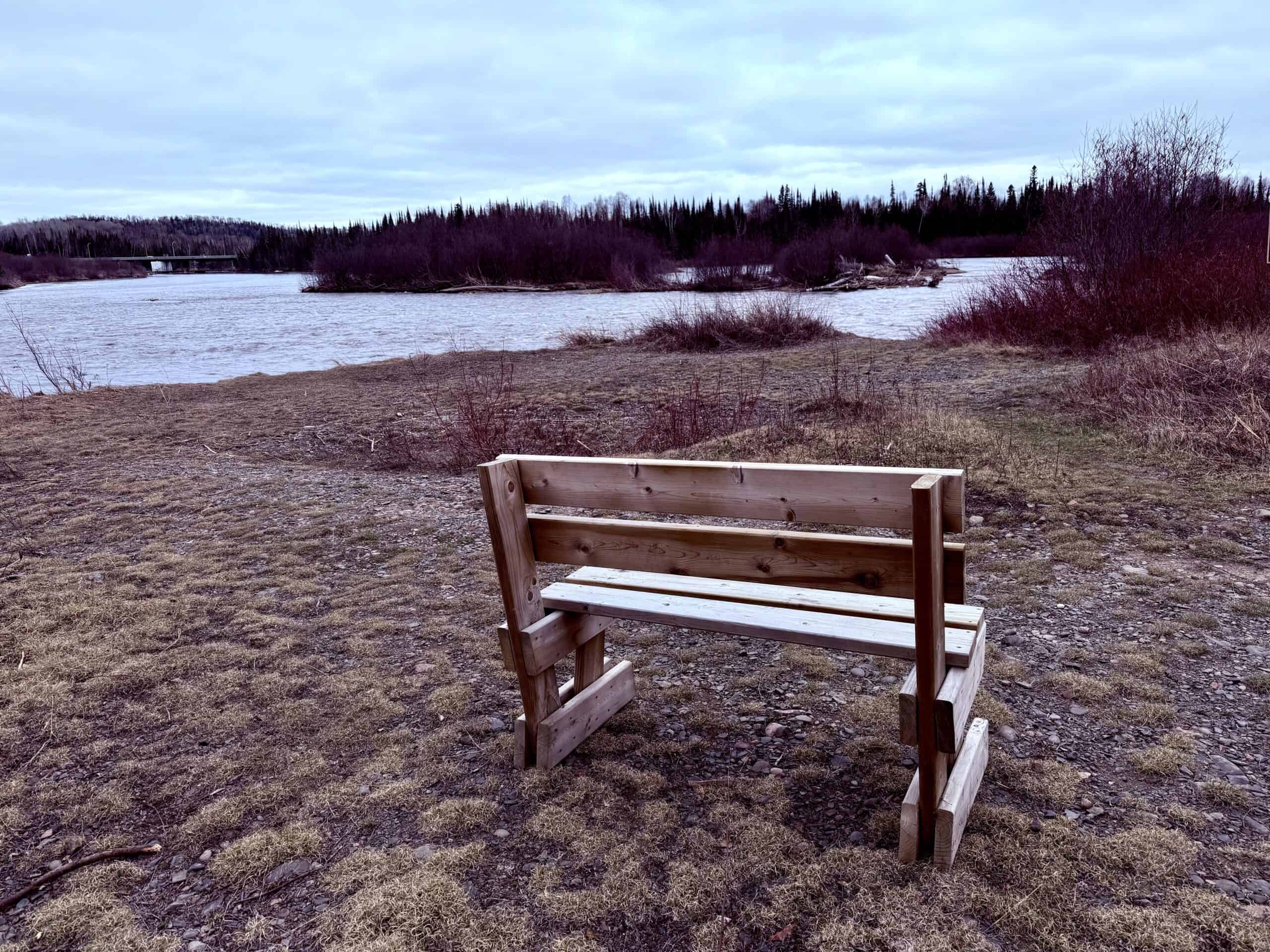
Caribou River Falls
Park at the Caribou Falls State Wayside on Highway 61 near mile marker 70 to explore this delightful, uncrowded waterfall. In just over a mile round-trip along the Superior Hiking Trail, you’ll first climb up to an overlook with breathtaking views of Lake Superior. From there, head back down a couple of minutes and follow the spur trail to your right, leading to a steep set of stairs descending to the basin of the Caribou River, surrounded by high rock walls and greenery.
For most of the year, there is a sizable sandbar, allowing you to walk within 20 feet of the thundering falls. (In early to mid-spring, the sandbar is mostly under water, so you’ll have to enjoy the scene from a little further away.) In either case, it is a secluded, peaceful place to marvel at this natural wonder.
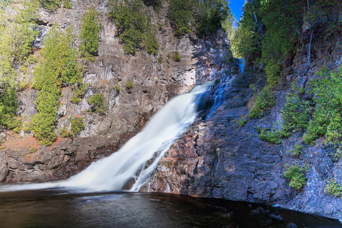
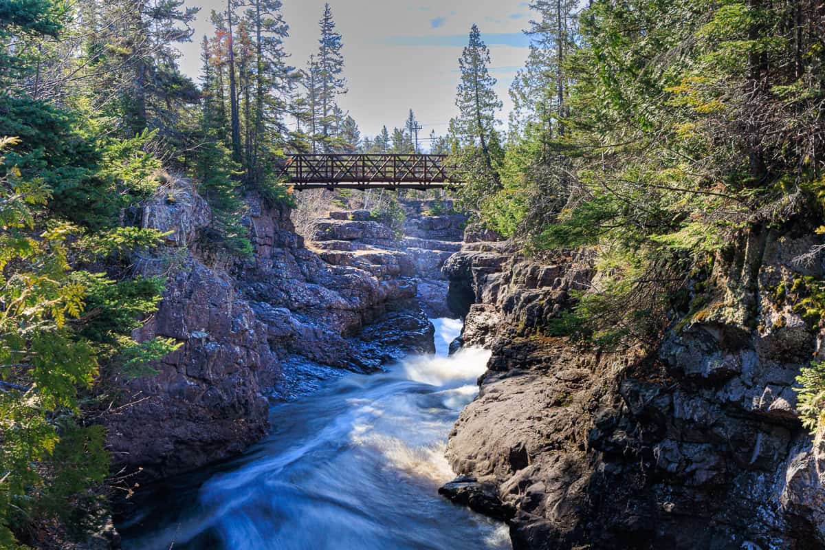
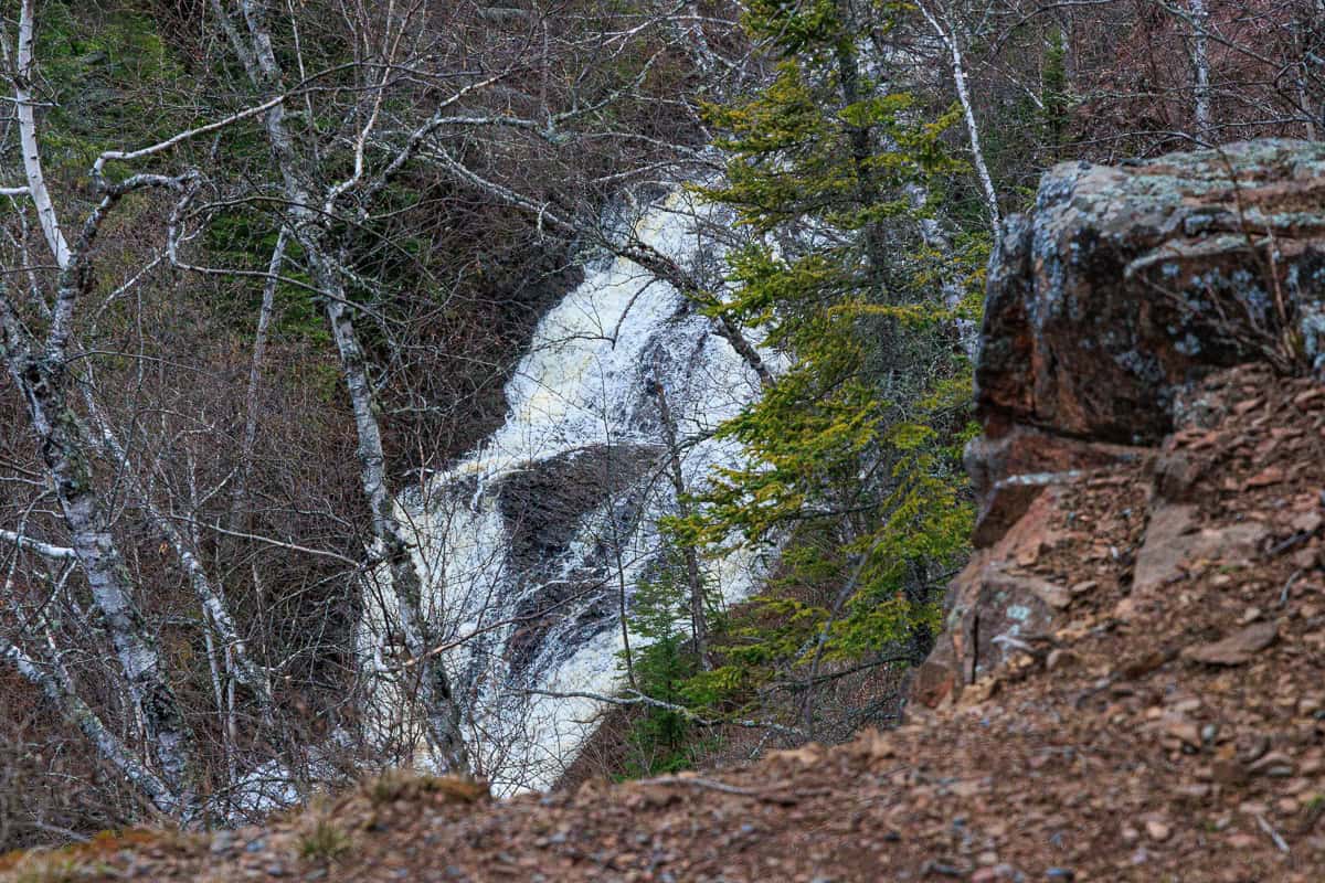
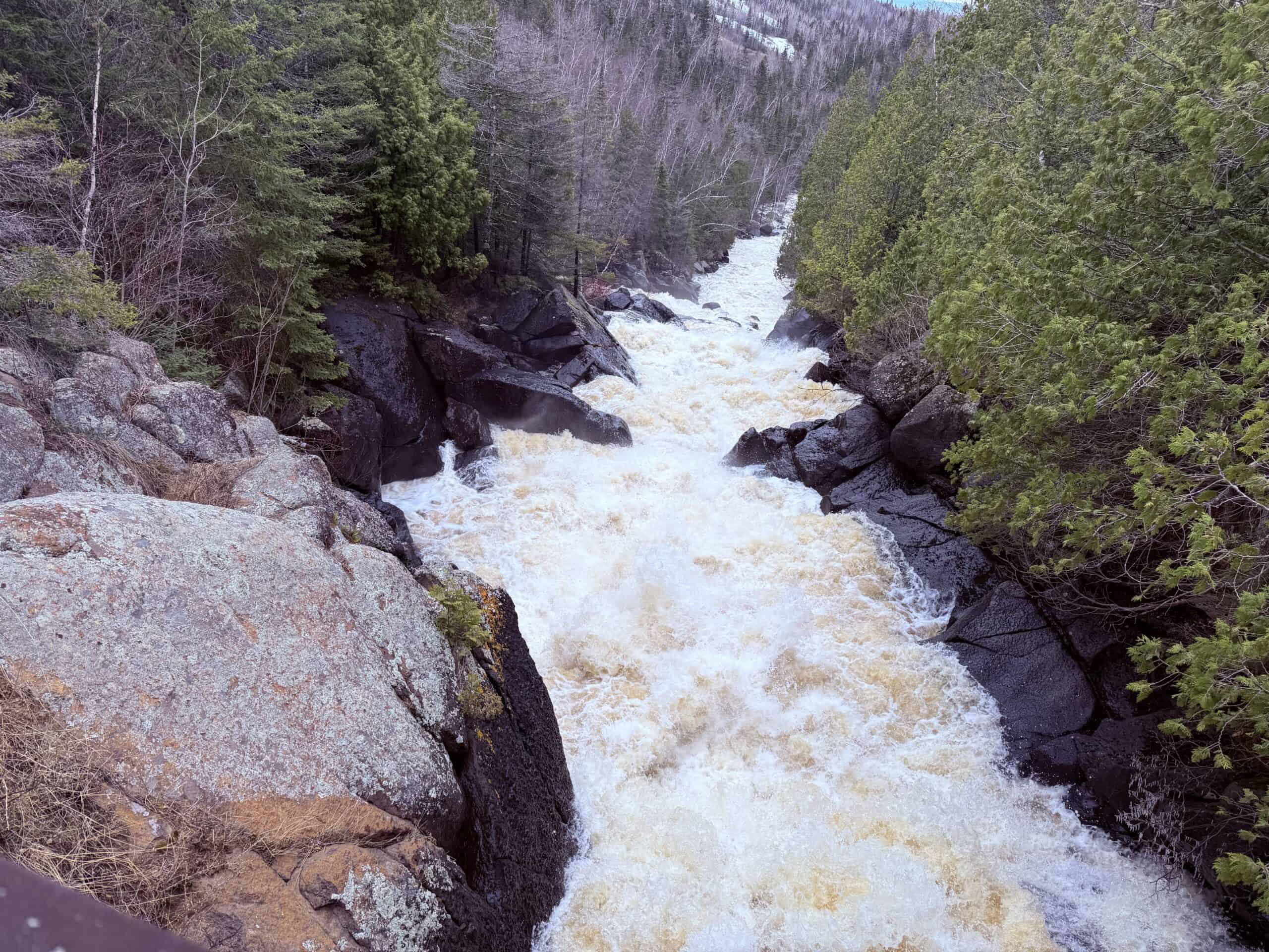
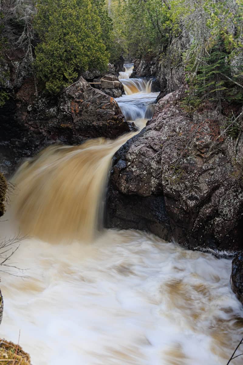
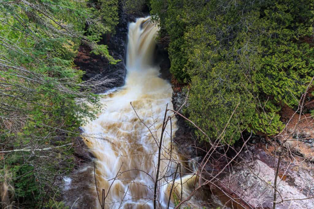
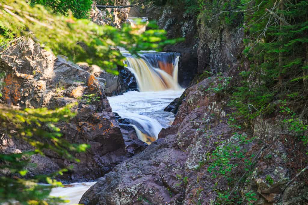
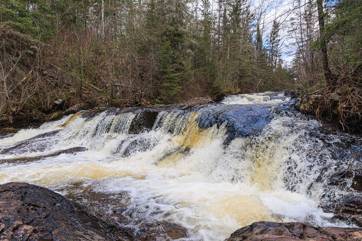
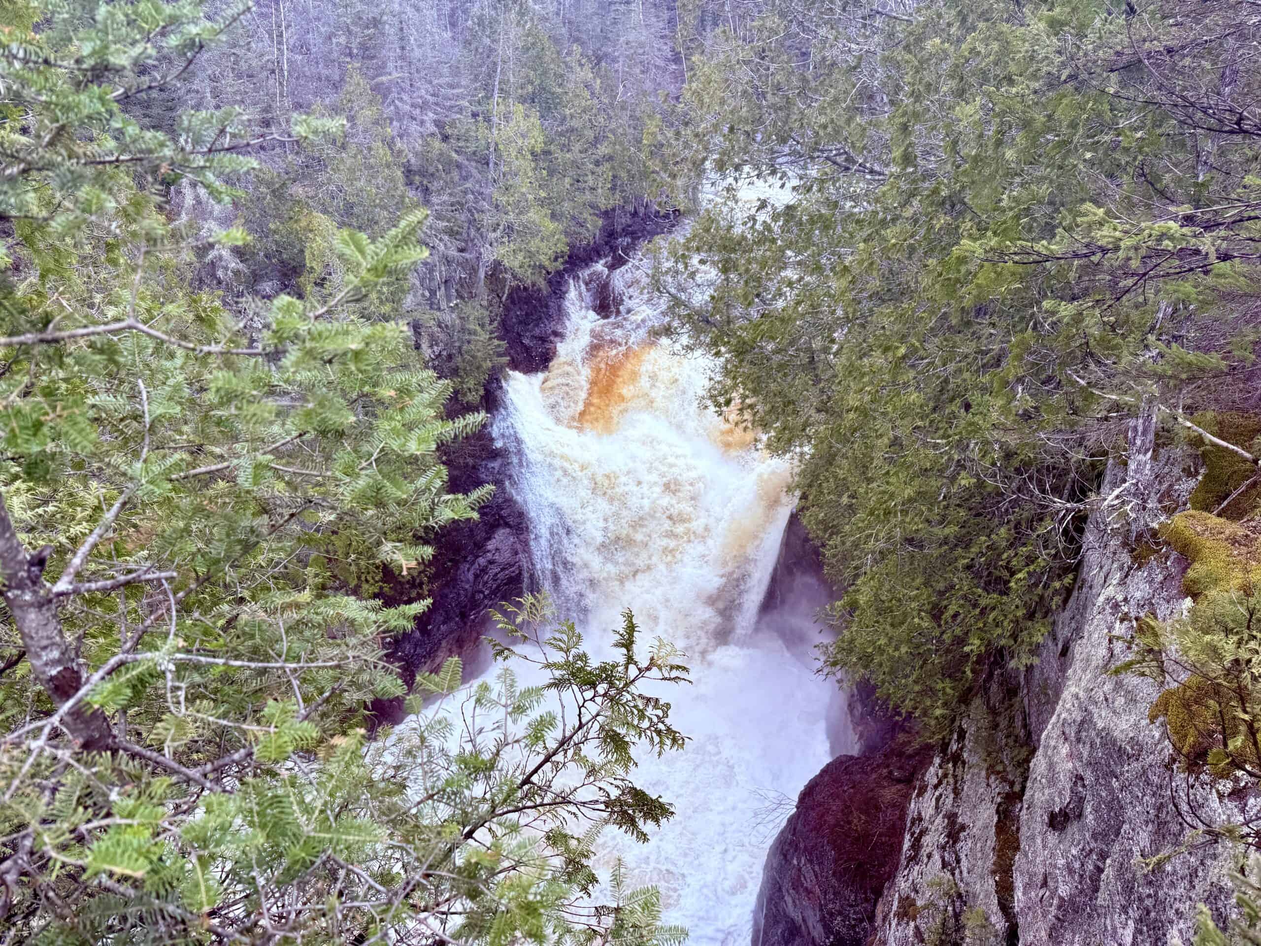
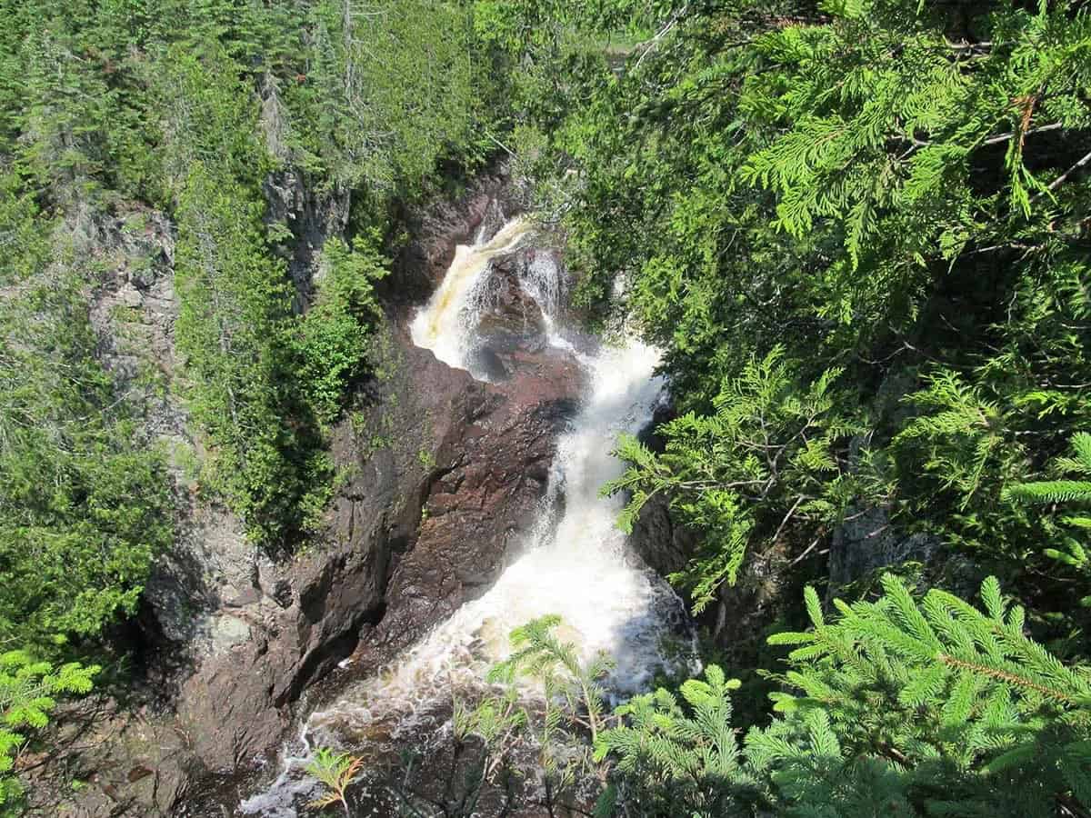
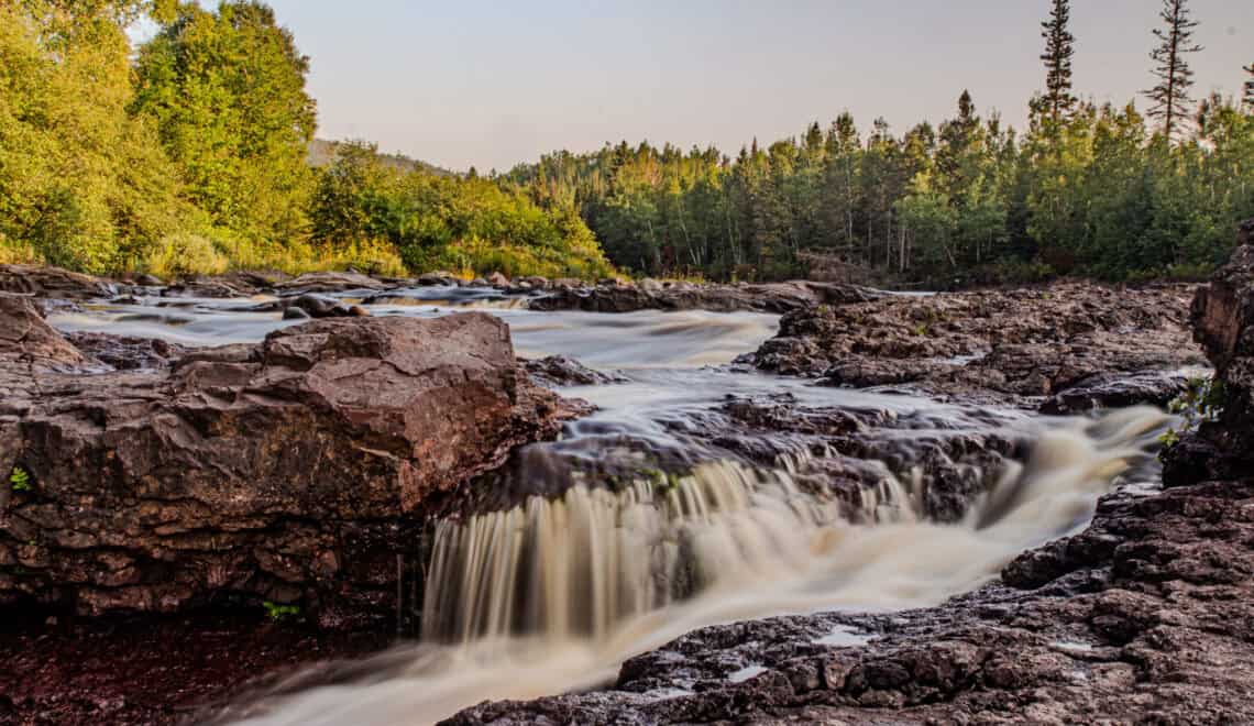
Temperence River Falls
Temperance River State Park is surely one of the most dramatic of Minnesota’s 60+ state parks. Just 4 miles south of Tofte, it is a “must-see” in our opinion. Park in one of the large turnouts on either side of Highway 61 near mile marker 80, just before the park entrance. (Don’t drive into the park; the trail is hard to access from there.)
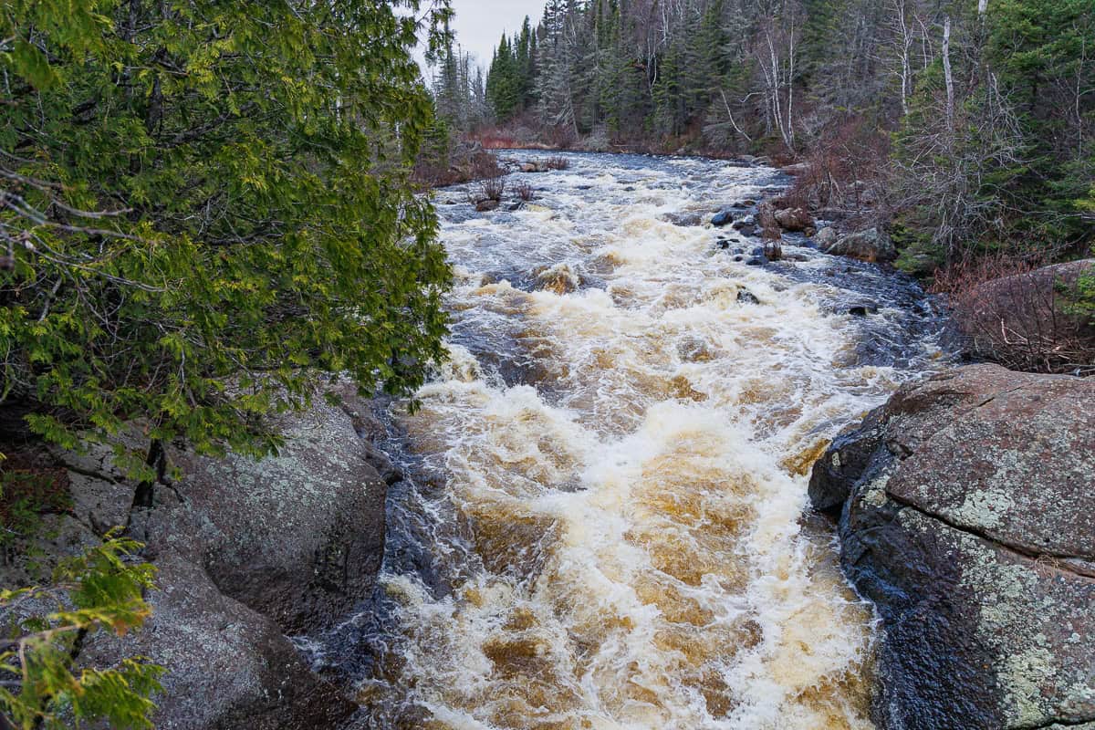
Humerously, the river was called the “no bar river” by early settlers, because it is the only river along the North Shore with no sand/gravel bar at its mouth. During the temperance movement in the US, the name evolved into Temperance River, as a nod to “no bar”. This tempestuous river, however, is anything but temperate!
A 1.4-mile round-trip hike through a spectacular gorge treats visitors to multiple falls. The first is shortly after the trail begins, at a short stone wall you can lean over to peek at Hidden Falls, concealed deep inside a cave in the gorge. Follow the trail to multiple overlooks of three more splendid falls, and of the raging river between them. At about .5 miles, you reach a pedestrian bridge providing breathtaking views all around. This is a good turnaround point if you prefer a shorter hike. Otherwise, continue on the trail for another 10 minutes or so to one more waterfall. Once the trail turns away from the river, turn around and head back.
Why do some of the waterfalls have a root beer color? It comes from tannins leached from the leaves of oak and fruit trees in riverside swamps as the water flows to Lake Superior.
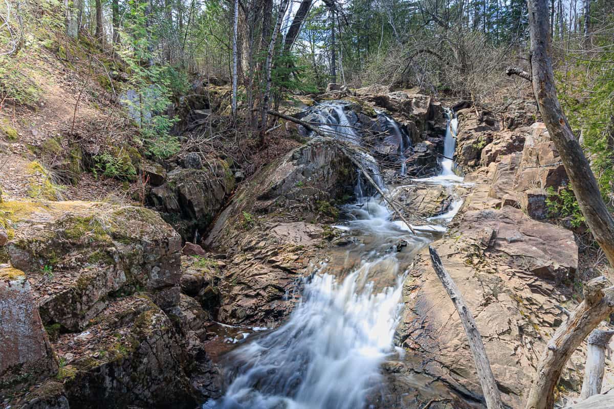
Onion River Falls
Access this hidden gem on a 3/4-mile round-trip walk from the Ray Berglund State Wayside along Highway 61, just a few miles past Tofte.
Lesser known and uncrowded, this trail is a joy in any season. In the spring, take the trail from the parking area, up the stairs to the top of the bluff over the rushing river. The path leads to several overlooks and some short spurs leading down towards the river. (Be careful!). The big, boisterous “stair-step” falls are visible through the trees, though capturing a photo is elusive due to their length, the steep drop-offs, and the trees.
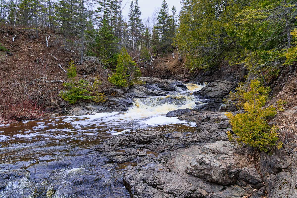
When the river is a bit lower, it is fun to just follow the riverbed from the parking lot (you can see where the river spills into Lake Superior at the beginning). Walk beside steep walls and among river rock and huge boulders to play at the base of the falls.
Upper Falls at the Poplar River
The short trail to Poplar River Falls is located in the Lutsen Ski Resort. Turn north (left) onto Ski Hill Road from Highway 61 (7 miles north of Tofte). Drive about 2 miles, just past the gondola parking, and there is a small lot with a Superior Hiking Trail sign.
Just 2-3 minutes down the trail, you’ll arrive at a bridge overlooking the roaring Poplar River and Falls in the gorge below, with wonderful views in both directions.
Cascade State Park
10 miles further up 61, towards Grand Marais, brings you to two dazzling waterfalls in Cascade River State Park, both quickly accessible from the highway parking turnout near mile marker 100. (No need to drive into the main park entrance a little farther up the highway.)
Follow the trail from the highway for just a couple of minutes and… bam! You’ll be rewarded with a view of the 25′ Cascade Falls bursting out of a narrow black gorge. (Bottom left photo.)
Just a little further up the river, following the trail and a few sets of steps, is The Cascades, a series of falls ranging from 8 to 20 feet, winding down through a tight section of the gorge.
A bridge crosses over the river, providing excellent viewing points. If you don’t plan to do any further hiking, cross the bridge and head back down to the highway parking area. Seeing both requires less than a mile round trip, but will surely take a full hour while you oooh and aaah.
If you looking to explore a little more, don’t cross the bridge, but instead take one of the other trails within the park, such as Lookout Mountain, with many lovely side trails and river views.
Hidden Falls on the Cascade River
To really escape other people, take a detour to Hidden Falls, just outside Cascade Park’s boundaries. Drive a mile northeast from the park on 61, and turn north (left) on CR 7. Go about 2 miles and turn left on CR 44. In 1/2 mile, turn left on Pike Lake Road (CR 45) and drive another 2.5 miles until you are approaching a bridge over the river. There is a fork in the road with a narrow road heading slightly right. This leads to the remote parking area. You may well be the only vehicle there.
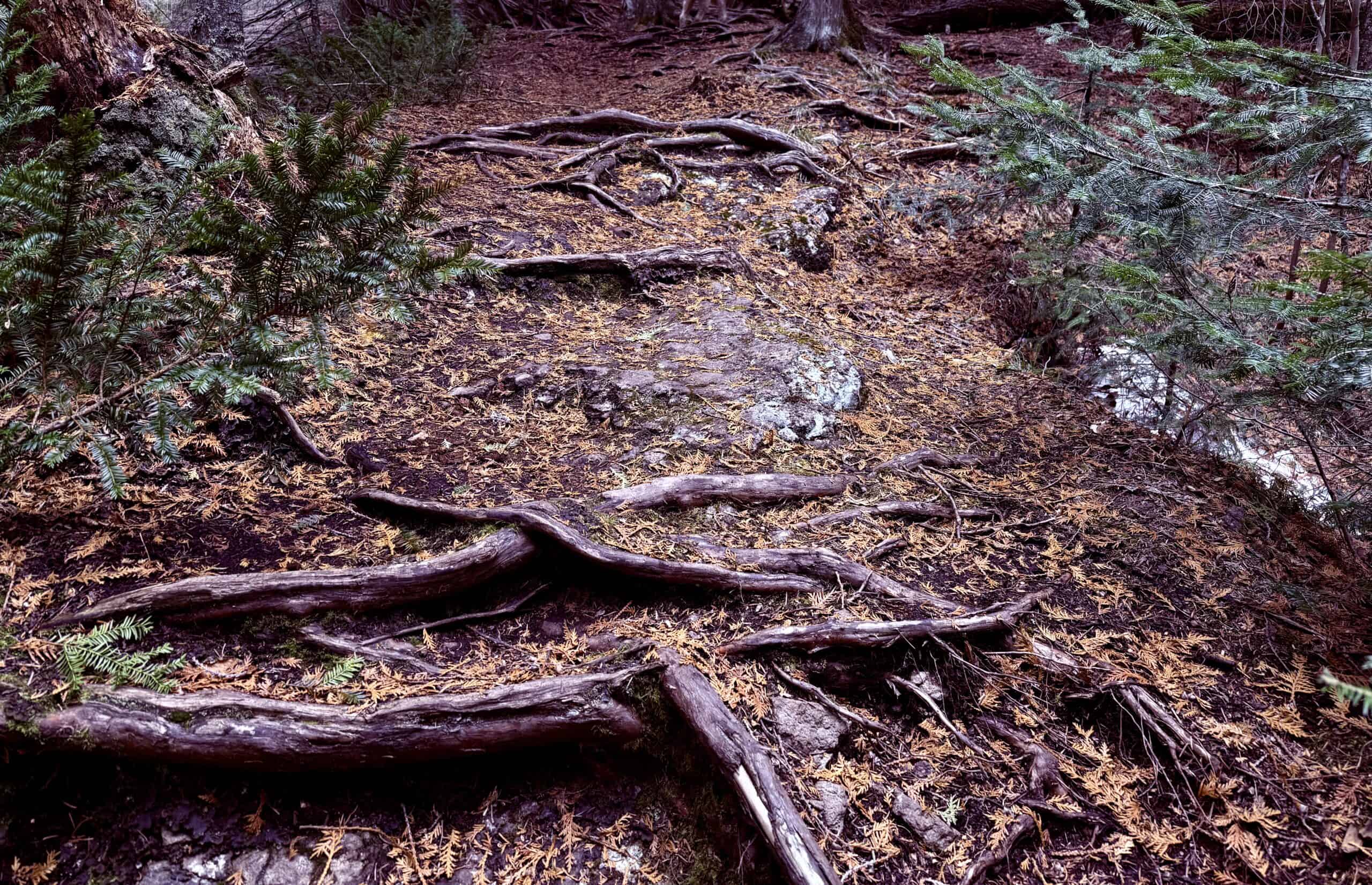
The delightful trail is just a mile round-trip. It leads under the bridge by the parking lot, then parallels the Cascade River through a dense forest featuring enormous cedar trees with gnarly exposed roots.
In just a few minutes, you’ll hear the rumble of the falls. There are multiple places to view the extended terraced falls along the trail.
When you arrive at the base of the falls, pull up a boulder and sit and enjoy the sights, sounds, and serenity in this little slice of paradise.
Kadunce River Falls
The Kadunce River walk is accessed from the Kadunce State Wayside, 9 miles north of Grand Marais on Highway 61. The wayside is on the Lake Superior side of the highway and has a lovely stretch of shoreline to walk along. To reach the river, cross 61 and find the sign for the “Spur Trail to Superior Hiking Trail”.
This pretty but overlooked trail is just under two miles round-trip. You will be serenaded by the river as you climb through dense woods, walking upstream and gaining elevation until you are atop a canyon above the river.
There are several overlooks, including one where a cave can be seen in the canyon wall on the other side of the river. You’ll hear the larger of the waterfalls and catch glimpses of it from above. Eventually, you descend back to river level, encountering several waterfalls and a bridge. With a little bit of a scramble, you can get close to the falls. The bridge is a good turnaround point.
If you want to go a little further, cross the bridge and take the narrow river trail to the right (not the Superior Hiking Trail) for another 8-10 minutes or so, and you will find another small waterfall.
Devil’s Kettle on the Brule River at Judge C.R. Magney State Park
14 miles northeast of Grand Marais on Highway 61 is Judge C.R. Magney State Park, and a mystery.
This wonderful 2-mile hike along the Superior Hiking Trail takes you to the base of the raging Upper Falls, then on to the mysterious “Devil’s Kettle” (a/k/a the “Devil’s Brule”).
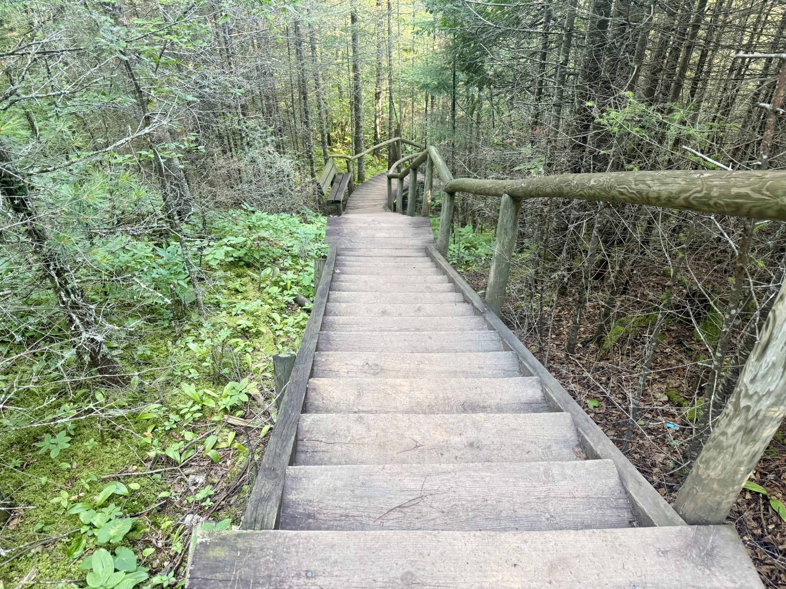
The scenic trail crosses a long bridge over the Brule River and then ascends to a viewing point high above Upper Falls. From there, prepare for stairs. Yes, nearly all hikes up here have stairs, but this one has so. many. stairs. Somewhere around 200 in just this section.
Fortunately, you are going down. Unfortunately, you will have to climb back up later. Mercifully, there are several benches along the way to take a break. It’s all worth it!
At the bottom, take the metal staircase to your left for a quick, wonderful detour to Upper Falls. You will have them practically in your face and are likely to get a little shower from the mist they create, particularly in the spring.
From here, guess what? Yes! More stairs. Follow them up, up, up to the main attraction, the booming Devil’s Kettle. The river splits at the top of the falls around a huge outcropping of volcanic rock. The right-hand side flows normally into a pool at the bottom and continues down the river, ultimately flowing into Superior. But the left side? It flows into a large hole (or kettle, if you will), and then…disappears.
Many a curious hiker and scientist has thrown things such as balls, sticks, and logs into the water to see where they come out, and seemingly, they never do. Rumor has it that an old car was pushed over the ledge into the kettle and never emerged. Of course, it seems unlikely that anyone could get a car up there, but why ruin a good story with the facts?
Some surmise that the water travels underground until it joins up with Superior, but geologists say that is nearly impossible. So where does the water go? That’s the mystery. (The photo on the left is from spring, when there was more water flowing. The mysterious hole is there, but not quite as visible. The photo on the right, taken in late summer, shows the two distinct sides of the falls.)
From here, take a few big gulps of water, turn around, and follow the same path down, then up the stairs and back to the parking lot.
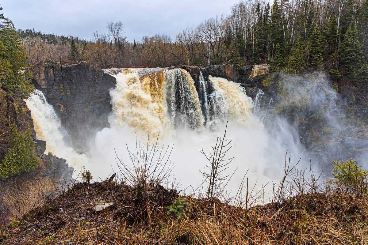
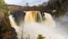
High Falls on the Pigeon River (Both in the US and Canada)
The Canadian border is about 45 minutes northeast of Grand Marais on Highway 61. Just a minute before you cross it, turn left into Grand Portage State Park and park in the spacious lot in front of the visitor center/rest area.
The park is named after the Grand Portage, an historic footpath from Lake Superior inland, utilized by indigenous people for thousands of years, and later by fur traders, to bypass part of the Pigeon River. Though they would all certainly have preferred to travel by water, this section of the river has a series of torrential rapids and waterfalls, dramatically concluding with 120′ High Falls. It is completely unnavigable, particularly for the canoes in which they traveled. Therefore, traders had to carry their canoes and supplies along this Grand Portage path from Lake Superior, and then back again. The Ojibwe Tribe calls the path Gichi-onigaming (Great Carrying Place).
The Pigeon River is the border between the US and Canada, and there are trails to the High Falls on both sides. Be sure to bring a raincoat! The mist from the falls is so powerful that it can feel like it is pouring down rain in the viewing areas.
On the US side, the easy, paved, handicap accessible path to High Falls is about a half mile each way. You can hear the falls almost the entire time; they are the highest and most powerful in the state, which is saying something.
Boardwalks access large overlooks where visitors can witness the jaw-dropping scene up close and personal, as the falls crash violently into a black rock gorge and the resulting rapids make their way to Lake Superior, about a mile downriver. Just wow.
If you cross the border to Canada (passport required), park at the Ontario Travel Information Center, immediately to your right. The trail begins there, following alongside the highway for a few minutes, then crossing underneath it into Pigeon River Provincial Park. This trail is far more rugged than on the US side, but it is well-maintained and well-marked. It is also much less crowded. (We did not see a soul.) The trail is longer, at 2.5 miles round-trip.
The view of the falls from Canada is different but no less glorious. From an expansive platform, visitors get to see the river above the falls, just before the water tumbles over.
The loop leading back to the Information Center follows the river as its flow calms and becomes peaceful and inviting. What a contrast.
Where to Eat
The North Shore is remote and wild, so the eateries are scattered and not as plentiful as in cities. But they’re nearly all small, locally owned, casual, and friendly. We enjoy meals at the following restaurants/cafes (in geographical order on the route up Highway 61):
Schroeder Baking Company (Schroeder) Mostly take-out items, including coffees and smoothies, pastries, breakfast sandwiches, lunch sandwiches, and fully cooked or take-and-bake pizzas and calzones.
Bluefinn Grill (at Bluefinn Bay resort, Tofte) Upscale American fare with terrific lake views.
Coho Cafe (at Bluefinn Bay resort, Tofte) Counter service offerings include full breakfasts, baked goods, sandwiches, and tasty pizza. Indoor and outdoor seating are available.
Lockport Marketplace & Deli (Lutsen) Cafe with hearty breakfasts, baked goods, burgers, and sandwiches. A small grocery market is attached.
Angry Trout (Grand Marais) Popular full-service Indoor/outdoor restaurant right on the harbor with rotating Lake Superior grilled and fried fish based on the day’s catch. (Burgers, vegetarian options, and a few other items are offered as well.)
Fisherman’s Daughter (Grand Marais) Counter-service cafe on the harbor offering their own fresh-caught Superior fish & chips baskets (with excellent fries), chowders, sandwiches, and sides. Equally wonderful is the market with a variety of smoked fish – as good as it gets! – sold by the pound along with picnic fixin’s and some gift items.
Hungry Hippy Tacos (Grand Marais) Counter service taco joint with yummy house-made puffy shells.
Crosby Bakery (Grand Marais) Heavenly croissants, pastries, baked breads, cookies & cakes, and rotating lunch sandwiches on their fresh focaccia.
My Sister’s Place (Grand Marais) Bar with a fun, rustic atmosphere serving craft beer, burgers, hot dogs, sandwiches, salads, and pizzas.
Looking for some additional walks/hikes while you’re in the area? Check out our favorites here. If you’re spending any time in Minneapolis on your way to or from the North Shore, take a look at this article.
Discover more from Werthwhile Wandering
Subscribe to get the latest posts sent to your email.


I’d normally sing “Don’t go chasing waterfalls “ but I’m glad you did!
Thanks, Timm. It’s a great song, but we definitely encourage chasing waterfalls!